The Lincou trail starting from Réquista

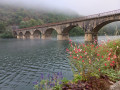
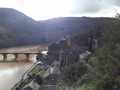
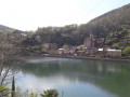
From the Ségala plateau to Lincou on the banks of the Tarn.
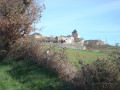
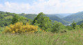
There are numerous vantage points overlooking the Tarn valley and the Requistan countryside, home to the Lacaune sheep, whose milk is used to make Roquefort.

Details

n°4749885
Creation:
Last update:
Last review:
  • Walking
    Activity: Walking
  • ↔
    Distance: 8.73 mi
  • ◔
    Average duration: 5h 20 
  • ▲
    Difficulty: Average

  • ⚐
    Back to start: Yes
  • ↗
    Ascent: + 1,526 ft
  • ↘
    Descent: - 1,503 ft

  • ▲
    Highest point: 1,988 ft
  • ▼
    Lowest point: 761 ft

Photos

Description of the walk

There is another walk starting from Réquista, which is slightly longer and has a bit more elevation gain, and part of the route is shared with this circular route but in the opposite direction.
https://www.visorando.com/randonnee-/303...
Another difference: rather than sections on small roads via Ortizet and La Vaysse, ending with a return via the D 44, this other circular route favours forest paths or ‘sunken lanes’.

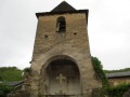
Parking is available all around the church in Réquista or a little further on, to the right of the roundabout, along Rue du Sergent Goulesque.

(S/E) In front of the church, head towards the Route de la Vallée du Tarn. At the roundabout, carry straight on until you reach a three-way junction. Take the right-hand branch towards Trébas. You’ll come to another Fork in the road.

(1) Turn right and carry on to reach the hamlet of Saint-Julien.

(2) Turn right to visit the beautiful Romanesque chapel with its carved corbels on the façade.

(3) Return to the previous junction.

(2) Turn right to rejoin the D344 road; follow it to the right until you reach another junction after the cemetery.

(4) Take the small road on the left, pass the hamlet of Combelongue, then keep right at the Fork in the road to reach, at the next bend, the junction with a wide dirt track.

(5) Turn left downhill onto this wide dirt track. Walk down through the fields to the Mas Falipot farm, where you can enjoy the views of the farmland and the Tarn valley.

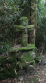
(6) Before the sheepfold, next to a beautiful stone cross, turn right. Enter a wood; take care here, as the path becomes stony and very steep. The ruts are caused by cart wheels.
After several hairpin bends, pass the cemetery and arrive in Lincou.

(7) First turn right then left, head down past the Manoir de Lincou Art Gallery and Museum, and cross the small bridge to climb up towards the church and then the calvary.

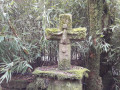
(8) You’ll reach the D200; follow it to the right until you reach the start of a footpath. Turn left onto this path running alongside the stream and note the beautiful carved cross. Head back up through the woods to the Clot farm.

(9) After Le Clot, at the crossroads, turn left towards La Devèze. The track becomes a small road and climbs up to La Devèze. Walk past the farm buildings and through the hamlet.

(10) Then head between two houses and turn right onto a wide track climbing through the woods towards Ortizet. When you reach a high-voltage electricity pylon, turn left and you’ll reach the junction with the road serving the hamlet.

(11) Turn left onto this road before thefirst houses in Ortizet, continue uphill and reach the highest point at the houses of La Vaysse. Walk through this hamlet and you’ll soon come to the junction with the D44.

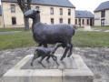
(12) Turn left onto this road and head towards Réquista. Then follow Avenue de Millau straight on, passing the town hall and the statue of the ewe and her lamb; when you reach the jeweller’s, turn left towards the church to head back towards the church (S/E).


Waypoints

  1. S/E : mi 0 - alt. 1,844 ft - Parking near the - Église Saint-Pierre (Réquista)
  2. 1 : mi 0.39 - alt. 1,844 ft - Fork in the road
  3. 2 : mi 0.69 - alt. 1,821 ft - Saint-Julien
  4. 3 : mi 0.86 - alt. 1,801 ft - Chapelle Saint-Julien (Requista)
  5. 4 : mi 1.33 - alt. 1,841 ft - Cemetery crossroads
  6. 5 : mi 1.92 - alt. 1,900 ft - Crossroads after Combelongue
  7. 6 : mi 3.26 - alt. 1,414 ft - Mas Falipot
  8. 7 : mi 4.4 - alt. 807 ft - Église Saint-Saturnin (Lincou)
  9. 8 : mi 4.57 - alt. 843 ft - D200 road - Tarn (rivère)
  10. 9 : mi 5.07 - alt. 1,152 ft - Le Clot
  11. 10 : mi 5.78 - alt. 1,191 ft - La Devèze
  12. 11 : mi 6.62 - alt. 1,729 ft - Ortizet – First houses
  13. 12 : mi 7.77 - alt. 1,985 ft - D44 junction
  14. S/E : mi 8.73 - alt. 1,844 ft - Parking near the - Église Saint-Pierre (Réquista)

Notes

A mix of quiet country lanes, wide farm tracks and narrow footpaths.
It’s accessible and enjoyable even after a spell of rain that has left the sunken tracks muddy.
Do take care, however, on the descent before Lincou.

As for the duration, the Visorando software calculates the time for a walker – perhaps an occasional one – families, people who take the time to enjoy a nice picnic… and so on. It’s true that, most of the time, it’s overestimated, but it’s better that than the opposite.
Personally, it took me 3 hours 30 minutes, as I took the time to take some photos.
Thanks to Nathalie GRANDIN for the clarifications.

Worth a visit

(S/E) Réquista:
- Sheep market every Monday,
- Dairy processing centre and Roquefort cheese-making company,
- Bronze statue of a ewe and her lamb,
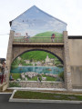
- Trompe-l’œil mural.

(2) Saint-Julien: Romanesque chapel.

(7) Lincou:
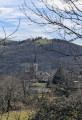
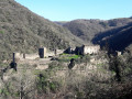
- A very old village overlooking the River Tarn with cobbled streets,
- Gothic church,
- Art gallery and museum at the Manoir de Lincou.

Reviews and comments

4.3 / 5
Based on 2 reviews

Reliability of the description
4.5 / 5
Ease of following the route
5 / 5
Route interest
3.5 / 5
pyrene12
pyrene12

Hello,
I’m sorry to hear that you didn’t particularly enjoy this walk.
If you’re in our part of Aveyron for a few days, do have a look at some other walks on my page https://www.visorando.com/page-pyrene12/, particularly ‘Le Moulin de Roupeyrac’ and ‘Les Méandres du Giffou’, which are suitable for ‘inexperienced walkers’.
Please note that at the Réquistanais Tourist Office, you’ll find a guidebook to local walks as well as a pocket-sized booklet entitled ‘The Treasures of the Réquistanais’.
Enjoy your walks!
Pyrene 12

Machine-translated

GIRON Raymond
GIRON Raymond

Overall rating : 4 / 5

Date of your route : Jul 29, 2026
Reliability of the description : ★★★★☆ Good
Ease of following the route : ★★★★★ Very good
Route interest : ★★★☆☆ Average
Very busy route : No

A family walk, you say? We’re not so sure, as the climb after Le Lincou towards Le Clot, followed by the one towards La Devèze, hardly seem feasible for little, untrained legs. As for completing it in 3½ hours, that’s no longer a hike but Nordic walking. That said, the start and finish are of little interest as they’re in the sun and mostly on tarmac, and can even be dangerous on the way back, at the entrance to Réquista (a chicane with no pedestrian crossing). On the other hand, from point 5 to point 10, the walk offers some lovely views, particularly of the Tarn. It’s important to follow the detailed and precise instructions carefully.

Machine-translated

Fernandez Benjamin
Fernandez Benjamin

Thank you very much – I’ll be sure to share it.

Machine-translated

pyrene12
pyrene12

Hello Benjamin Fernandez,
Thank you for your review, even though it doesn’t relate to the walk described here.
I’d like to invite you to explore other walks in this wide Tarn valley, which I’ve described on Visorando.
Simply visit my profile.
Wishing you some lovely walks!
pyrene12

Machine-translated

Fernandez Benjamin
Fernandez Benjamin

We didn’t do that walk but opted for the ‘Les Rives du Tarn’ PR instead.
For the same distance, it took us 6 hours rather than 4 – though of course that depends on the walkers.
The paths in this area are particularly well maintained.
The problem for us is that there are quite a few tarmac sections or overly wide forest tracks.
It’s also worth noting that in wet weather, some sections may be slippery.
We also came across a wild boar hunt. The hunters were, incidentally, very friendly.
Thank you for this suggestion.

Machine-translated

Chassagnac Linda
Chassagnac Linda

I didn’t go on the walk in Lincou, but I did visit the village, so I have some practical information to share: There are two picnic areas in Lincou: one in the centre of the village with a water tap – so there’s no need to carry water with you – and toilets next to the manor house museum; and another a little further away but brand new, near the castle, which also has a water tap, three or four covered tables, toilets and two barbecues for a hot meal
As for the downsides: there’s no mobile network coverage in the village – as far as I’ve been told, only Bouge and Orange have reception; SFR has none – and there’s no public transport
Thank you, and enjoy your walk

Machine-translated

jaja12
jaja12

Overall rating : 4.7 / 5

Date of your route : Jan 18, 2022
Reliability of the description : ★★★★★ Very good
Ease of following the route : ★★★★★ Very good
Route interest : ★★★★☆ Good
Very busy route : Yes

Very good, and a lovely day

Machine-translated

Other walks in the area

For more walks, use our search engine .

The GPS track and description are the property of this route's author. Please do not copy them without permission.