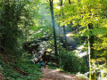
Exploring the Ségala on foot: Discovering a rich local heritage

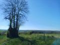
Travellers at the turn of the century who took the royal road from Rodez to Toulouse, between the two coaching inns at La Primaube and Baraqueville (Baraque de Fraysse), crossed an almost deserted plateau covered in moorland and chestnut groves.
Only the riverbanks and the valley slopes were cultivated. The region was plagued by famine. It was the land of the ‘black bellies’; their diet consisted mainly of rye bread and chestnuts.
The arrival of the railway in 1902 made it possible to bring in lime to improve these acidic soils. Rye disappeared, replaced by crops of wheat, potatoes and maize, which enabled the establishment of high-quality cattle farming.
This agricultural revolution reshaped the region and led to the creation of two new towns, Baraqueville and La Primaube.

Details

n°1578190
Creation:
Last update:
–
Last review:
  • Walking
    Activity: Walking
  • ↔
    Distance: 7.16 mi
  • ◔
    Average duration: 4h 20 
  • ▲
    Difficulty: Moderate

  • ⚐
    Back to start: Yes
  • ↗
    Ascent: + 1,214 ft
  • ↘
    Descent: - 1,184 ft

  • ▲
    Highest point: 2,415 ft
  • ▼
    Lowest point: 1,755 ft

Description of the walk

From Baraqueville, take the RN88 towards Rodez. After 2.5 km, turn right towards Manhac and park in the square by the town hall.

(S/E) With your back to the town hall, walk up Avenue du Centre for 150 m, keeping to the right three times. Then turn left onto Route de la Coste to reach the junction marking the start of the circular route.

(1) Turn left. Ignore the first junction, then, before the last houses in the village, turn right onto Chemin du Biel. At the bend, carry straight on along a path leading down towards the Ruisseau de Bagar.

(2) Cross the stream and head back up towards the Liette farm, continuing to follow the path as it climbs. Carry on along the access path until you reach the four-way junction. Turn left towards Noyès and keep going in that direction until you reach the next cross.

(3) Turn right, leaving the Salle des Fêtes on your left. Continue along a wide farm track, then follow a ‘forest path’, always taking the path that leads downhill. You’ll emerge onto the Route de Camboulazet, at the bridge over the Ruisseau de Malrieu.

(4) Cross the bridge. Follow the small road uphill for 500 m, then turn right onto the first stony track leading up towards the hamlet of Les Jonquières. You’ll reach a plateau, then come to a junction with the hamlet in sight.
(5) Turn right onto a grassy track. Then follow a small road for 500 m, before turning right onto the road leading to Les Crouzets.

(6) In the hamlet, turn left. Continue along the road for 800 m, until you reach the next crossroads.

(7) Turn right towards Le Fieu. Carry on straight ahead at the first two paths, then turn right at the third to enter the hamlet.

(8) Walk through the hamlet to reach a shaded path leading down towards the Ruisseau de Malrieu (ruins of the Volpillac mill). Cross the stream and take two bends until you reach a crossroads.

(9) Take the sharp left-hand bend and join the road leading to Lacombe. Turn right. At the entrance to the village, veer left and carry on until you reach two new houses and a cross.

(10) Turn left onto a stony track which becomes a grassy path. Cross the Ruisseau de Bagar and head back towards the village of Manhac. When you reach the first houses, carry straight on along the Chemin de la Combe.

(1) Turn left and return to the starting point by following the route in reverse (S/E).

Waypoints

  1. S/E : mi 0 - alt. 2,290 ft - Mairtie de Manhac
  2. 1 : mi 0.13 - alt. 2,336 ft - Crossroads at the circular loop
  3. 2 : mi 0.6 - alt. 2,096 ft - Bagard stream
  4. 3 : mi 1.25 - alt. 2,254 ft - Cross
  5. 4 : mi 2.13 - alt. 1,755 ft - Malrieu stream
  6. 5 : mi 3.01 - alt. 2,113 ft - Junction
  7. 6 : mi 3.78 - alt. 2,257 ft - Les Crouzets
  8. 7 : mi 4.29 - alt. 2,411 ft - Junction
  9. 8 : mi 4.99 - alt. 2,293 ft - Le Fieu
  10. 9 : mi 5.54 - alt. 2,257 ft - Crossroads
  11. 10 : mi 6.3 - alt. 2,365 ft - Cross
  12. S/E : mi 7.16 - alt. 2,290 ft - Mairtie de Manhac

Worth a visit

Along the way

The Bagard and Malrieu valleys and streams.
The old mill at Valpillac.

Nearby

A Gothic-style church and a small 13th-century market hall in Naves, Manhac.
Val de Lenne Lake in Baraqueville
Basilica of Notre Dame de Ceignac in Calmont de Plancatge

Reviews and comments

5 / 5
Based on 1 review

Reliability of the description
5 / 5
Ease of following the route
5 / 5
Route interest
5 / 5
Maiko
Maiko

Overall rating : 5 / 5

Date of your route : Apr 14, 2024
Reliability of the description : ★★★★★ Very good
Ease of following the route : ★★★★★ Very good
Route interest : ★★★★★ Very good
Very busy route : No

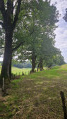
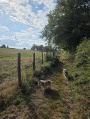
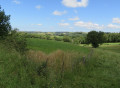
A lovely walk. Moderate difficulty. Very varied terrain, with flat sections, hills and descents. Beautiful views, crossing small streams, lovely paths.
I’d recommend it.
Eliane

Machine-translated

Other walks in the area

For more walks, use our search engine .

The GPS track and description are the property of this route's author. Please do not copy them without permission.