Trémolières: between Cône and Giffou

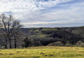
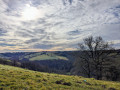
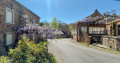
A chance to explore the area around Trémolières, a hamlet in the commune of Rullac-Saint-Cirq, situated on a plateau between the Cône and Giffou valleys.

Details

69285061
Creation:
Last update:
Last review:
  • Walking
    Activity: Walking
  • ↔
    Distance: 5.51 mi
  • ◔
    Average duration: 3h 25 
  • ▲
    Difficulty: Easy

  • ⚐
    Back to start: Yes
  • ↗
    Ascent: + 1,001 ft
  • ↘
    Descent: - 1,014 ft

  • ▲
    Highest point: 1,660 ft
  • ▼
    Lowest point: 1,148 ft

Photos

Description of the walk

To get to Trémolières from Réquista, take the D902 towards Rodez, then a few kilometres further on, at a place called Le Bouti, take the D116 towards Montautat. Shortly after passing the hamlet of La Serre, turn right onto the access road to the hamlet of Trémolières. Park in the centre of the hamlet on the grassy area.

(S/E) Return to the entrance to the hamlet and, after the last house, turn left onto a grassy path.

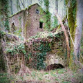
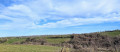
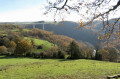
(1) At the three-way junction, continue to the right along the track (make sure you close the gates properly) a little further on. After passing a ruin (a chestnut-drying shed), the path runs overlooking the Cône valley. At the next three-way junction, stay on the path climbing to the right. Leave the woods and turn right (view of the Cône valley and the farmland).

(2) Turnleft onto the road. Walk through the hamlet of La Serre. At the well and the chapel, go straight on along the Chemin du Giffou. On leaving the hamlet, go round a farm building on the left and take the path on the right (views over the Giffou Valley).

(3) Turnright onto the path running alongside the meadow. Pass to the right of a ruin and continue to the River Giffou.

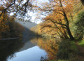
(4) Follow the river to the right, leave the woods and continue to the left.

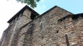
(5) Crossthe Récombis footbridge (former mill and reused stones and carvings on a barn). Continue along the uphill road.

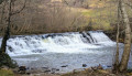
(6) At the hairpin bend, carry on straight ahead along the road leading to Le Moulinau (paved road and waterfall on the Giffou). Turn left onto the path that crosses the hamlet, then left again onto the descending footpath. Continue along the edge of the woods.

(7) After the embankment and its waterfall, continue to the right along the ascending path. Cross the D116 with care and continue straight ahead on the path climbing into the woods.

(8) At the three-way junction, head down to the left. At the entrance to La Fabrèguerie, turn right onto the bridge over the Ruisseau le Cône.

(9) Turnright onto the C1 and continue along this road. Cross the Ruisseau de Connilloug and reach the footbridge over the Cône. 

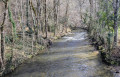
(10) Continue along the path climbing through the woods until you reach the junction from the outward journey.

(1) Turnright and retrace your steps along the outward route in the opposite direction to return to the car park (S/E)

Waypoints

  1. S/E : mi 0 - alt. 1,650 ft - Car park at Trémolières on the grassy area
  2. 1 : mi 0.16 - alt. 1,604 ft - Junction of the circular loop
  3. 2 : mi 0.94 - alt. 1,650 ft - Road junction
  4. 3 : mi 1.77 - alt. 1,247 ft - Junction at the edge of the meadow - Giffou (rivière)
  5. 4 : mi 2.02 - alt. 1,191 ft - The River Giffou
  6. 5 : mi 2.5 - alt. 1,161 ft - Footbridge
  7. 6 : mi 2.79 - alt. 1,270 ft - Hairpin bend
  8. 7 : mi 3.62 - alt. 1,161 ft - Junction
  9. 8 : mi 4.01 - alt. 1,299 ft - Three-way junction
  10. 9 : mi 4.33 - alt. 1,152 ft - La Fabrèguerie
  11. 10 : mi 4.79 - alt. 1,181 ft - Footbridge over the Cône
  12. S/E : mi 5.51 - alt. 1,650 ft - Car park at Trémolières in the meadow area

Notes

- IBP difficulty rating: 42
- Yellow markings

Swimming is possible in the Giffou

Worth a visit

Nearby, explore the Reycabrot site with its prehistoric cave, climbing area and picnic area.

Reviews and comments

4.3 / 5
Based on 3 reviews

Reliability of the description
4.7 / 5
Ease of following the route
4 / 5
Route interest
4.3 / 5
Christian12170
Christian12170

Overall rating : 4.3 / 5

Date of your route : Sep 21, 2026
Reliability of the description : ★★★★★ Very good
Ease of following the route : ★★★★☆ Good
Route interest : ★★★★☆ Good
Very busy route : No

It’s a shame that logging operations have damaged part of the route along the Giffou, particularly by felling some magnificent oak trees that used to provide shade along this section of the path!

Machine-translated

verdalle
verdalle

Overall rating : 4.3 / 5

Date of your route : Apr 27, 2026
Reliability of the description : ★★★★☆ Good
Ease of following the route : ★★★★☆ Good
Route interest : ★★★★★ Very good
Very busy route : No

a lovely walk

Machine-translated

PilRando31
PilRando31

Overall rating : 4.3 / 5

Date of your route : Jan 05, 2026
Reliability of the description : ★★★★★ Very good
Ease of following the route : ★★★★☆ Good
Route interest : ★★★★☆ Good
Very busy route : No

We chose to start from the village of La Fabrèguerie, which is more accessible and has parking space.
We set off along the valley of the cone until we reached a footbridge made from tree trunks. Just before arriving at the footbridge, the embankment had been reinforced, but a few steps would have been welcome on this short descent, which could be slippery in wet weather. The climb up the track through the woods is very pleasant. We took a short detour to discover the hamlet of Trémolière, where the hike normally starts. We resumed the trail to reach La Serre, with some beautiful views and a small chapel in the hamlet (it was closed), then descended into the Giffou valley. A very pleasant trail along the river, discovering several mills and finally arriving at La Fabrèguerie from above. A beautiful route for winter days, with lots of trails and tracks and little tarmac.

Machine-translated

Other walks in the area

For more walks, use our search engine .

The GPS track and description are the property of this route's author. Please do not copy them without permission.