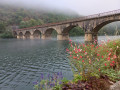
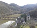
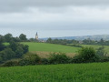
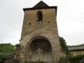
La Clauze route starting from Saint-Jean-Delnous

Walk from the village of Saint-Jean-Delnous. Much of the route runs through woodland, alongside the Ruisseau de Farradet, passing from farm to farm. The route presents no particular difficulty. 

Details

n°72069608
Creation:
Last update:
Last review:
  • Walking
    Activity: Walking
  • ↔
    Distance: 6.53 mi
  • ◔
    Average duration: 3h 40 
  • ▲
    Difficulty: Moderate

  • ⚐
    Back to start: Yes
  • ↗
    Ascent: + 728 ft
  • ↘
    Descent: - 735 ft

  • ▲
    Highest point: 1,703 ft
  • ▼
    Lowest point: 1,296 ft

Description of the walk

Parking is available in the church square, Place Saint-Jean. Public transport is available via the “LIO Occitanie” service.

(S/E) From the church square, take Rue de l’Église opposite you when you have your back to the church. 

(1) Cross the Route de Frayssinet and continue straight ahead along the Chemin de la Clauze. At the end of the housing estate, carry on straight ahead along the dirt track which descends into a wood about 500 metres further on. 

(2) Ignore the track coming from the right, carry on straight ahead and cross two small streams. The track begins to climb as you leave the woodland, leading to a farm at a place called Le Rastoullou. Walk through the farm, ignoring the track on the right and the next two on the left, to reach the RD186 (Route de la Clauze).

(3) Continuecarefully to the right along this road, passing to the left of the care home. At the junction, take the Chemin du Roc on the left, which leads to the Ruisseau de Farradet. Continue for about 1 km along the path, which crosses the stream four times and ends opposite a gated private property.

(4) Just before the gate, turn left onto the path that crosses the stream, continue for about 200 m, then keep to the stream, ignoring the path that heads uphill to the left. The path begins to climb as it moves away from the stream.

(5) Take Route de Farret on the right, carry on straight ahead at the junction, pass between the two farm buildings and continue along the path that starts just beyond them. At the next bend, ignore the side path branching off to the left. Make two wide hairpin bends and you’ll reach a junction with another path.

(6) Carry on straight ahead along the path, which descends slightly, until you reach a Y-junction. 

(7) Turn right and continue for about 800 m, following the Ruisseau de Farradet. 

(8) Cross the stream via a wide concrete bridge, then head uphill. 

(9) Cross a ford and follow the Ruisseau de Cabadoul. Continue to the four-way junction. 

(10) Turn right, cross the stream and follow the path as it climbs, changing direction further up to reach Frayssinet. 

(11) Carry on straight ahead along the road. Further on, carry on straight ahead, leaving Le Pouget on your right. You’ll reach an inverted Y-junction with a cross. 

(12) Head slightly to the left. Continue straight on, passing the Impasse du Prat on your left and the entrances to the housing estate on your right further on.

(1) Turn left onto Rue de l’Église to reach the car park (S/E).

Waypoints

  1. S/E : mi 0 - alt. 1,703 ft - Church Square
  2. 1 : mi 0.05 - alt. 1,686 ft - Junction for both directions (A/R). Route de Frayssinet
  3. 2 : mi 0.39 - alt. 1,585 ft - Junction
  4. 3 : mi 0.87 - alt. 1,693 ft - Junction with the RD186
  5. 4 : mi 1.73 - alt. 1,496 ft - Private property access, path on the left
  6. 5 : mi 2.47 - alt. 1,631 ft - Junction with Route de Farret
  7. 6 : mi 3.22 - alt. 1,306 ft - Crossroads
  8. 7 : mi 3.36 - alt. 1,312 ft - Four-way junction
  9. 8 : mi 3.85 - alt. 1,309 ft - Bridge over the Ruissseau de Farradet
  10. 9 : mi 4.67 - alt. 1,444 ft - Fording
  11. 10 : mi 5.1 - alt. 1,601 ft - Four-way junction
  12. 11 : mi 5.35 - alt. 1,644 ft - Junction at the hamlet of Frayssinet
  13. 12 : mi 6.12 - alt. 1,670 ft - Three-way junction, cross
  14. S/E : mi 6.53 - alt. 1,703 ft - Church Square

Notes

  • The route is signposted in yellow, clockwise only, as described here. 

Worth a visit

Reviews and comments

4 / 5
Based on 2 reviews

Reliability of the description
4 / 5
Ease of following the route
4 / 5
Route interest
4 / 5
kad12
kad12

Overall rating : 4 / 5

Date of your route : Jul 20, 2026
Reliability of the description : Not used / Not applicable
Ease of following the route : ★★★★☆ Good
Route interest : ★★★★☆ Good
Very busy route : No

A pleasant walk, generally well signposted and following wide, well-maintained paths, with no major difficulties throughout…… some lovely views and very little road walking

Machine-translated

surpilix
surpilix

Overall rating : 4 / 5

Date of your route : Apr 14, 2025
Reliability of the description : ★★★★☆ Good
Ease of following the route : ★★★★☆ Good
Route interest : ★★★★☆ Good
Very busy route : No

A pleasant walk, generally well signposted and following wide, well-maintained paths, with no major difficulties throughout...... lovely views and very little road walking, although the start isn’t obvious and the directions are poor! “With your back to the church entrance, turn right down the alleyway which is a no-entry street....”

Machine-translated

Other walks in the area

For more walks, use our search engine .

The GPS track and description are the property of this route's author. Please do not copy them without permission.