


Refine your search for walks in Mecé
Mecé walks

 The circular Chevalerie path in Livré-sur-Changeon
 Local authority
 3.74 mi
 +167 ft
 -171 ft
 1h 50
 Easy
 Departure from Livré-sur-Changeon (Ille-et-Vilaine)
A peaceful, family-friendly walk through the Livré countryside, passing the cemetery and La Chevalerie. There is a shortcut of around 30 minutes for those who prefer a shorter walk. The path is suitable for vehicles from start to finish, so you can access it with a pushchair. There is a stony section which may be difficult for umbrella pushchairs.
The cows’ paddock from the White Cross
1.67 mi
+13 ft
-13 ft
0h 45
Easy
Departure from Livré-sur-Changeon (Ille-et-Vilaine)
A countryside walk between Saint-Aubin-du-Cormier and Livré-sur-Changeon, through fields and woodland, suitable for children, pushchairs with tyres (other than umbrella pushchairs), and dogs. Ideal, therefore, for a family outing.
The Bois Cornillé route in Val-d’Izé
 9.70 mi
+256 ft
-246 ft
4h 40
 Moderate
Departure from Val-d'Izé (Ille-et-Vilaine)
Lovely country lanes winding through gently rolling countryside dotted with charming houses.
A circular medieval path in Saint-Aubin-du-Cormier
 Visorando Member7.89 mi
+105 ft
-102 ft
3h 45
Moderate
Departure from Saint-Aubin-du-Cormier (Ille-et-Vilaine)
Starting off through woodland, followed by wide, shaded country lanes, and finishing with a short loop around the pond – this route should satisfy walkers and cycle tourists alike, although walkers will have to contend with two stretches along small tarmac roads.
On one of the reed paths in Saint-Jean-sur-Couesnon
3.47 mi
+46 ft
-46 ft
1h 40
Easy
Departure from Saint-Jean-sur-Couesnon (Ille-et-Vilaine)
Starting from Saint-Jean-sur-Couesnon, a small country village, come and discover peace and tranquillity on this walk, which will take you past historic sites, old houses and the banks of the Couesnon.
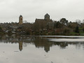
La Roche Piquée in Saint-Aubin-du-Cormier
 4.58 mi
+98 ft
-102 ft
2h 10
Easy
Departure from Saint-Aubin-du-Cormier (Ille-et-Vilaine)
A very pleasant walk in the forest of Saint-Aubin-du-Cormier with a return to the pond. Walkers can continue their visit to this small town by pushing on to the ruins of the dismantled castle.
The Bois de Ruminion in Saint-Aubin-du-Cormier
2.42 mi
+72 ft
-72 ft
1h 10
Easy
Departure from Saint-Aubin-du-Cormier (Ille-et-Vilaine)
On this short family walk, you’ll enjoy the ruins of the medieval castle destroyed by the King of France after Brittany lost its independence at the Battle of Saint-Aubin-du-Cormier. Only the side facing France remains....
La Lande de la Rencontre in Saint-Aubin-du-Cormier
 6.48 mi
+105 ft
-85 ft
3h 05
Easy
Departure from Saint-Aubin-du-Cormier (Ille-et-Vilaine)
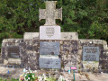
Throughout this route, the whole of Brittany unfolds before you across moors, streams and forests. Do take a short detour to see the memorial stone commemorating the battle of 28 July 1488.
On the heights of Saint-Marc-sur-Couesnon
 4.13 mi
+223 ft
-210 ft
2h 05
Easy
Departure from Saint-Marc-sur-Couesnon (Ille-et-Vilaine)
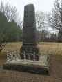
Built on a promontory overlooking the Couesnon valley, Saint-Marc is a must-see for walkers heading for Mont-Saint-Michel. On this route, on a clear day, Mont-Saint-Michel is ever-present.
From Champeaux to La Cantache
 8.19 mi
+433 ft
-423 ft
4h 10
Moderate
Departure from Champeaux (Ille-et-Vilaine)
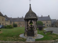
A typical village of the Upper Breton bocage, come and discover the little hamlet of Champeaux with its huge collegiate church, then set off along the bocage paths to reach the 140-hectare Cantache lake, created in 1995 to support the low-water level of the Vilaine and to regulate floodwaters.
The Cantache tour in Pocé-les-Bois
 7.56 mi
+79 ft
-72 ft
3h 35
Moderate
Departure from Montreuil-sous-Pérouse (Ille-et-Vilaine)
A stone's throw from Vitré, a historic town in the Marches de Bretagne region, Lake Cantache stretches across three municipalities: Champeaux, Monteuil-sous-Pérouse and Pocé-les-Bois. A winter stopover for migratory birds, their presence is a source of wonder.
Route through the heart of the valley at Montreuil-sous-Pérouse
 4.46 mi
+338 ft
-335 ft
2h 20
Easy
Departure from Montreuil-sous-Pérouse (Ille-et-Vilaine)
This FFRP-certified route will take you through the valleys of the Montreuil-sous-Pérouse countryside. You’ll also pass by Lac de la Cantache.
Suitable for both walking and cycling.
Signposting in a clockwise direction: green arrows marked with the number 6
Route des Petits Ponts de Bois (Montreuil-sous-Pérouse)
 4.81 mi
+440 ft
-423 ft
2h 35
Easy
Departure from Montreuil-sous-Pérouse (Ille-et-Vilaine)
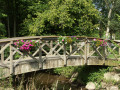
Take a stroll through the countryside of Montreuil-sous-Pérouse and its valleys. On this route, you’ll cross charming little wooden bridges spanning the Ruisseau de la Pérouse.
Route of the Lisière Trail in Marpiré
 10.81 mi
+236 ft
-236 ft
5h 10
Moderate
Departure from Marpiré (Ille-et-Vilaine)
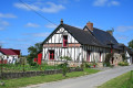
After walking through the undergrowth of the Chevré Forest, you will discover this vast plateau via wide paths and small country lanes, where fields of grain blend with green meadows, ending as you began with a walk through the Bois de Briérue and the Orée du Bois lake near La Lisière.
Menhir Trail (Champeaux)
 3.03 mi
+138 ft
-138 ft
1h 30
Easy
Departure from Champeaux (Ille-et-Vilaine)
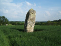
Take a stroll along the Plan d’Eau de la Cantache, a leisure area much loved by locals: fishing, birdwatching, walking… You’ll pass close to the Haute Pierre menhir.
FFR-certified route, marked with yellowPR® signs, supplemented by green arrows bearing the number 15 (anti-clockwise). Suitable for both walking and mountain biking.