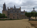
Menhir Trail (Champeaux)

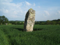
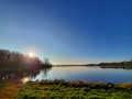
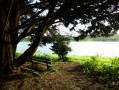
Take a stroll along the Plan d’Eau de la Cantache, a leisure area much loved by locals: fishing, birdwatching, walking… You’ll pass close to the Haute Pierre menhir.

FFR-certified route, marked with yellowPR® signs, supplemented by green arrows bearing the number 15 (anti-clockwise). Suitable for both walking and mountain biking.

Details

30319313
Creation:
Last update:
Last review:
  • Walking
    Activity: Walking
  • ↔
    Distance: 3.03 mi
  • ◔
    Average duration: 1h 30 
  • ▲
    Difficulty: Easy

  • ⚐
    Back to start: Yes
  • ↗
    Ascent: + 138 ft
  • ↘
    Descent: - 138 ft

  • ▲
    Highest point: 351 ft
  • ▼
    Lowest point: 203 ft
  • ⚐ Country: France
  • ⚐ City: Champeaux (35500)
  • ⚑
    Start/End: N 48.136683° / W 1.274757°
  • ❏
    IGN map(s): Ref. 1318SB
  • Hour-by-hour weather

Photos

Description of the walk

Start from the Rabaud car park, along the D29, on the edge of the Plan d’Eau de la Cantache.

(S/E) Head west (do not take the bridge) and follow the D29. After about a hundred metres, turn left onto a path.

(1) Cross a road and continue straight ahead along the small road leading to Grand Fresnay. Go round the hamlet on the left and follow a track to Grabusson.

(2) Follow a road to the left and theGR®37(red and white markings). Ignore a road on the left, turn right and you’ll reach a junction just before La Cornillerais.

(3) Turn left onto a small road. When this turns right, carry on straight ahead along a track following theGR® and you’ll soon reach the Menhir de la Haute Pierre, situated on the left in a field.

(4) Then turn right along the track, then left twice. You’ll reach the western end of the Plan d’Eau de la Cantache.

(5) Continue straight on along a path, skirting the lake on your right-hand side, until you reach the Rabaud car park (S/E).

Waypoints

  1. S/E : mi 0 - alt. 213 ft - Rabaud car park - Plan d'Eau de la Cantache
  2. 1 : mi 0.55 - alt. 344 ft - Crossing the road
  3. 2 : mi 1 - alt. 335 ft - Grabusson
  4. 3 : mi 1.32 - alt. 302 ft - Junction before La Cornillerais
  5. 4 : mi 1.45 - alt. 299 ft - Menhir de la Haute Pierre (Champeaux)
  6. 5 : mi 1.79 - alt. 220 ft - Plan d'Eau de la Cantache
  7. S/E : mi 3.03 - alt. 213 ft - Rabaud car park - Cantache (rivière)

Notes

Car park at the starting point.

Worth a visit

Always be cautious and plan ahead when you're outdoors. Visorando and the author of this route cannot be held responsible for any accidents occurring on this route.

The GR® and PR® markings are the intellectual property of the Fédération Française de Randonnée Pédestre.

Reviews and comments

5 / 5
Based on 2 reviews

Reliability of the description
5 / 5
Ease of following the route
5 / 5
Route interest
5 / 5
Azimut71
Azimut71

Overall rating : 5 / 5

Date of your route : Sep 16, 2025
Reliability of the description : ★★★★★ Very good
Ease of following the route : ★★★★★ Very good
Route interest : ★★★★★ Very good
Very busy route : No

The tree-lined roads are very pleasant.
The small roads are very quiet.
The return journey along the lake is less interesting.

Machine-translated

BRICECOCO
BRICECOCO

Overall rating : 5 / 5

Date of your route : Feb 26, 2023
Reliability of the description : ★★★★★ Very good
Ease of following the route : ★★★★★ Very good
Route interest : ★★★★★ Very good
Very busy route : No

A very pleasant walk in peaceful surroundings

Machine-translated

Other walks in the area

For more walks, use our search engine .

The GPS track and description are the property of this route's author. Please do not copy them without permission.