


 Country:
 City:
City:


The entire route is signposted in yellow, although the markings are sometimes barely visible or even non-existent.
Red and white markings forthe GR® 39 plus yellow
(S/E) From the church car park, cross Rue Notre-Dame and head south along Impasse Les Cours. The cul-de-sac becomes a path, veering slightly towards the south-east.
(1) As you approach the houses at La Connuaie, take the path on the right which leads directly to the hamlet of Saint-Georges.
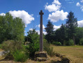
Follow the D22 county road to the left, going round the ruins of the old vicarage, and continue along the road to the right to see the Cross of Saint-Georges.
(2) Retrace your steps and continue left onto the D22.
(3) Take the grassy path on the right which runs alongside the Ruisseau de Ritort, which you’ll come across again later.
(4) When you reach the hamlet of Les Granges, cross the road and carry on straight ahead. Ignore the first path on the left and follow theGR® 39. Carry on straight ahead along a variant ofthe GR® on the path, which turns into a stony track. Follow it round a bend to the left, then another to the right, before coming out onto a road.
(5) Turn right onto the road and pass the Goussardaie buildings on your left. Let theGR® 39 variant branch off to the left and carry on for a few metres.
Yellow markings
Follow the road as it winds sharply to the right and descends towards the Ritort Stream valley. Turn left onto the path just after the entrance to a private property and head uphill towards La Gennerie. Once you reach the hamlet, continue to the left.
(6) Follow the road to the left for a few metres and turn right at the hairpin bend, following a white fence. Continue northwards to La Montagnerie. Follow the road to the left, cross over and turn right onto the small road with a Stop sign.
(7) Pass between the houses, keeping as close as possible to the one on the right, with a low stone wall on your left. The black dog isn’t aggressive but may startle you. The start of the path is barely visible after the house but is definitely there, with an immediate bend to the left. Cross the Ruisseau du Haut de Mont to the right and continue northwards.
Ignore the first turn-off to the left towards La Gallionnais; at thesecond turn-off, the path widens. Continue for about 200 m.
Red and white markings forthe GR® 39 plus yellow
(8) Please note: look out for a passage on the right between two fields where theGR® 39 joins the path. Take this passage heading east. When you reach another path, turn right and then immediately left. At the next T-junction, turn right. Cross the Ruisseau du Haut du Mont again and you’ll reach the access road to the valley.
(9) Turn left and continue along the left-hand side of Rue Sainte-Anne, which leads into Chauvigné and passes the church car park (S/E).


 Visorando Member
 Moderate
 Difficult
