Route de la Vilaine, Saint-Didier

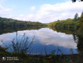
Take a stroll through the countryside around Saint-Didier on this route which runs alongside a stretch of the River Vilaine. You’ll pass close to the Peinière Chapel, a place of pilgrimage which, every 15 August and on the Sunday closest to the Feast of the Nativity in early September, attracts thousands of Catholics from across the department (and even beyond) to celebrate the Virgin Mary. Stop for a moment to admire the mosaics created by the Odorico brothers that adorn the altars.

Details

31035698
Creation:
Last update:
Last review:
  • Walking
    Activity: Walking
  • ↔
    Distance: 8.18 mi
  • ◔
    Average duration: 4h 05 
  • ▲
    Difficulty: Moderate

  • ⚐
    Back to start: Yes
  • ↗
    Ascent: + 361 ft
  • ↘
    Descent: - 371 ft

  • ▲
    Highest point: 308 ft
  • ▼
    Lowest point: 154 ft

Description of the walk

Starts at the town hall square.

YellowPR® signposting supplemented by green arrows marked with the number 19

(S/E) Head down Impasse des Lagunes, which leads to a park with a lake. Stay on the right-hand bank and take the path that climbs through the woodland. At the end, turn left to join the road.

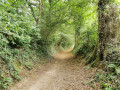
(1) Turn right once, then turn right again after the hamlet of Le Pont-Riou, at the corner of No. 4. Follow the road, which turns into a path after 200 m. At the end, you’ll reach a crossroads at Le Chêne Dêt, opposite No. 11 on your right.

(2) Turn left to follow the road and, just after No. 22 and opposite a wayside cross, turn right to reach the hamlet of Le Feil. Walk alongside it on your right and continue along the road until you reach a ‘Stop’ sign.

(3) Turn right and follow the road to a tunnel that passes under the railway line. Go through it.

(4) Once on the other side, turn right onto a dirt track. Follow the Vilaine for about 300 metres, then veer off to the right and follow the track to a junction. Turn right onto the bridge that crosses over the railway line. Once on the other side, carry on straight ahead along the road until you reach a junction with a small chapel on your left, at a place called La Melleraye.

(5) Carry on straight ahead until you reach the hamlet of Villermé. Walk between the buildings, then take the first grassy path on the left.

(6) Follow this path and, almost at the corner of the field on your right, turn left. Then go round a house on your left and rejoin the road you took earlier. Turn right and return to the crossroads with the small chapel.

(5) Turn left, carry on straight ahead and pass L’Orvinière. Ignore the first road on the right, then 250 metres further on, take the grassy path that branches off to the right towards a row of trees, running alongside a ditch on your right. Follow it to a road junction.

(7) Turn left and follow the road to La Poissonnière.

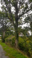
(8) Just past the houses in the hamlet, turn right and, facing the gate at No. 1, turn left and follow the path to the Chêne Harel.

(9) Veer to the left and follow the road to the Chêne Dêt.

(2) Continue along the path you took on the way there, but in the opposite direction, to reach the Place de la Mairie (S/E).

Waypoints

  1. S/E : mi 0 - alt. 223 ft - Town Hall Square
  2. 1 : mi 0.45 - alt. 226 ft - Junction shared by the out-and-back route. Road/track
  3. 2 : mi 1.04 - alt. 249 ft - Junction of the first circular loop. Chêne Dêt
  4. 3 : mi 1.66 - alt. 233 ft - Stop - Chapelle de la Peinière
  5. 4 : mi 2.43 - alt. 157 ft - Crossing under the railway line - Vilaine (fleuve)
  6. 5 : mi 3.76 - alt. 272 ft - Crossroads with a small chapel
  7. 6 : mi 4.15 - alt. 302 ft - Grassy path to the left
  8. 7 : mi 6.07 - alt. 285 ft - Road junction. La Gruère
  9. 8 : mi 6.37 - alt. 295 ft - La Poissonnière
  10. 9 : mi 6.82 - alt. 308 ft - The Harel Oak
  11. S/E : mi 8.18 - alt. 223 ft - Town Hall Square

Notes

Car park, shops and toilets near the starting point.

Signposted in a clockwise direction.

Suitable for both walking and mountain biking.

Worth a visit

La Peinière Chapel.
The Vilaine.

Always be cautious and plan ahead when you're outdoors. Visorando and the author of this route cannot be held responsible for any accidents occurring on this route.

The GR® and PR® markings are the intellectual property of the Fédération Française de Randonnée Pédestre.

Reviews and comments

4.7 / 5
Based on 2 reviews

Reliability of the description
5 / 5
Ease of following the route
5 / 5
Route interest
4 / 5
Lisounou
Lisounou

Overall rating : 4.3 / 5

Date of your route : Aug 30, 2024
Reliability of the description : ★★★★★ Very good
Ease of following the route : ★★★★★ Very good
Route interest : ★★★☆☆ Average
Very busy route : No

The first part of the route is nice (lots of fields). But I think the end is dangerous because you’re on a main road where cars drive very fast.

Machine-translated

jacdav35
jacdav35

Overall rating : 5 / 5

Date of your route : Jun 16, 2024
Reliability of the description : ★★★★★ Very good
Ease of following the route : ★★★★★ Very good
Route interest : ★★★★★ Very good
Very busy route : No

A pleasant, easy route – a bit more road than the Vallons route, but a lovely discovery. The grass hasn’t been cut along the route, so take care on the D105.

Machine-translated

Other walks in the area

For more walks, use our search engine .

The GPS track and description are the property of this route's author. Please do not copy them without permission.