The Chemin des Bogues around Saint-Marc-le-Blanc

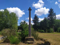
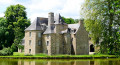
The Chemin des Bogues winds through a landscape where working with granite has become second nature and part of the local culture. Granite has left an indelible mark on the landscape. Houses and manor houses dating from the 16th and 17th centuries are a common sight in a region where the rock even features in the names of villages: Rocher-Guy, Rocher Gerré, Rocher Renard, Rochedien, … You may even come across rock carvings on the sides of certain quarries, former haunts of the Picaous (granite workers).

Details

882388
Creation:
Last update:
Last review:
  • Walking
    Activity: Walking
  • ↔
    Distance: 8.11 mi
  • ◔
    Average duration: 3h 50 
  • ▲
    Difficulty: Moderate

  • ⚐
    Back to start: Yes
  • ↗
    Ascent: + 118 ft
  • ↘
    Descent: - 108 ft

  • ▲
    Highest point: 364 ft
  • ▼
    Lowest point: 246 ft

Description of the walk

Park in the new car park reserved for walkers: Rue de Normandie, on the left as you leave the village.

(S/E) Head south-east, passing behind the school and following the footpath. Continue past the back of the church, then cross the road and carry on straight ahead. Turn left onto Rue des Glaïeuls and then left again onto Rue de la Beausse. After 30 metres, follow the road to the right, cross Rue des Rochers and continue along the path opposite. At the junction, take the second left. Very soon, the road turns into a path.

(1) Carry on to the right. Cross the road and turn slightly right onto the north-west-facing path. This path does not appear on maps, but, lined with trees on both sides, it is easy to follow.

(2) Reach the access road to La Mésangère and turn right onto the road. At the Rocher Ferré crossroads, carry straight on.

(3) After a bend to the left, take the path on the right, which initially heads north. Continue westwards through the hamlet of l’Esconerie. On leaving the hamlet, take the road on the left. In the hamlet of Échallerie, at a right-hand bend, take the path on the left and, at the Fork in the road, keep to the right. Continue along this path to La Poupardaie, turn left onto the road and follow the bend to the right.

(4) Before the last house, take the path on the right and continue north-west to the Route du Fretay. Turn right. Cross the D18 county road and take the path heading north, slightly to the left.

(5) Turn 90° to the right, then, after 250m, take the path on the left. Continue along this path, skirting the hamlet of La Perlais on the right.

(6) When you reach the road, follow it to the right. Pass through La Vairie. Take the path on the left towards La Noë.

(7) Turn right and carry on straight ahead along the path. Cross a road and carry on straight ahead. Cross the D98 and continue along the path opposite.

(8) At the hamlet of Les Plessis, turn left and, very quickly, take the path on the right.

(9) At Rocher Guy, turn left. Keep right at La Vallée Olive, then follow the road to the left.

(10) Take the D18 on the right and enter Saint-Marc-le-Blanc via Rue de Fougères. Turn right onto Rue de l’Étang, then left onto Rue des Curés.

(11) Turn right onto Rue des Marais to pass, as at the start, behind the school and reach the car park (S/E).

Waypoints

  1. S/E : mi 0 - alt. 315 ft - Hikers’ car park, Rue de Normandie
  2. 1 : mi 0.58 - alt. 272 ft - A hairpin bend to the right
  3. 2 : mi 1.16 - alt. 262 ft - On the right: access road to La Mésangère
  4. 3 : mi 1.48 - alt. 285 ft - Path on the right
  5. 4 : mi 2.38 - alt. 312 ft - Path on the right
  6. 5 : mi 3.09 - alt. 305 ft - Path on the right at a 90° angle
  7. 6 : mi 4.12 - alt. 351 ft - Road on the right
  8. 7 : mi 4.91 - alt. 335 ft - Road on the right
  9. 8 : mi 6.2 - alt. 348 ft - Turn left at Les Plessis
  10. 9 : mi 6.8 - alt. 348 ft - Towards Rocher Guy, on the left
  11. 10 : mi 7.33 - alt. 325 ft - Turn right towards La Maladrerie
  12. 11 : mi 7.93 - alt. 305 ft - On the right
  13. S/E : mi 8.11 - alt. 315 ft - Hikers’ car park, Rue de Normandie

Notes

This route sometimes follows paths along the edges of fields. It is generally well signposted with wooden signs. All the paths used are on communal land acquired through land consolidation following a very specific policy implemented by local councillors.

You can shorten the route to 10 km by following the instructions below: After L’Esconerie (a few hectometres past the ‘3 ’), continue along the road. Cross the D18 and follow the path opposite. Cross a road and follow the route described above, continuing straight on towards the Noé

Reviews and comments

4.6 / 5
Based on 3 reviews

Reliability of the description
4.7 / 5
Ease of following the route
4.7 / 5
Route interest
4.3 / 5
Mamie th
Mamie th

Overall rating : 4.7 / 5

Date of your route : Mar 20, 2025
Reliability of the description : ★★★★★ Very good
Ease of following the route : ★★★★★ Very good
Route interest : ★★★★☆ Good
Very busy route : Yes

A superb hike

Machine-translated

OLVMALOU
OLVMALOU

Overall rating : 4.7 / 5

Date of your route : Feb 07, 2021
Reliability of the description : ★★★★★ Very good
Ease of following the route : ★★★★★ Very good
Route interest : ★★★★☆ Good
Very busy route : No

The paths were a bit damp... but it was a walk without any rain.

So much granite!

Machine-translated

dedep
dedep

Overall rating : 4.3 / 5

Date of your route : Mar 14, 2019
Reliability of the description : ★★★★☆ Good
Ease of following the route : ★★★★☆ Good
Route interest : ★★★★★ Very good

A lovely walk through the land of granite

Machine-translated

Other walks in the area

For more walks, use our search engine .

The GPS track and description are the property of this route's author. Please do not copy them without permission.