


Refine your search for walks in Louzac-Saint-André
Louzac-Saint-André walks


 Exploring the Vallée de la Croix
 Visorando Member
 2.43 mi
 +138 ft
 -138 ft
 1h 15
1h 15
 Easy
Easy
 Departure from Louzac-Saint-André (Charente)
The municipality of Louzac-Saint-André is criss-crossed by around 40 km of country lanes, offering the chance to discover a wide variety of landscapes amidst vineyards and woodland. The peaceful Vallée de la Croix is a remarkable example of this, unanimously recognised as representative of the natural and historical heritage of the Borderies.
Hikers and walkers, set off to explore it or rediscover it for yourselves with the route suggested here, which is accessible to all.
Route des Borderies in Louzac-Saint-André
9.12 mi
+541 ft
-564 ft
4h 40
 Moderate
Departure from Louzac-Saint-André (Charente)
Moderate
Departure from Louzac-Saint-André (Charente)
At the westernmost tip of Charente, Louzac-Saint-André, with its two villages and numerous hamlets, is a typical commune of the Borderies region in Saintonge.
These rural paths wind through alternating wooded areas and vineyards.
From valleys to hills, in addition to beautiful views of the Romanesque churches of Saint-Martin de Louzac and Saint-André, walkers will discover two remarkable natural landscapes, the Ri Bellot Valley and the Vallée de La Croix.
Hills and valleys in the Borderies
 4.53 mi
+315 ft
-312 ft
2h 20
Easy
Departure from Saint-Laurent-de-Cognac (Charente)
4.53 mi
+315 ft
-312 ft
2h 20
Easy
Departure from Saint-Laurent-de-Cognac (Charente)
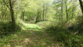
This route includes a tour of the Vallée de La Croix, part of the natural and historical heritage of the Borderies region, via the Chemin du Panteneau in the canton of Saint-Martin, whose right-of-way has marked one of the boundaries between the two municipalities of Saint-Laurent-de-Cognac and Louzac-Saint-André since 1824.
Saint-Laurent-de-Cognac / Louzac-Saint-André - Sentier des Combes
 Local authority
 6.00 mi
+328 ft
-318 ft
3h 05
Easy
Departure from Saint-Laurent-de-Cognac (Charente)
6.00 mi
+328 ft
-318 ft
3h 05
Easy
Departure from Saint-Laurent-de-Cognac (Charente)
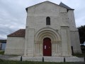
Bordered to the South by the Charente river, theSaint-Laurent area consists of a small town gathered around its church and its 11th century portal, several villages spread across the valleys and the hills as well as farms and secluded dwellings.
Merpins - Sentier François Ier
 5.68 mi
+62 ft
-62 ft
2h 40
Easy
Departure from Merpins (Charente)
5.68 mi
+62 ft
-62 ft
2h 40
Easy
Departure from Merpins (Charente)
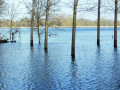
Located at the confluence of the Né and Charente rivers, the Merpins commune has been permanently occupied by men from very early times: arrowheads, pottery shards, and later an imposing medieval fortress, an 11th century church and an abbey dating back to the 12th century are the living proof. These fertile lands are home to meadows, cereal fields and a Grande-Champagne listed vineyard.
Saint-Sulpice-de-Cognac / Cherves-Richemont - Sentier des Chauffeurs
 7.45 mi
+381 ft
-377 ft
3h 45
Moderate
Departure from Saint-Sulpice-de-Cognac (Charente)
7.45 mi
+381 ft
-377 ft
3h 45
Moderate
Departure from Saint-Sulpice-de-Cognac (Charente)
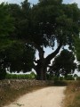
Saint-Sulpice-de-Cognac is pleasantly located between the marshlands of the Antenne River and limestone hillsides. There, are hidden the remains of the Agrippa Roman road as well as forgotten local railroad.
Cherves-Richemont is graced with the Antenne River and offers an unexpected diversity of landscapes. Its historic heritage is particularly rich: Romanesque churches, Château Chesnel, watermills, manor houses….
The Sentier du Biau starting from Ars
 5.55 mi
+23 ft
-23 ft
2h 35
Easy
Departure from Ars (Charente)
5.55 mi
+23 ft
-23 ft
2h 35
Easy
Departure from Ars (Charente)
A pleasant walk starting from Ars-en-Saintonge, exploring a very natural area including the Bois de la Grande Prée and the Né. The route features some fine examples of built heritage, such as the school complex and the Bûcher d’Ars, the Château d’Ars at the start of the walk, and the Church of Saint-Maclou on the return journey.
 Vallons et Borderies in Saint-Bris-des-Bois
11.65 mi
+597 ft
-587 ft
3 hrs
Moderate
Departure from Saint-Césaire (Charente-Maritime)
This route will allow you to discover the variety of landscapes in the Borderies region. The Coran valley from Saint-Brice-des-Bois to Saint-Sauvant runs alongside three villages where you will find places to eat as well as remarkable churches and monuments. Once past Saint-Sauvant, you will experience the secret side of the Borderies, where vineyards and farms can be discovered at the edge of a wood or in the hollow of a valley. Here, nature is less tamed than in the rest of the region.
The distillery tour starting from L’Ermitage
6.71 mi
+253 ft
-249 ft
3h 20
Moderate
Departure from Chaniers (Charente-Maritime)
A countryside walk that follows the paths of the Chagnolais countryside through vineyards and fields, forming a circular route that approaches the Domaine de Lavoissière to the north and leads to the Bossuet distillery to the south. You can visit the distillery before heading west to the Domaine de Nancrevant, where you can also stop off.
Gimeux - Sentier du Fanaud
 6.44 mi
+377 ft
-374 ft
3h 15
Easy
Departure from Gimeux (Charente)
6.44 mi
+377 ft
-374 ft
3h 15
Easy
Departure from Gimeux (Charente)
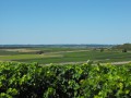
Gimeux was built on a hillside overlooking the valley and marshlands of the river Né and enjoys a flourishing farming activity: meadows and cereal fields in the valley, vineyards on the hills. Ancient burial sites and the outline of the old Roman road called ‘Chemin Boisné’ are revealing of the ancestral occupation of the land. The parish church dates back to the 12th century. Also marking the landscape are an old chapel as well as the remains of a windmill on the Fanaud hillside.
Nature as Heritage in Villars-les-Bois
 4.81 mi
+289 ft
-302 ft
2h 30
Easy
Departure from Villars-les-Bois (Charente-Maritime)
4.81 mi
+289 ft
-302 ft
2h 30
Easy
Departure from Villars-les-Bois (Charente-Maritime)
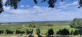
Perched on the heights of Romanesque Saintonge at an altitude of 78 metres, this small village lies at the heart of the Cognac vineyards. Scattered around the village centre, fifteen hamlets share the 271 inhabitants amidst the tranquillity of the countryside. The landscape consists mainly of farmland, vineyards and woodland. As the seasons change, discover a rich botanical and wildlife heritage worth preserving.
Short circular in the woods of Brizambourg
 4.92 mi
+177 ft
-154 ft
2h 25
Easy
Departure from Brizambourg (Charente-Maritime)
4.92 mi
+177 ft
-154 ft
2h 25
Easy
Departure from Brizambourg (Charente-Maritime)
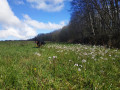
A short, peaceful circular on wide paths, in a wooded and hilly setting.
Circular tour in the vineyards between Vénérand and Saint-Bris-des-Bois
 5.51 mi
+131 ft
-138 ft
2h 40
Easy
Departure from Vénérand (Charente-Maritime)
5.51 mi
+131 ft
-138 ft
2h 40
Easy
Departure from Vénérand (Charente-Maritime)
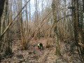
The hike is mostly in the woods, on dirt tracks as they say here. There is little elevation gain and very little tarmac. You are guaranteed to be surrounded by nature, with flora and fauna.
Saint-Brice - Sentier de l'Abbaye
 6.63 mi
+243 ft
-240 ft
3h 15
Moderate
Departure from Saint-Brice (Charente)
6.63 mi
+243 ft
-240 ft
3h 15
Moderate
Departure from Saint-Brice (Charente)
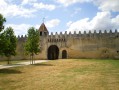
Thanks to the natural beauty of its location and the richness of its heritage, Saint-Brice is one of the most picturesque areas of Cognac region. At the heart of the Charente and Soloire rivers valley, man has erected many symbolic buildings: dolmens, churches, abbeys, castles and manors, all expertly crafted.
From La Chapelle-des-Pots to Saint-Césaire
 6.60 mi
+381 ft
-344 ft
3h 20
Moderate
Departure from La Chapelle-des-Pots (Charente-Maritime)
6.60 mi
+381 ft
-344 ft
3h 20
Moderate
Departure from La Chapelle-des-Pots (Charente-Maritime)
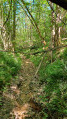
This 10 km circular will show you the very diverse landscapes of Saintonge. Two-thirds of the route is shaded by woods, one-third is through vineyards (we are in the "Fins Bois" area of the Cognac appellation) and a small third (thank you Pagnol) is in the two villages at the start and finish.
The route is sometimes complicated, but the paths are well marked. The route was surveyed on site, so it is very reliable, even if it sometimes seems to stray from the paths marked on the IGN map (especially at the start).
From Chaniers to Port Hublé via Les Grandes Combes and back via the Charente
5.83 mi
+207 ft
-207 ft
2h 50
Easy
Departure from Chaniers (Charente-Maritime)
This hike will take you to the heights of the commune of Chaniers to discover the view of the hillsides on the other side of the Charente, before returning along the river.
Route du Chemin 101
 6.04 mi
+285 ft
-299 ft
3h 00
Moderate
Departure from Genté (Charente)
6.04 mi
+285 ft
-299 ft
3h 00
Moderate
Departure from Genté (Charente)
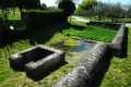
Built on the lower slopes of Grande Champagne, Genté offers its residents proximity to the town of Cognac, 8 km away, and the charms of rural life. Point 101 is an iconic location in the commune of Genté, where the orientation table is located. This site was once home to an old mill, some remains of which are still buried in the ground around the site. Point 101 is also the reference point for sea level.
Route du Gouffre au Marais
 10.28 mi
+56 ft
-56 ft
4h 45
Moderate
Departure from Gensac-la-Pallue (Charente)
10.28 mi
+56 ft
-56 ft
4h 45
Moderate
Departure from Gensac-la-Pallue (Charente)
Gensac-la-Pallue is notable for its marshes, to which the locals are deeply attached. La Pallue comes from ‘palus’: marshes. This wetland was once an extension of a branch of the Charente. La Pallue, an enclave within the parish of Gensac, became an independent commune during the Revolution. The two communes of Gensac and La Pallue were merged in 1857, with the exception of the villages of Roissac.
Gouffre to the Marshes Route (medium-length circular route)
 7.92 mi
+56 ft
-56 ft
3h 40
Easy
Departure from Gensac-la-Pallue (Charente)
7.92 mi
+56 ft
-56 ft
3h 40
Easy
Departure from Gensac-la-Pallue (Charente)
Gensac-la-Pallue is characterised by its marshes, to which the locals are very attached. The name ‘La Pallue’ comes from ‘palus’ (marshes). This wetland was once the extension of a branch of the River Charente. La Pallue, an enclave within the parish of Gensac, became an independent commune during the French Revolution. The two communes of Gensac and La Pallue were merged in 1857, with the exception of the villages of Roissac.
Cognac vineyards starting from Gensac-la-Pallue
 5.79 mi
+56 ft
-56 ft
2h 45
Easy
Departure from Gensac-la-Pallue (Charente)
5.79 mi
+56 ft
-56 ft
2h 45
Easy
Departure from Gensac-la-Pallue (Charente)
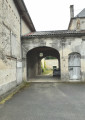
A route with very little elevation gain; the path is very easy to walk on, even in wet weather. At the start, you’ll pass the trout farming ponds. And nearby are some beautiful wine-growing estates.
On the paths of Aujac
5.92 mi
+33 ft
-33 ft
2h 45
Easy
Departure from Aujac (Charente-Maritime)
Here is an easy walking route through the countryside around the village of Aujac. Vineyards, meadows, hedgerows and copses – a peaceful, bucolic setting.
Courcerac Pond
 3.40 mi
+20 ft
-20 ft
1h 35
Easy
Departure from Courcerac (Charente-Maritime)
3.40 mi
+20 ft
-20 ft
1h 35
Easy
Departure from Courcerac (Charente-Maritime)
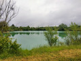
A walk in the commune of Courcerac, a circular route starting from the nature area and its pond, winding through the vineyards and along a few forest paths.
The Templars’ Route in Angles
 6.27 mi
+236 ft
-207 ft
3h 05
Easy
Departure from Salles-d'Angles (Charente)
6.27 mi
+236 ft
-207 ft
3h 05
Easy
Departure from Salles-d'Angles (Charente)
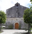
It was in December 1856 that Salles de Segonzac joined forces with the Commanderie d'Angles, a small village nestled in a bend of the River Le Né. Angles lived in harmony with the river, whilst Salles, resembling a large village, centred its life around wine-growing.
Circuit des Trois Pierres
 5.91 mi
+125 ft
-125 ft
2h 50
Easy
Departure from Angeac-Champagne (Charente)
5.91 mi
+125 ft
-125 ft
2h 50
Easy
Departure from Angeac-Champagne (Charente)
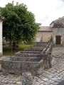
A lovely walk through the Charentais vineyards, passing beautiful buildings and around the village of Roissac.
Angeac- Champagne counts numerous prosperous-looking Charentais houses, witness to the wealth which lies in the local economy producing cognac, its principal occupation. The entrances to the estates are marked by a gate or porch way: there are at least 50. They are unique and typical of our local heritage. At Roissac village they embellish the main street.
"Step by Step" through the village centre of Saint-Fort-sur-le-Né
 2.62 mi
+98 ft
-72 ft
1h 15
Easy
Departure from Saint-Fort-sur-le-Né (Charente)
2.62 mi
+98 ft
-72 ft
1h 15
Easy
Departure from Saint-Fort-sur-le-Né (Charente)
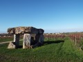
Situated at an altitude of 25 metres, the River Né and the Motte stream are the main watercourses flowing through the commune of Saint-Fort-sur-le-Né.
From certain vantage points, there are excellent views of the village, the dolmen, the vineyards, the Grande Champagne countryside and the other surrounding villages.
Each season offers a chance to discover its own unique charms.
Circuit du Dolmen
 7.20 mi
+236 ft
-236 ft
3h 30
Moderate
Departure from Saint-Fort-sur-le-Né (Charente)
7.20 mi
+236 ft
-236 ft
3h 30
Moderate
Departure from Saint-Fort-sur-le-Né (Charente)
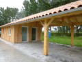
Situated at 25m altitude - the river Né and the Motte stream are the principal water courses which cross the locality.
In certain places there are excellent views towards and from the village, the Dolmen, of the vineyards, the landscape of the Grande Champagne and surrounding villages. In every season you can discover a certain charm and appeal in St. Fort.
Route des Bois de la Barde
6.61 mi
+26 ft
-26 ft
3h 05
Moderate
Departure from Matha (Charente-Maritime)
A walk created and signposted by the Randonneurs du Pays de Matha association. This 11km route winds through the countryside and vineyards to the south of the small town of Matha.
Hubins-Archambaud Route
 3.98 mi
+20 ft
-20 ft
1h 50
Easy
Departure from Matha (Charente-Maritime)
3.98 mi
+20 ft
-20 ft
1h 50
Easy
Departure from Matha (Charente-Maritime)
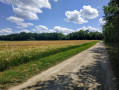
A walk created and signposted by the Randonneurs du Pays de Matha association. This 7km route winds through the countryside and vineyards to the south of the small town of Matha.
Côt Route
 10.86 mi
+463 ft
-453 ft
5h 25
10.86 mi
+463 ft
-453 ft
5h 25
 Difficult
Departure from Juillac-le-Coq (Charente)
Difficult
Departure from Juillac-le-Coq (Charente)
Juillac-Le-Coq is crossed by the Mothe stream, a tributary of the Charente. The village has a population of around 667. Wine-growing is its main industry.
The Côt Route (short circular route)
3.77 mi
+69 ft
-69 ft
1h 45
Easy
Departure from Juillac-le-Coq (Charente)
Juillac-Le-Coq is crossed by the Mothe stream, a tributary of the Charente. The village has a population of around 667. Wine-growing is its main industry.
Bois Bernard from Pons
 5.24 mi
+217 ft
-220 ft
2h 35
Easy
Departure from Pons (Charente-Maritime)
5.24 mi
+217 ft
-220 ft
2h 35
Easy
Departure from Pons (Charente-Maritime)
A pleasant walk through the medieval town of Pons, continuing into the surrounding countryside amongst vineyards, woods and fields. The start of the route offers a lovely stroll through the town of Pons, allowing you to take in its various features, culminating in its esplanade, castle and keep.
Walk along the banks of the Seugne in Pons
 2.59 mi
+82 ft
-82 ft
1h 15
Easy
Departure from Pons (Charente-Maritime)
2.59 mi
+82 ft
-82 ft
1h 15
Easy
Departure from Pons (Charente-Maritime)
A walk in Pons along the River Seugne and through the town centre, the market and the keep. A short walk with a slight elevation gain, but without any difficulty and offering the coolness of the River Seugne’s banks.
The Bellevue route: between hillsides and valleys
4.17 mi
+138 ft
-141 ft
2h 00
Easy
Departure from Verrières (Charente) (Charente)
The commune is bordered to the south by the Né valley, towards which its land slopes gently. Vineyards, the main crop, cover more than two-thirds of the commune’s area and produce excellent, refined Grande Champagne brandies.
More walks in Louzac-Saint-André
Select a point of interest below: