Country:
 City:
City:


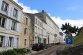
The car park is located on Place de l’Europe, near the Salle des Fêtes Roger Renaud.
(S/E) Leave the car park and head south-east towards the Agrippa d’Aubigné Nursery School. Cross Avenue Gabriel Moreau with care.
(1) Turn right onto the path that runs past the nursery school. Cross Cours Alsace Lorraine with care (at the pedestrian crossing). Follow Avenue du Lycée south-westwards. At the next roundabout, turn left into Rue des Cordeliers.
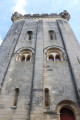
(2) At the junction with Rue du Président Roosevelt (Émile Combes), turn left to follow the road uphill. Take the steps on the right leading up to Place de la Marronnière. From there, head to the Donjon de Pons and walk around three sides of it, starting from the north. At the end of the second side, stop to enjoy the view from the balcony between the two town hall buildings.
(3) Return to the area near the keep and take the path on the left which runs alongside the town hall and leads to Place du Rempart. From there, head back onto Rue du Président Roosevelt (Émile Combes) and walk down it to the left until you reach the junction you passed earlier.
(2) Carry on straight ahead along Rue du Président Roosevelt. Further on, turn left into Rue du Collège at the corner of the Résidence Marie d’Albret. At the end of the street, turn left into Rue des Jardins.
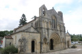
(4) Cross Rue Thiers carefully (at the pedestrian crossing) and continue straight ahead into Rue Étienne Landrau. At the next junction, turn right into Rue du Colombier. Follow this road until it joins Rue du Général Leclerc. Turn left and follow this road to the roundabout, passing in front of Saint-Vivien Church.
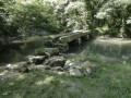
(5) At the roundabout, take a look at the sculptures paying tribute to the Way of St James. Follow the D732 to the left, staying on the pavement. Cross the first branch of the Seugne and, immediately after the second, turn left onto a path that runs alongside the branch of the Seugne on your left (before the Cabane leisure area). At the Pont de la Balade de la Seugne, carry on straight ahead until you reach the Seugne bathing area. Turn left onto Rue Thiers.
(6) Turn right and follow Rue Thiers to the junction with Rue de Verdun. Turn left to head up Rue de Verdun. Just as the street curves to the right, turn left into Passage Glemet. At the end of the passage, continue along the path leading to the Saint-Gilles Chapel. Walk past the south side of the chapel, cross the gardens along the southern edge until you pass in front of Pons Town Hall.
(3) In front of the keep, turn right towards Place de la République. Cross the square to reach Rue Émile Combes.
(7) Follow it to the right. Shortly after the Pons post office, turn left into Rue des Jacobins. Follow it until you are running alongside the Agrippa d’Aubigné Primary School. At the northern corner of the school grounds, turn left onto the path that runs alongside the school and return to the original junction in front of the school.
(1) Cross Avenue Gabriel Moreau with care and return to the car park ((S/E)).
 Visorando Member

 Moderate
 Tourist office