The Sentier du Biau starting from Ars

A pleasant walk starting from Ars-en-Saintonge, exploring a very natural area including the Bois de la Grande Prée and the Né. The route features some fine examples of built heritage, such as the school complex and the Bûcher d’Ars, the Château d’Ars at the start of the walk, and the Church of Saint-Maclou on the return journey.

Details

3167178
Creation:
Last update:
Last review:
  • Walking
    Activity: Walking
  • ↔
    Distance: 5.55 mi
  • ◔
    Average duration: 2h 35 
  • ▲
    Difficulty: Easy

  • ⚐
    Back to start: Yes
  • ↗
    Ascent: + 23 ft
  • ↘
    Descent: - 23 ft

  • ▲
    Highest point: 69 ft
  • ▼
    Lowest point: 26 ft
  • ⚐ Country: France
  • ⚐ City: Ars (16130)
  • ⚑
    Start/End: N 45.64273° / W 0.382195°
  • Hour-by-hour weather

Photos

Description of the walk

(S/E) Turn left (west) onto Rue de la Mairie and join the Chaussée de Gimeux (D148). Cross it carefully using the pedestrian crossing and follow the road to the right, then turn onto Rue de Coulonges (D147), passing the post office. A little further on, cross this road at the pedestrian crossing and look out for the school complex and the Bûcher on the right-hand side of the street (see the ‘During the walk’ section).

(1) Turn right into Rue des Écoles. Carry on straight ahead until you reach the edge of a woodland on your right. Turn right into the small street just before the woodland; this street runs alongside it before veering away to reach a junction (castle on the left, see “During the walk”).

(2) Continue left along Rue du Château and go round the castle. Carry on straight ahead until the next junction in the Potence area (vineyards).

(3) Turn left. Follow the road carefully, with the Grand Bois on your left, and ignore a turn-off on the right. At the end of the woods, take a path on the left. You’ll soon reach Rue des Écoles; follow it as it continues.

(4) Take thefirst right, Rue de Chez Chauvière. Go straight on at every junction (take care when crossing the D147). Pass through the hamlet of Chez Bénétaud and, just after a small wood, turn right onto a track.

(5) Just before the D147, at the foot of the silos belonging to an agricultural co-operative, turn left (south) onto a track. Walk alongside a vineyard on your left and, at its end, turn right onto a dirt track. Then take a series of left-right-left bends to reach Rue de Chez Dexmier. Follow it to the right, winding your way through the hamlet. You’ll come out onto the D147; follow it to the left until you quickly reach a junction.

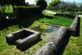
(6) Turn left onto Chemin de derrière la Palisse. Continue straight on (east) until you come out onto a road. Then turn right and walk alongside the Bois de la Grande Prée on your left. When the road bends to the right, take the path opposite, on the left-hand side of the road. Walk to the first copse of trees on the left, where you’ll find the Font de Bonbonnet.

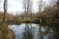
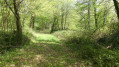
(7) Continue along the main path heading north-east until you reach the River Né. Carry on along the path which passes through a small clearing. When you reach a bridge, cross it to get over a branch of the Né.

(8) Immediately afterwards, turn left into a wood and follow the branch of the Né on your left. Further on, turn right and head away from the river. Follow the course of the main branch of the Né at a slight distance to your right. Turn left with the path and cross through a wood. Cross two secondary branches of the Né in succession and join Rue du Moulin Foucaud.

(9) Follow the street to the right. Cross the Chaussée de Gimeux (D148) with care and continue straight on along Rue de l’Église. At the foot of the church (see the ‘During the walk’ section), turn left and you will immediately reach the car park (S/E).


Waypoints

  1. S/E : mi 0 - alt. 46 ft - Town hall car park - Église Saint-Maclou (Ars)
  2. 1 : mi 0.16 - alt. 43 ft - Rue de Coulonges × Rue des Écoles
  3. 2 : mi 0.73 - alt. 46 ft - Château d'Ars (Ars)
  4. 3 : mi 1.12 - alt. 56 ft - La Potence – Road junction
  5. 4 : mi 1.88 - alt. 62 ft - Junction
  6. 5 : mi 2.53 - alt. 43 ft - Silos – Junction
  7. 6 : mi 3.23 - alt. 43 ft - D147 road x Chemin de derrière la Palisse
  8. 7 : mi 3.93 - alt. 36 ft - Font de Bonbonnet
  9. 8 : mi 4.51 - alt. 30 ft - Bridge over a branch of the - Né (rivière)
  10. 9 : mi 5.36 - alt. 30 ft - Rue du Moulin Foucaud
  11. S/E : mi 5.55 - alt. 46 ft - Town hall car park - Église Saint-Maclou (Ars)

Notes

The car park is located next to the town hall and the church.

This walk, which takes place over varied terrain, requires suitable footwear.

This route is not signposted, but does not present any real difficulties. Consequently, it is advisable to follow the instructions in the description and on the map, whilst paying close attention to the landscape. The waypoints (with their GPS coordinates and the distance from the starting point) serve as aids for walkers exploring the route for the first time.

Hike completed by the author on 29 November 2021.

Worth a visit

ARS en Saintonge
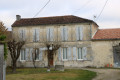
The old part of the village, centred around the church, is clearly distinguishable. Together with the town hall – a former presbytery featuring an octagonal tower – it forms a remarkable architectural ensemble that gives the village its distinctive character.

The Church of Saint-Maclou
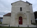
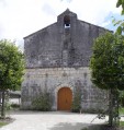
The Church of Saint-Maclou in Ars is a building constructed in the 12th, 15th and 18th centuries, featuring a Romanesque façade with a carved portal surmounted by a bell-wall. A second bell tower was added to the façade in the 18th century. The church contains numerous Romanesque sculptures as well as a remarkable altarpiece, baptismal font and holy water font.
It is open to visitors every day: keys are available from the bakery, the town hall and the ‘Le Fief du chevalier’ guesthouse.
▹ The church: find out more
▹ The baptismal font: find out more
▹ The four altarpieces: find out more

Ars Castle
Ars Castle is also a key part of the region’s identity. The construction of the castle’s first buildings by a local lord dates back to the Middle Ages; these were rebuilt in the 17th century on the site of the motte-and-bailey castle by the de Brémond d’Ars family.
Lovers of the arts and architecture in particular, as evidenced by the castle’s construction in the classical architectural style, followed by the restoration of the church in the midst of the Fronde. Since 1988, the courtyard façade of the south-east wing and a carved stone chimney have been listed as Historic Monuments.
This château, now privately owned, is not open to the public.

The school complex and the Bûcher
The front gable of the school complex, built in 1898–1899, is characterised by decorative bands and a clock on the façade. A contemporary stone sculpture, entitled ‘Gourmandise à l’infini’ (Endless Gluttony), which forms part of the sculpture trail created in Julienne during the symposia, adorns the grassy area in front of the school.
Next to it stands the old woodstore, so named because the pupils used to store the logs they brought there to heat the classroom. It was renovated by the community of communes’ work integration scheme in 2006; it is a small stone building with stone jambs and an ox-eye window. A sign there explains its history and that of the school.

The Toutvent Mill
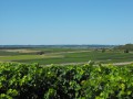
Wander through the Petite Champagne vineyards, which cover more than a third of the village, and you will find, on the highest hill known as the ‘Terrier de Balanzac’, the Toutvent Mill, fully restored by a private individual, Mr DALANSON, who also owns the Museum of Traditional Trades. From this highest point, you can admire the vineyards stretching as far as the eye can see and the nearby village of Lonzac.

The Bonbonnet Estate
The château dates from the 18th century and was built by the estate’s prominent family, the Briands, who provided the village with two mayors: Jean from 1860 to 1865 and Narcisse from 1904 to 1945. His father, Stanislas, was mayor of Merpins from 1895 to 1912. At that time, Jean and Stanislas were major landowners, producers, distillers and merchants of spirits.
In 1923, it became the property of the Firino MARTELL cognac house, then was sold in 1994 to the Ferrand Cognac House, which currently owns the site and takes particular care to preserve its history, heritage and grounds.

Source: the municipality’s official website

Reviews and comments

3.8 / 5
Based on 3 reviews

Reliability of the description
3.7 / 5
Ease of following the route
3.7 / 5
Route interest
4 / 5
valejale
valejale

Overall rating : 4 / 5

Date of your route : Apr 14, 2024
Reliability of the description : ★★★★☆ Good
Ease of following the route : ★★★★☆ Good
Route interest : ★★★★☆ Good
Very busy route : No

Hike undertaken in mid-April 2024… difficulty finding the path at point (8) by the locks due to very dense vegetation (nettles, etc.) and the recent flooding in early April.
Further along the Bras du Né, there are numerous fallen trees blocking the path and the ground is very muddy

Machine-translated

cognac
cognac

Overall rating : 4 / 5

Date of your route : Jun 06, 2023
Reliability of the description : ★★★★☆ Good
Ease of following the route : ★★★★☆ Good
Route interest : ★★★★☆ Good
Very busy route : No

A path that isn’t too busy… what a shame
A trail best enjoyed in fine weather
The banks of the Né are very pleasant
as well as the local heritage: the château and the church in Ars

Machine-translated

tatee42 pepe4217
tatee42 pepe4217

Overall rating : 3.3 / 5

Date of your route : Mar 27, 2023
Reliability of the description : ★★★☆☆ Average
Ease of following the route : ★★★☆☆ Average
Route interest : ★★★★☆ Good
Very busy route : No

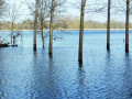
An interesting route, but it can be a bit tricky to follow until you reach the locks and bridges over the River Né. Furthermore, do not walk this trail when the River Né is in flood. A large section of the route is not very well-used and it is difficult to follow the path without signposts. !!!!

Machine-translated

Other walks in the area

For more walks, use our search engine .

The GPS track and description are the property of this route's author. Please do not copy them without permission.