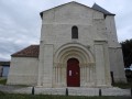
Courcerac Pond

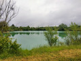
A walk in the commune of Courcerac, a circular route starting from the nature area and its pond, winding through the vineyards and along a few forest paths.

Details

2118410
Creation:
Last update:
Last review:
  • Walking
    Activity: Walking
  • ↔
    Distance: 3.40 mi
  • ◔
    Average duration: 1h 35 
  • ▲
    Difficulty: Easy

  • ⚐
    Back to start: Yes
  • ↗
    Ascent: + 20 ft
  • ↘
    Descent: - 20 ft

  • ▲
    Highest point: 112 ft
  • ▼
    Lowest point: 79 ft
  • ⚐ Country: France
  • ⚐ City: Courcerac (17160)
  • ⚑
    Start/End: N 45.841336° / W 0.36208°
  • ❏
    IGN map(s): Ref. 1631SB
  • Hour-by-hour weather

Photos

Description of the walk

Park in the shaded car park next to Courcerac cemetery.

(S/E) Head down towards the pond and walk round it on the left-hand side.

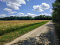
(1) Walk up through the meadow towards a limestone track on the left. Once on this track, turn right. Just after a barrier blocking traffic, turn onto the dirt track on the left. Walk through the vineyards until you reach the woods.

(2) Facing the woods, turn right then take the small forest path at the corner formed by the woods. Just after crossing a wooden footbridge, at the junction of four paths, take the one straight ahead. The path leads onto a wide limestone track.
Turn right onto it.

(3) Ignore the path on the right, which will be the one you take on the way back. Shortly afterwards, take a dirt track on the left. When this track forms a ‘Y’, take the right-hand branch. Walk round the vineyard plot, keeping it on your right.

(4) A forest path leads straight into the woods on the left; take it. As soon as you emerge from the tree cover, continue straight on between the rows of vines. Join a farm track and continue straight ahead. When you reach the small road, turn right.

(5) At the first bend, take the path on the right, without entering the hamlet of Les Hubins. Pass under the power line and, at the junction of the dirt tracks, turn right. You’ll reach a right-angled crossroads by the woods.

(6) Turn right to head back into the woods. You’ll reach the junction where the circular route crosses, which you passed on the way out.

(3) Turn left onto the grassy path in the clearing, just after crossing a small bridge over the Fossé Branger. Continue through the woodland, then further on reach Courcerac Pond via a gap in the hedge surrounding the nature reserve.
Return to the car park by walking alongside the pond (S/E).

Waypoints

  1. S/E : mi 0 - alt. 98 ft - Shaded car park next to the cemetery
  2. 1 : mi 0.2 - alt. 85 ft - Meadow
  3. 2 : mi 0.4 - alt. 108 ft - Turn right when facing the woodland
  4. 3 : mi 0.82 - alt. 98 ft - Junction of the circular loop
  5. 4 : mi 1.18 - alt. 102 ft - Forest path on the left
  6. 5 : mi 1.72 - alt. 102 ft - Path on the right
  7. 6 : mi 2.44 - alt. 102 ft - New entrance to the woods
  8. S/E : mi 3.4 - alt. 98 ft - Shaded car park next to the cemetery

Notes

There are no busy roads to walk alongside or cross. Some sections of the route follow farm tracks or little-used footpaths, so please wear suitable walking shoes.

Worth a visit

The nature area around the pond is an ideal spot for a picnic in the countryside. Fishing is permitted on this Category2 water body (maximum of two lines).

Reviews and comments

4.2 / 5
Based on 3 reviews

Reliability of the description
4 / 5
Ease of following the route
4.7 / 5
Route interest
4 / 5
Piquerusse
Piquerusse

Overall rating : 4.7 / 5

Date of your route : Oct 07, 2024
Reliability of the description : ★★★★★ Very good
Ease of following the route : ★★★★★ Very good
Route interest : ★★★★☆ Good
Very busy route : No

A pleasant, easy walk starting from the pond.

Machine-translated

Other walks in the area

For more walks, use our search engine .

The GPS track and description are the property of this route's author. Please do not copy them without permission.