Hubins-Archambaud Route

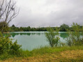
A walk created and signposted by the Randonneurs du Pays de Matha association. This 7km route winds through the countryside and vineyards to the south of the small town of Matha.

Details

2159595
Creation:
Last update:
Last review:
  • Walking
    Activity: Walking
  • ↔
    Distance: 3.98 mi
  • ◔
    Average duration: 1h 50 
  • ▲
    Difficulty: Easy

  • ⚐
    Back to start: Yes
  • ↗
    Ascent: + 20 ft
  • ↘
    Descent: - 20 ft

  • ▲
    Highest point: 121 ft
  • ▼
    Lowest point: 89 ft
  • ⚐ Country: France
  • ⚐ City: Matha (17160)
  • ⚑
    Start/End: N 45.860571° / W 0.323023°
  • ❏
    IGN map(s): Ref. 1631SB
  • Hour-by-hour weather

Photos

Description of the walk

Start from the car park at Saint-Hérie Church in Matha.

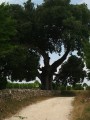
(S/E) From the car park, cross Rue de Saint-Hérie to join the small Rue de la Pépinière. This narrow lane quickly turns into a wide limestone track. When you reach the sewage treatment plant, continue along the road to the right.

(1) When you reach the D131, turn left. Walk carefully along this road (there is a pavement on one side only) for about 100 metres. Take the first limestone track on the right and follow it to the hamlet of Les Hubins.

(2) Walk through the hamlet and, as you leave it, leave the road and take the tree-lined path opposite. Pass under a power line and you’ll come to a crossroads.

(3) At the junction of the dirt tracks, turn left. Pass under the power line again and, at the next junction, turn right to rejoin the D131.

(4) Cross the road and continue along a small road to the hamlet of Archambaud.

(5) Walk through the hamlet, cross the River Antenne and, at the next crossroads, turn left to follow Rue du Moulin.

(6) At the three-way junction, continue along Rue du Moulin until you reach the village of Matha.

(7) This street leads onto the main Rue de Saint-Hérie; turn left and you’ll arrive at the church car park (S/E).

Waypoints

  1. S/E : mi 0 - alt. 108 ft - Car park at Saint-Hérie Church
  2. 1 : mi 0.49 - alt. 105 ft - D131
  3. 2 : mi 1.16 - alt. 105 ft - Les Hubins hamlet
  4. 3 : mi 1.74 - alt. 95 ft - Crossroads of dirt tracks
  5. 4 : mi 2.21 - alt. 98 ft - Cross the D131
  6. 5 : mi 2.52 - alt. 92 ft - Archambaud hamlet. Cross the - Antenne (rivère) - Affluent de la Charente
  7. 6 : mi 2.72 - alt. 95 ft - Rue du Moulin
  8. 7 : mi 3.93 - alt. 112 ft - Rue de Saint-Hérie
  9. S/E : mi 3.98 - alt. 108 ft - Car park at Saint-Hérie Church

Notes

This route presents no difficulties. The local paths are wide and well-maintained. The route is fully signposted; follow the blue markings.

Alternative route:
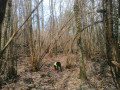
(6) I suggest a personal alternative to the original route, to avoid walking on the road as much as possible. This alternative route is shaded and peaceful.
Take the first limestone path on the right. About 200 metres further on, take the path on the left. At the next junction in the woods, turn left then immediately right, and continue along the limestone path. Take the next path on the left (before you find yourself amongst the houses) to reach Rue du Moulin.

Return to the original route by turning right onto the road.

---

This section is shared between (2) and (3) with the “Étang de Courcerac” walk; it is therefore possible to add this route to your walk for a total distance of around 12 km.

Reviews and comments

5 / 5
Based on 2 reviews

Reliability of the description
5 / 5
Ease of following the route
5 / 5
Route interest
5 / 5
victorien didier
victorien didier

Overall rating : 5 / 5

Date of your route : Nov 09, 2025
Reliability of the description : ★★★★★ Very good
Ease of following the route : ★★★★★ Very good
Route interest : ★★★★★ Very good
Very busy route : Yes

Nothing to report

Machine-translated

chipie33290
chipie33290
• Edited:

Overall rating : 5 / 5

Date of your route : Aug 18, 2024
Reliability of the description : Not used / Not applicable
Ease of following the route : ★★★★★ Very good
Route interest : ★★★★★ Very good
Very busy route : No

At point 6, I followed the alternative route, which does indeed take you along a lovely, well-shaded path.
An easy, flat and pleasant route starting from St Hérie’s Church, which we were able to visit.
Don’t hesitate to visit Matha’s second church, situated on the other side of the village.
Thank you for this route.

Machine-translated

Other walks in the area

For more walks, use our search engine .

The GPS track and description are the property of this route's author. Please do not copy them without permission.