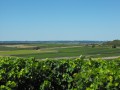
Hills and valleys in the Borderies

This route includes a tour of the Vallée de La Croix, part of the natural and historical heritage of the Borderies region, via the Chemin du Panteneau in the canton of Saint-Martin, whose right-of-way has marked one of the boundaries between the two municipalities of Saint-Laurent-de-Cognac and Louzac-Saint-André since 1824.

Details

6863154
Creation:
Last update:
Last review:
  • Walking
    Activity: Walking
  • ↔
    Distance: 4.53 mi
  • ◔
    Average duration: 2h 20 
  • ▲
    Difficulty: Easy

  • ⚐
    Back to start: Yes
  • ↗
    Ascent: + 315 ft
  • ↘
    Descent: - 312 ft

  • ▲
    Highest point: 243 ft
  • ▼
    Lowest point: 46 ft

Photos

Description of the walk

Park in the Salle Polyvalente car park in Saint-Laurent-de-Cognac.

(S/E) Leave the car park on the left and follow the road for a few metres. Turn right off the road onto a dirt track. Walk alongside and through the vineyards on the right. Continue on to reach the edge of the Bois de Montlambert.

(1) Follow the edge of the woodland to the left, then keep to the right. Continue for a few metres, then turn right into the woodland. Cross through it. On emerging, carry on straight ahead across the fields until you reach the junction with the D144.

(2) Turn left onto the D144 and follow it for about a hundred metres. Leave the road and turn right onto the path that initially runs alongside the sewage treatment works. Then find the path leading through the woods to the hamlet of Pallain. On emerging from the woods, you’ll reach a junction with a wide path.

(3) Turn right and continue straight on. At the junction with theGR®4, carry on straight ahead and walk alongside the Petit Bois, to the left of the route. Turn right until you reachthe GR®4.

(4) Take this to the right for a few hundred metres. Leave it to the left to take the path through the vineyards. Stay on this path, keep left at thefirst junction, then left again at the hairpin bend atthe second junction. Join theGR®4once more.

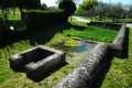
(5) Turn right back onto theGR®4. Follow it southwards to join Rue du Bois du Prieur. At the junction, turn left onto Rue des Borderies, then right onto Rue du Prieuré. Follow Rue du Prieuré, then turn immediately left onto Rue de la Fontaine. Walk alongside the river and past the wash house to reach the Church of Saint-Laurent.

(6) Leave theGR® again, turning right then left into Rue de Kerbach, then right into Rue Maurice Sellal. Turn right into Rue du Lys and walk back up to Rue des Borderies. Turn left into Rue des Borderies and continue straight on to return to the Salle Polyvalente car park in Saint-Laurent-de-Cognac (S/E).

Waypoints

  1. S/E : mi 0 - alt. 69 ft - Car park at the Saint-Laurent-de-Cognac Multi-purpose Hall
  2. 1 : mi 0.87 - alt. 210 ft - Bois de Montlambert.
  3. 2 : mi 1.57 - alt. 105 ft - D144 - Vallée de la Croix (Louzac)
  4. 3 : mi 2.14 - alt. 207 ft - Crossroads after Le Pallain
  5. 4 : mi 2.73 - alt. 174 ft - GR4 junction
  6. 5 : mi 3.61 - alt. 194 ft - GR4 junction
  7. 6 : mi 4.28 - alt. 56 ft - Eglise paroissiale Saint-Laurent (Saint-Laurent-de-Cognac)
  8. S/E : mi 4.53 - alt. 69 ft - Car park at the Saint-Laurent-de-Cognac Multi-purpose Hall

Notes

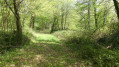
(2) The Panteneau country lane in the canton of Saint-Martin. Marking the boundary between the municipalities of Louzac and Saint-Laurent-de-Cognac since the land registry was first established, it lies at the heart of a remarkable natural environment.

Between points (1) and (2) As the right of way for the rural track at the entrance to the Bois de Montlambert has been destroyed by a local resident, having the GPX track on your mobile phone may help you find your way whilst awaiting the restoration, which has been formally requested from the Mayor of Saint-Laurent-de-Cognac in accordance with his policing duties.

Worth a visit

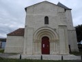
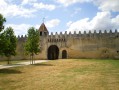
(6) Saint-Laurent Church

Always be cautious and plan ahead when you're outdoors. Visorando and the author of this route cannot be held responsible for any accidents occurring on this route.

The GR® and PR® markings are the intellectual property of the Fédération Française de Randonnée Pédestre.

Reviews and comments

3.9 / 5
Based on 3 reviews

Reliability of the description
4 / 5
Ease of following the route
3.3 / 5
Route interest
4.3 / 5
courseul
courseul

Overall rating : 3.7 / 5

Date of your route : Nov 18, 2024
Reliability of the description : ★★★★☆ Good
Ease of following the route : ★★★☆☆ Average
Route interest : ★★★★☆ Good
Very busy route : No

Hello,
part of the route running beneath and along the edge of the woodland is overgrown with brambles and low-growing shrubs.
Otherwise, it’s a lovely walk.

Machine-translated

Zoemalone
Zoemalone

Overall rating : 4.3 / 5

Date of your route : May 12, 2024
Reliability of the description : ★★★★☆ Good
Ease of following the route : ★★★★☆ Good
Route interest : ★★★★★ Very good
Very busy route : No

A lovely walk through the vineyards, the forest and the valleys. It’s still not possible to walk from point 1 to point 2, as the path is impassable. We walked from point 1 to point 3 via Montlambert and Louzac. We really enjoyed this walk. Best avoided in hot weather, as there’s very little shade.

Machine-translated

vivreenvillage
vivreenvillage

The country lane between points 1 and 2, shared by Louzac Saint-Andté and Saint-Laurent-de Cognac, is being deliberately neglected in order to deter walkers from using it,
This behaviour is a retaliatory measure following the failure in 2021 of their attempt to sell and transfer the land to the CAMUS company.
The matter was, in fact, widely reported in the *Charente Libre* at the time.
This battle has been going on for over fifteen years, and it is regrettable that Grand-Cognac is, in a sense, complicit in such a state of disarray.
I invite you to find out more via the following link
https://environnement-louzac-saint-andre...
If you would like further details, I am at your disposal and you can contact me directly either via Visorando or via the blog to which this link directs you.
In theory, the legal action taken in 2021 should legally prohibit the sale of the said path for 10 years
The fact that several walkers are interested in it (it forms part of another route) is also a factor likely to help ensure its preservation.

Machine-translated

nathaliecognac
nathaliecognac

Overall rating : 3.7 / 5

Date of your route : Feb 19, 2023
Reliability of the description : ★★★★☆ Good
Ease of following the route : ★★★☆☆ Average
Route interest : ★★★★☆ Good
Very busy route : No

A lovely walk through the vineyards, the forest and the valleys.
However, it’s impossible to find your way between point 1 and point 2, as there’s no path through the forest.
I’d recommend going from point 1 to point 3 via Montlambert and Louzac – that way, it’s perfect!

Machine-translated

Other walks in the area

For more walks, use our search engine .

The GPS track and description are the property of this route's author. Please do not copy them without permission.