Exploring the Vallée de la Croix

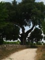
The municipality of Louzac-Saint-André is criss-crossed by around 40 km of country lanes, offering the chance to discover a wide variety of landscapes amidst vineyards and woodland. The peaceful Vallée de la Croix is a remarkable example of this, unanimously recognised as representative of the natural and historical heritage of the Borderies.

Hikers and walkers, set off to explore it or rediscover it for yourselves with the route suggested here, which is accessible to all.

Details

n°7631123
Creation:
Last update:
–
Last review:
  • Walking
    Activity: Walking
  • ↔
    Distance: 2.43 mi
  • ◔
    Average duration: 1h 15 
  • ▲
    Difficulty: Easy

  • ⚐
    Back to start: Yes
  • ↗
    Ascent: + 138 ft
  • ↘
    Descent: - 138 ft

  • ▲
    Highest point: 259 ft
  • ▼
    Lowest point: 105 ft

Photos

Description of the walk

Park in the Town Hall car park on the east side of Saint-Martin’s Church

(S/E) Leave the car park by walking along the south side of the church to reach the forecourt and the entrance gate.
Go down the stairs to the right of the church forecourt and turn left into Rue du Marronnier, then into Rue de la Croix du Bourg. At the crossroads, turn left into Rue de la Vallée, then right into Rue des Chaumes.
At the junction of Rue des Chaumes and Rue des Aireaux, go straight on, then turn right into the valley.
Turn right at the bottom of the valley and continue downhill, passing the sewage treatment plant, until you reach the D144. Follow the D144 for about 100 metres southwards (towards Saint-Laurent-de-Cognac).

(1) Turn right onto the Panteneau country lane in the canton of Saint-Martin. Continue straight on, following the vineyards to the left of the lane, until you reach the entrance to the Bois de Montlambert.
Carry on straight ahead due west and, at the crossroads of the paths, continue straight on for 80 metres.

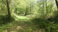
(2) Turn 45° to the right, leaving the Bois de Montlambert via the Chemin de la Lodge à Montlambert on the edge of the woodland (the woodland is to the right of the track). Continue straight on to the hamlet of Montlambert, then turn left for approximately 150 metres.

(3) Turn right and follow theGR®4to the D376.

(4) Just before this, turn right and continue straight on to reach the village of Louzac, then turn into Rue de l’Ancienne Mairie.
Carry on straight ahead and climb the steps leading up to the church square.
Walk along the north side of the church and past the vicarage to the war memorial.
Turn right onto Rue de la Vallée to return to the Town Hall car park (A/D).

Waypoints

  1. S/E : mi 0 - alt. 207 ft - Town hall car park - Eglise Saint-Martin de Louzac
  2. 1 : mi 0.64 - alt. 105 ft - Chemin du Panteneau in the Canton of Saint-Martin - Vallée de la Croix (Louzac)
  3. 2 : mi 1.13 - alt. 217 ft - Exit from the woods
  4. 3 : mi 1.41 - alt. 246 ft - GR junction
  5. 4 : mi 1.78 - alt. 259 ft - T-junction before the D376
  6. S/E : mi 2.43 - alt. 207 ft - Town hall car park - Eglise Saint-Martin de Louzac

Notes

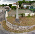
(1) The Panteneau rural track in the Canton of Saint-Martin. Marking the boundary between the municipalities of Louzac and Saint-Laurent-de-Cognac since the land registry was first established, it lies at the heart of a remarkable natural environment.
(2) As the right of way for the rural track leading out of the Bois de Montlambert has been destroyed by a local resident, having the GPX track saved on your mobile phone may help you find your way whilst awaiting the restoration formally requested from the Mayor of Louzac-Saint-André in accordance with his policing duties.

Worth a visit

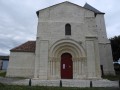
(S/E) Saint-Martin’s Church (Louzac): Dating from the 12th century, rebuilt in the 14th and 16th centuries, restored in the 16th century and most recently in 2011. It features numerous inscriptions.

Always be cautious and plan ahead when you're outdoors. Visorando and the author of this route cannot be held responsible for any accidents occurring on this route.

The GR® and PR® markings are the intellectual property of the Fédération Française de Randonnée Pédestre.

Reviews and comments

3.3 / 5
Based on 3 reviews

Reliability of the description
4 / 5
Ease of following the route
3 / 5
Route interest
3 / 5
Chris17
Chris17

Overall rating : 1 / 5

Date of your route : Jul 24, 2023
Reliability of the description : Not used / Not applicable
Ease of following the route : ★☆☆☆☆ Very disappointing
Route interest : ★☆☆☆☆ Very disappointing
Very busy route : No

Route not maintained.

Machine-translated

vivreenvillage
vivreenvillage
• Edited:

The problem currently stems from a local resident who has deliberately destroyed part of the route on the Montlambert side and is displaying misleading and dissuasive signs aimed at deterring the public from using a ‘communal’ asset, all with the sole aim of appropriating its use for his own benefit (see map by clicking here)
A further attempt on his part has very recently been thwarted in the guise of a farcical public inquiry, and the mayors of Louzac-Saint-André and Saint-Laurent-de-Cognac have just been reminded of their duty to enforce the law;

Machine-translated

chemin 16
chemin 16

Overall rating : 4 / 5

Date of your route : Apr 30, 2021
Reliability of the description : ★★★★☆ Good
Ease of following the route : ★★★★☆ Good
Route interest : ★★★★☆ Good
Very busy route : No

The signposting along the path is rather hard to spot, especially in the Montlambert woods, which we had to go round via the southern side, following the edge of the woods. A pleasant walk all the same.

Machine-translated

vivreenvillage
vivreenvillage
• Edited:

Hello,

The Vallée de La Croix can also be explored in the opposite direction. I have included it in a 7.3 km route mapped out in the commune of Saint-Laurent-de-Cognac under the name ‘Combes et vallons en Borderies’.

It will also soon feature on a route of around 15 km mapped out in the municipality of Louzac-Saint-André

Kind regards

Machine-translated

brigitte harly
brigitte harly

Overall rating : 4 / 5

Date of your route : Apr 26, 2021
Reliability of the description : ★★★★☆ Good
Ease of following the route : ★★★★☆ Good
Route interest : ★★★★☆ Good
Very busy route : No

A lovely walk, though a bit short – we made it longer

Machine-translated

Other walks in the area

For more walks, use our search engine .

The GPS track and description are the property of this route's author. Please do not copy them without permission.