Country:
 City:
City:


The car park is located on Place de l’Europe, near the Salle des Fêtes Roger Renaud.
(S/E) Leave the car park and head south-east towards the Agrippa d’Aubigné Nursery School. Cross Avenue Gabriel Moreau with care.
(1) In front of the nursery school, turn left towards Rue des Jacobins. Turn right and follow the road south-eastwards.
(2) At the junction with Rue Émile Combes, cross it carefully and continue almost directly opposite into Rue Pasteur, where the market bakery is on the corner. At Place Saint-Martin on the left, turn left to go past Saint-Martin’s Church.
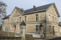
(3) Walk round the south-east side (on the right) of the church and join Rue Saint-Jacques. When you reach it, turn right and follow Rue Saint-Jacques. At the junction with Rue Pasteur, cross it carefully to continue almost directly opposite into Passage Glemet. At the end of the passage, continue along the path leading to Saint-Gilles Chapel, then walk past the south side of the chapel (on your left) through the gardens towards the town hall (the former Château de Pons). Just after passing the town hall, take in the beautiful view of the Seugne Valley on your left.
(4) Head back towards the Pons keep, then turn left to walk alongside the second town hall building before crossing the Place des Remparts and joining Rue du Président Roosevelt. Turn left and follow this street downhill. A little further on, the route passes the Résidence Marie d’Albret. A little further still, the route reaches the Croix Chaillebourg, where the Pierre Senillou Media Centre is situated on the right-hand side of the street. At this point, the route crosses the Place du Haras. Continue straight on until you reach the Church of Saint-Vivien.
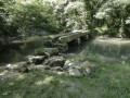
(5) Just before the church, turn right into Rue Barthélémy Gautier. About 120 metres further on, turn right into a narrow lane between two properties – this is the Ruelle des Eaux Barrées: red and white barriers prevent motorised two-wheelers from entering. Follow it to its end along a good path running alongside the Soule.
(6) Turn left onto the path running alongside the Soule and, when you reach a car park, continue straight ahead into Rue de la Piscine. When you reach Avenue du Poitou, turn right to cross the Soule and then immediately left into Rue de Coudennes. Follow this road north-west.
(7) Pass under the RD137. When you reach the hamlet of Coudennes, continue until you reach the Impasse de Coudennes on the left-hand side, just after a retail area.
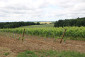
(8) Turn right onto a track opposite Impasse de Coudennes (there is a telecoms mast at the junction on the right-hand side). The track heads north-west. Follow it until you reach Rue des Pierrières. Turn left and carefully follow Rue des Pierrières for about twenty metres before turning right onto a track. Follow it straight on until you reach the RD142 further north-west. Just before this, the track runs alongside a vineyard on the right-hand side.
(9) Turn left and follow the D142 with great care for two hundred metres, before turning right onto the road leading to the hamlet of Soute. Follow the small road carefully; after passing through Soute, you’ll pass close to Soute and Martouret on your left. The road climbs towards an antenna.
(10) Turn right onto a track less than one hundred metres from the mast. The route now follows the GRP® de Saintonge. The track heads towards Bois Bernard, then the hamlet known as La Bichauderie.
(11) On reaching the road serving this hamlet, continue straight ahead, passing in front of the hamlet towards the east. Continue along the GRP® de Saintonge and, just after the hamlet known as La Thibauderie, turn right onto a small road that runs alongside a vineyard on your left.
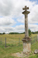
(12) At the junction with the RD142, there is a cross on a column. Carefully cross the RD142 at the hamlet of La Croix Saint Roc and continue along the road heading south-east, which passes under the RD137 whilst leaving the slip roads leading to it on your left. Continue until you reach Rue du Champ de Foire on the left-hand side, then return to the car park (S/E).
 Visorando Member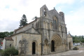

 Moderate
 Tourist office