Refine your search for walks in Le Châtelet-sur-Meuse
Le Châtelet-sur-Meuse walks
 The Route des Moines through the Morimond Forest
 Visorando Member
 6.00 mi
 +279 ft
 -279 ft
 3h 00
3h 00
 Easy
Easy
 Departure from Parnoy-en-Bassigny (Haute-Marne)
A pleasant walk around the site of the former Morimond Abbey and through the woods of the same name. Morimond Abbey, a Cistercian abbey founded in 1115, is the mother house of more than seven hundred monasteries for men and women in France and Europe. The route also takes you past the Morimond Lakes, a series of artificial lakes created by the Cistercian monks to supply water to the abbey’s various outbuildings: gardens, mills, sawmill, nail-making workshop, and so on.
Côte des Fourches circular
3.89 mi
+207 ft
-207 ft
2h 00
Easy
Departure from Bourbonne-les-Bains (Haute-Marne)
A walk through meadows, past cows and horses, with beautiful countryside scenery and dirt tracks.
South of Coiffy-le-Haut
5.53 mi
+686 ft
-689 ft
3h 10
Easy
Departure from Coiffy-le-Haut (Haute-Marne)
A very lovely little walk, especially in autumn, through the woods and vineyards of Coiffy-le-Haut, with lovely views.
Views of Langres between Arbigny-sous-Varennes and the Liez Dam
19.00 mi
+1,112 ft
-768 ft
9h 40
 Difficult
Departure from Arbigny-sous-Varennes (Haute-Marne)
Difficult
Departure from Arbigny-sous-Varennes (Haute-Marne)
From Arbigny-sous-Varennes, the waters of the Presle stream flow into the Mediterranean, whilst from Orbigny-au-Mont those of the Liez flow into the English Channel. Perched on its hilltop, Langres serves as our landmark.
A route taking in three villages in the Haute-Marne
8.44 mi
+935 ft
-919 ft
4h 40
 Moderate
Departure from Guyonvelle (Haute-Marne)
Moderate
Departure from Guyonvelle (Haute-Marne)
A lovely walk through varied, rolling countryside: woods, pastures, meadows and farmland, passing through three villages in the Haute-Marne with beautiful views.
Morizécourt - Bourbonne-les-Bains
14.52 mi
+377 ft
-804 ft
7h 00
Difficult
Departure from Morizécourt (Vosges)
A route showcasing the transition in landscapes and architecture between the Vosges and the Haute-Marne.
Rosières-sur-Mance circular via Saint-Marcel
 5.69 mi
+407 ft
-410 ft
3h 00
Easy
Departure from Rosières-sur-Mance (Haute-Saône)
5.69 mi
+407 ft
-410 ft
3h 00
Easy
Departure from Rosières-sur-Mance (Haute-Saône)
A walk in a peaceful corner of the Haute-Saône, amongst pastures and wind turbines.
On the Grignoncourt ridges
 5.21 mi
+354 ft
-371 ft
2h 40
Easy
Departure from Grignoncourt (Vosges)
5.21 mi
+354 ft
-371 ft
2h 40
Easy
Departure from Grignoncourt (Vosges)
An easy walk with superb panoramic views of the beautiful Saône valley.
The Balcons de la Saône circular route starting from Godoncourt
12.99 mi
+1,106 ft
-1,115 ft
6h 55
Difficult
Departure from Godoncourt (Vosges)
A lovely, long walk with numerous viewpoints and a beautiful path along the Bois de Darney.
Route de découverte de Fayl-Billot
3.34 mi
+200 ft
-207 ft
1h 45
Easy
Departure from Fayl-Billot (Haute-Marne)
Fayl-Billot is a village of 1,300 inhabitants located in the Haute-Marne department. It is best known as the capital of basketry. There are many artisans practising this craft in the village. At the end of this walk, do not hesitate to take home a souvenir. This walk takes in the village’s main tourist and cultural attractions, such as the National School of Osier Cultivation and Basketry, Notre-Dame Church, as well as all the village’s wash houses and fountains.
From the Liez Dam to Perrancey-les-Vieux-Moulins, taking a stroll through Langres
7.53 mi
+722 ft
-696 ft
4h 05
Moderate
Departure from Peigney (Haute-Marne)
This stage takes place in the Marne catchment area, whose waters flow into the English Channel. Perched on a high hill detached from the plateau, Langres invites us to stroll along its ramparts. Opt for its restaurants rather than the usual picnic.
Tour of Lake Liez near Langres
 9.47 mi
+49 ft
-49 ft
4h 25
Moderate
Departure from Chatenay-Mâcheron (Haute-Marne)
9.47 mi
+49 ft
-49 ft
4h 25
Moderate
Departure from Chatenay-Mâcheron (Haute-Marne)
This route takes you around Lac de la Liez along a path in the heart of unspoilt countryside. The lake is very busy in season and is the perfect place to relax, either on the beach or by taking part in the various activities on offer (sailing, water skiing, tubing, etc.). But nature lovers can also enjoy themselves away from the area near the Liez Reservoir dam and Langres Plage.
Between Millières and Esnouveaux via Le Raillemont
 7.01 mi
+528 ft
-518 ft
3h 40
Moderate
Departure from Millières (Haute-Marne) (Haute-Marne)
7.01 mi
+528 ft
-518 ft
3h 40
Moderate
Departure from Millières (Haute-Marne) (Haute-Marne)
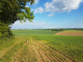
Discover part of the Langres plateau and the Rognon valley. A route through woods and meadows.
La Bove and La Cona
 6.84 mi
+594 ft
-597 ft
3h 40
Moderate
Departure from Bourmont (Haute-Marne)
6.84 mi
+594 ft
-597 ft
3h 40
Moderate
Departure from Bourmont (Haute-Marne)
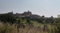
Starting from Bourmont, a charming little village in the Haut-Marne region, you’ll go on a short walk through the surrounding forest.
To Montigny-lès-Cherlieu Abbey
 5.58 mi
+581 ft
-577 ft
3h 05
Moderate
Departure from Montigny-lès-Cherlieu (Haute-Saône)
5.58 mi
+581 ft
-577 ft
3h 05
Moderate
Departure from Montigny-lès-Cherlieu (Haute-Saône)
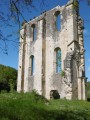
It’s well worth venturing deep into the woods to discover the ruins of the Cistercian Abbey of Cherlieu.
Tour du Mont, starting from Noroy-lès-Jussey
 4.41 mi
+348 ft
-354 ft
2h 20
Easy
Departure from Jussey (Haute-Saône)
4.41 mi
+348 ft
-354 ft
2h 20
Easy
Departure from Jussey (Haute-Saône)
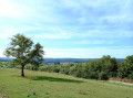
Pass through the beautiful hilltop village of Noroy-lès-Jussey and enjoy the panoramic view over Montigny-lès-Cherlieu and its national forest.
Follow the old vineyard paths that wind past meadows and orchards.
Enjoy a lovely walk beneath the canopy of trees covering Mont de Noroy. You’ll discover remnants of its wine-growing past and perhaps be lucky enough to spot a European golden oriole.
Route de découverte de Langres
4.96 mi
+118 ft
-105 ft
2h 25
Easy
Departure from Langres (Haute-Marne)
Langres is one of the sub-prefectures of Haute-Marne. The town is unique in being completely surrounded by ramparts, making it the town with the longest fortified wall in Europe. This section takes you on a tour of Langres’ historic centre and along the 3-kilometre-long walkway of the medieval fortifications. The route through the town itself is equally charming, featuring a number of historic monuments, including Saint-Mammès Cathedral, and for those wishing to extend their visit to Langres, there is also the town museum to explore.
La Rochelle Castle
 5.88 mi
+413 ft
-423 ft
3h 05
Moderate
Departure from La Rochelle (Haute-Saône) (Haute-Saône)
5.88 mi
+413 ft
-423 ft
3h 05
Moderate
Departure from La Rochelle (Haute-Saône) (Haute-Saône)
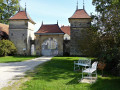
The village of La Rochelle takes its name from ‘Roche’, in the medieval sense of a hilltop on which a fortified castle stands.
This small village is clustered around the castle square; the water from its fountains adds to its charm and authenticity.
In the footsteps of the past in Bulgnéville
 Tourist office
 7.27 mi
+607 ft
-587 ft
3h 50
Moderate
Departure from Bulgnéville (Vosges)
7.27 mi
+607 ft
-587 ft
3h 50
Moderate
Departure from Bulgnéville (Vosges)
A route linking Bulgnéville to Lake Conge in Saulxures-les-Bulgnéville, mainly through woodland and of a manageable length.
The Three Lakes Trail in Bulgnéville
 11.75 mi
+853 ft
-830 ft
6h 10
Moderate
Departure from Bulgnéville (Vosges)
11.75 mi
+853 ft
-830 ft
6h 10
Moderate
Departure from Bulgnéville (Vosges)
The longest of the routes starting from Bulgnéville is ideal for those who enjoy a slightly more challenging walk, but it’s a real treat for the eyes, with its lush greenery and lakes.
Route longue autour des deux lacs à Bulgnéville
 8.06 mi
+607 ft
-581 ft
4h 15
Moderate
Departure from Bulgnéville (Vosges)
8.06 mi
+607 ft
-581 ft
4h 15
Moderate
Departure from Bulgnéville (Vosges)
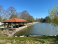
A fairly easy, tree-lined route between two towns renowned for their lakes.
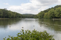
The Lakes Trail in the Park: from Contrexéville to Vittel
 3.77 mi
+249 ft
-243 ft
1h 55
Easy
Departure from Contrexéville (Vosges)
3.77 mi
+249 ft
-243 ft
1h 55
Easy
Departure from Contrexéville (Vosges)
A trail linking the two spa towns, accessible to all, on foot or by bike.
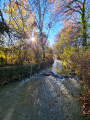
Vair and the Roman Road in Contrexéville
 6.48 mi
+364 ft
-354 ft
3h 20
Moderate
Departure from Contrexéville (Vosges)
6.48 mi
+364 ft
-354 ft
3h 20
Moderate
Departure from Contrexéville (Vosges)
A lovely walk through varied landscapes (lakeshore, forest, countryside, town), where you can discover a rich heritage: there’s something for everyone!