The Lakes Trail in the Park: from Contrexéville to Vittel

A trail linking the two spa towns, accessible to all, on foot or by bike.

Details

43463682
Creation:
Last update:
Last review:
  • Walking
    Activity: Walking
  • ↔
    Distance: 3.77 mi
  • ◔
    Average duration: 1h 55 
  • ▲
    Difficulty: Easy

  • ⚐
    Back to start: No
  • ↗
    Ascent: + 249 ft
  • ↘
    Descent: - 243 ft

  • ▲
    Highest point: 1,260 ft
  • ▼
    Lowest point: 1,076 ft
  • ⚐ Country: France
  • ⚐ City: Contrexéville (88140)
  • ⚑
    Start: N 48.1961° / E 5.880751°
  • ⚑
    End: N 48.204844° / E 5.941743°
  • Accessible from the train station Gare de Vittel.
  • ❏
    IGN map(s): Ref. 3318SB
  • Hour-by-hour weather

Photos

Description of the walk

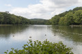
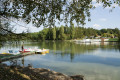
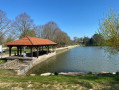
Car park at the Lacs site (to the right of the Hôtel-Restaurant des Lacs).

(S) Start by walking part of the route around the lower lake, keeping to the right; ignore a side path to stay along the shore and reach a crossroads.

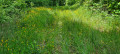
(1) Turn right and head into the woods until you reach the second crossroads.

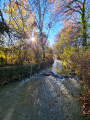
(2) Pass routes 21, 22 and 23 on your right and continue straight on. Walk alongside the woods. Cross the D13 with care, head straight ahead towards Outrancourt and continue on the D13d. Walk through the village and cross a bridge over the River Vair.

(3) Pass route no. 22 on your right and turn left to leave the D13d. Enter the woodland and turn right. Continue straight on until you reach the third junction in the Bois du Grand Ban.

(4) Turn left onto a forest track. At the end of this track, turn left, then right. Carry on straight ahead, ignoring a track on the right, until you reach the next Fork in the road.

(5) Turn left, then you’ll reach the D18 (Caution: dangerous road, heavy traffic!). Cross the road, then carry on straight ahead, passing through a wooded area. You’ll arrive at Rue des Grands Bois, then follow Avenue de Châtillon to the junction near the Renault garage.

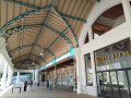
(6) Keep left, continue along Avenue des Tilleuls and arrive at the entrance to the Vittel Thermal Park (E).

Waypoints

  1. S : mi 0 - alt. 1,119 ft - Lacs de la Folie – Contrexéville
  2. 1 : mi 0.27 - alt. 1,119 ft - Crossroads - Lacs de la Folie (Contrexeville)
  3. 2 : mi 0.48 - alt. 1,125 ft - Junction of routes
  4. 3 : mi 1.09 - alt. 1,083 ft - Vair (rivière)
  5. 4 : mi 2.05 - alt. 1,260 ft - Bois du Grand Ban – Forest track
  6. 5 : mi 2.73 - alt. 1,158 ft - Fork in the road, forest track
  7. 6 : mi 3.54 - alt. 1,119 ft - Carrefour Renault garage, Avenue des Tilleuls
  8. E : mi 3.77 - alt. 1,102 ft

Notes

One-way walk: make sure you have a car waiting at the Vittel Spa (E)

Worth a visit

Places to discover along the way:
- The Folie Lakes in Contrexéville (S)
- The village of Outrancourt
- Vittel Spa (E)

Find a wide range of activities in Contrexéville right here: https://www.contrextourisme.com/

Reviews and comments

4.3 / 5
Based on 3 reviews

Reliability of the description
4.3 / 5
Ease of following the route
4.3 / 5
Route interest
4.3 / 5
User 11039722

Overall rating : 5 / 5

Date of your route : May 30, 2026
Reliability of the description : ★★★★★ Very good
Ease of following the route : ★★★★★ Very good
Route interest : ★★★★★ Very good
Very busy route : No

Machine-translated

fredmotard
fredmotard

Overall rating : 4 / 5

Date of your route : May 26, 2025
Reliability of the description : ★★★★☆ Good
Ease of following the route : ★★★★☆ Good
Route interest : ★★★★☆ Good
Very busy route : No

The fountain – a detour of little interest

Machine-translated

reitop
reitop

Overall rating : 4 / 5

Date of your route : Feb 19, 2025
Reliability of the description : ★★★★☆ Good
Ease of following the route : ★★★★☆ Good
Route interest : ★★★★☆ Good
Very busy route : No

Starting from Vittel, follow the signposted path to the bridge over the Vair; instead of heading towards Contrexeville, turn left before the bridge towards the ranch to continue along the path, which, after crossing the railway bridge, takes you left through the forest to the wildlife park, leading you towards the centre of Vittel and then to the station, where the route finally circles back.

Machine-translated

Other walks in the area

For more walks, use our search engine .

The GPS track and description are the property of this route's author. Please do not copy them without permission.