Between Millières and Esnouveaux via Le Raillemont

Discover part of the Langres plateau and the Rognon valley. A route through woods and meadows.

Details

1365198
Creation:
Last update:
Last review:
  • Walking
    Activity: Walking
  • ↔
    Distance: 7.01 mi
  • ◔
    Average duration: 3h 40 
  • ▲
    Difficulty: Moderate

  • ⚐
    Back to start: Yes
  • ↗
    Ascent: + 528 ft
  • ↘
    Descent: - 518 ft

  • ▲
    Highest point: 1,388 ft
  • ▼
    Lowest point: 1,056 ft

Photos

Description of the walk

Starting point: the Millères washhouse; you can park here.

(S/E) When facing the wash house, head off to the right and follow the road to Forcey, passing the Fontaine Saint-Gengoul. Turn left, then take the first left onto Rue des Dhuits and leave the village.
After the cemetery, leave a tarmac path on your right and continue to the three-way junction.

(1) Follow the road (D231) on your right. You’ll be looking down over the Lonzay valley.

(2) Once you’ve entered the forest, continue to a hunting lodge and turn left onto a forest track that leads downhill.
Take a path on your right 50 metres before the forest track turns left. Turn left, then right, to join a lovely tree-lined path.

(3) Turn left onto this path, which will take you to the Moulin d’Esnouveaux, on the banks of the Rognon.

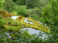
(4) Once you reach the banks of the Rognon, turn round to admire the old fish farm pond and don’t miss the mill’s spillway before turning left onto the road (D142) which climbs towards Millières. Follow the road to a secluded cottage.

(5) Shortly afterwards, take a path on the left at the corner of an old farm building. Head down towards the hamlet of Le Rondez and take the path opposite, which winds its way through the fields to the Ferme des Duis.

(6) Leave this farm on your left and rejoin the road which descends and then climbs back up onto the plateau. Pass a path on your left leading to the Etang du Lonzay and stay on the road; you’ll soon reach the three-way junction that you’re already familiar with.

(1) Carry on to the right, pass the cemetery again to reach the village and your starting point (S/E).

Waypoints

  1. S/E : mi 0 - alt. 1,293 ft - Parking at the Millières wash house
  2. 1 : mi 0.76 - alt. 1,312 ft - Crossroads at the end of the circular loop
  3. 2 : mi 1.89 - alt. 1,371 ft - Forcey Hunting Lodge
  4. 3 : mi 2.37 - alt. 1,270 ft - Turn left at the fork
  5. 4 : mi 3.56 - alt. 1,056 ft - Esnouveau Mill - Rognon (rivière)
  6. 5 : mi 4.7 - alt. 1,293 ft - Farm building, path on the left
  7. 6 : mi 5.48 - alt. 1,224 ft - Ferme des Duis
  8. S/E : mi 7.01 - alt. 1,293 ft - Parking at the Millières washhouse

Notes

When you reach the wash house, do feel free to cool off in the clear water.

Reviews and comments

4.6 / 5
Based on 3 reviews

Reliability of the description
5 / 5
Ease of following the route
5 / 5
Route interest
3.7 / 5
patouche
patouche

Overall rating : 4.5 / 5

Date of your route : Mar 28, 2022
Reliability of the description : ★★★★★ Very good
Ease of following the route : Not used / Not applicable
Route interest : ★★★★☆ Good
Very busy route : No

A pleasant route, but not signposted

Machine-translated

MARTDomi
MARTDomi

Overall rating : 4.3 / 5

Date of your route : Aug 04, 2020
Reliability of the description : ★★★★★ Very good
Ease of following the route : ★★★★★ Very good
Route interest : ★★★☆☆ Average
Very busy route : No

A lovely, easy walk

Machine-translated

Clemente Sinlaé
Clemente Sinlaé

Overall rating : 4.7 / 5

Date of your route : Feb 09, 2020
Reliability of the description : ★★★★★ Very good
Ease of following the route : ★★★★★ Very good
Route interest : ★★★★☆ Good

Each step is explained very clearly; I didn’t miss a single point of reference

Machine-translated

Other walks in the area

For more walks, use our search engine .

The GPS track and description are the property of this route's author. Please do not copy them without permission.