Country:
 City:
City:


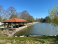
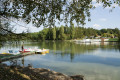
Lac des Récollets car park in Bulgnéville.
(S/E) At the information sign marking the starting point, take the path running alongside Lac des Récollets. Turn left to continue round the lake and reach the arboretum.
(1) Turn left, following the lake, and ignore a junction until you reach a second crossroads.
(2) Turn right and you’ll come to a car park (with picnic tables). Cross the car park along its length on the right-hand side and carry on straight ahead. The tarmac road passes under the dual carriageway and becomes a track. You’ll pass the Fontaine du Naingrecourt. Keep going straight ahead, then enter the woodland.
(3) At the end of the track, turn right. At the junction, carry on straight ahead until you reach the car park situated on a bend in the D294. Walk along the left-hand side of the car park and the D294 until you reach the end of the bend.
(4) Take the forest track on the left. Caution! This is a steep downhill slope, which can be slippery in places! Continue straight on until you reach the Upper Lac de la Folie.
(5) Continue to the dividing dam by following the path to the left at the pond.
(5) Turn right at the dam and follow the Route des Lacs. Pass under the D165, then cross the D164 and continue straight on along Rue Claude Gelée until the first junction with Rue Maurice Barrès.
(7) Turn right onto Rue Maurice Barrès. You’ll come to a roundabout. Take the left-hand lane. Walk alongside the ZA de la Chaille industrial estate. Enter the forest and you’ll come to a forest track. Turn right until you reach the recycling centre.
(8) Turn left and follow the track, which climbs steadily, until you reach the edge of the forest, ignoring a junction on the left.
(9) Turn right, then left onto a forest track running along the edge of the woodland. At the fork, turn right at a right angle. You’ll reach a crossroads at the top of a hillock.
(10) Turn left, then left again after a few metres. You’ll reach the D14. Take the track almost directly opposite. At the end, take the straight track to the right. Continuing along this track, after crossing a footbridge, you’ll reach a junction.
(11) Turn right to reach the entrance to Bulgnéville. Walk past the two stadiums. When you reach the road, turn left, then at the junction, head straight on along Rue François Mitterrand. Pass the two roundabouts. At the end, turn left for a few metres and turn right onto a path leading to the far end of Lac des Récollets, which you passed on the way out.
(1) Continue straight on along the lake and, following the route in the opposite direction to the outward journey, head towards the (S/E).


 Tourist office

 Easy
Easy 

 Difficult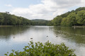
 Visorando Member