South of Coiffy-le-Haut

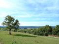
A very lovely little walk, especially in autumn, through the woods and vineyards of Coiffy-le-Haut, with lovely views.

Details

4230573
Creation:
Last update:
Last review:
  • Walking
    Activity: Walking
  • ↔
    Distance: 5.53 mi
  • ◔
    Average duration: 3h 10 
  • ▲
    Difficulty: Easy

  • ⚐
    Back to start: Yes
  • ↗
    Ascent: + 686 ft
  • ↘
    Descent: - 689 ft

  • ▲
    Highest point: 1,266 ft
  • ▼
    Lowest point: 843 ft

Description of the walk

Park near the church at Coiffy-le-Haut.

(S/E) Take the small road marked ‘No Entry’ which leads downhill.

(1) Just after the wayside cross, take the steeply descending path on the right and continue straight on to reach the D130.

(2) Cross the road with care and take the path opposite, which widens and climbs through the woods to the summit. At the top, the path becomes less visible: keep heading in the same south-westerly direction.

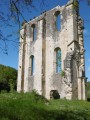
(3) When you reach a ruin, carry on straight ahead along a good path marked with yellow-yellow signposts. Ignore the markings when they turn right and carry on straight ahead through the Bois du Jeune Chênoi.

(4) Take the first path on the left which descends to another path, which you should also take on the left. Then, descend steeply along the first track on the right to the Route Forestière de la Combe Millot.

(5) Turn left onto this track, which continues as a grassy path and joins the D26.

(6) Follow it to the left with care for about 600 m until you reach the sign for Les Granges du Val on the right.

(7) Turn right here and follow this signposted path to Les Granges du Val, where you’ll turn left to rejoin the D26 and head back up to the right.

(8) Turn left onto the second small road (no entry sign) which climbs alongside the vineyards.

(1) Continue straight on until you reach the church (S/E).

Waypoints

  1. S/E : mi 0 - alt. 1,266 ft - Église Notre-Dame-de-la-Nativité (Coiffy-le-Haut)
  2. 1 : mi 0.07 - alt. 1,211 ft - Path after the wayside cross
  3. 2 : mi 0.57 - alt. 1,004 ft - D130
  4. 3 : mi 1.42 - alt. 1,230 ft - Ruins
  5. 4 : mi 2.28 - alt. 1,214 ft - Path on the left
  6. 5 : mi 2.51 - alt. 1,017 ft - Route Forestière de la Combe Millot
  7. 6 : mi 3.18 - alt. 899 ft - D26
  8. 7 : mi 3.55 - alt. 892 ft - Sign for Les Granges du Val
  9. 8 : mi 5.16 - alt. 1,050 ft - Small road (no entry sign)
  10. S/E : mi 5.53 - alt. 1,263 ft - Church of Coiffy-le-Haut

Worth a visit

- On the D26, there’s a lovely view of the vineyards of Coiffy-le-Haut, with the church perched above them.
- After (9), a lovely view over the vineyards and the valley.

Reviews and comments

3.3 / 5
Based on 7 reviews

Reliability of the description
3.3 / 5
Ease of following the route
3.4 / 5
Route interest
3.1 / 5
leoderynck
leoderynck

Overall rating : 3 / 5

Date of your route : Dec 03, 2025
Reliability of the description : ★★★☆☆ Average
Ease of following the route : ★★★☆☆ Average
Route interest : ★★★☆☆ Average
Very busy route : No

Trail of average difficulty. Not easy (especially the first part). This section in the forest is the most difficult because the trail is not very visible. You have to make do with following what remains of the ruts. Towards the end of this section, you will have to improvise a little to get out of the forest. After the forest section, there are no further difficulties.

Machine-translated

Christian21
Christian21

Just to clarify: after point 1, after about 20 metres, leave the dirt track leading towards the boundary of a meadow and continue along the grassy path that descends steeply to the left.
And after point 2, I gave the path a few snips with my secateurs to make it easier to get through. Further up, however – as has been the case everywhere in the forest of late – you’ll need to step over or go round fallen tree trunks.

Machine-translated

Theomart
Theomart

Overall rating : 3.3 / 5

Date of your route : Sep 03, 2023
Reliability of the description : ★★★★☆ Good
Ease of following the route : ★★★☆☆ Average
Route interest : ★★★☆☆ Average
Very busy route : No

The section at the top of the vineyards offers a lovely view, although the route needs to be diverted from point 1. The first path leads to a fenced-off field
You need to head further south
Then, between points 2 and 3, the path has not been cleared and trees and brambles have grown across it
You’ll need to take another detour, this time via a path a little further up
Once past point 3, the route is clear; the forest is lovely and the forest tracks are passable
60 per cent of the route is through woodland
Two sections of about 300 m run along the road and then along dirt tracks
A pleasant route once you’ve passed the first third

Machine-translated

Gefli
Gefli

Overall rating : 4.5 / 5

Date of your route : Aug 21, 2023
Reliability of the description : Not used / Not applicable
Ease of following the route : ★★★★★ Very good
Route interest : ★★★★☆ Good
Very busy route : No

Some sections of the route aren’t very well cleared, but that makes it more challenging and wilder. What’s more, the route includes a few hills. So I’d say the route is of moderate difficulty. Otherwise, there are some lovely stretches through the forest. Very pleasant.
Point of interest 8: I’d say it’s the road on the left at the second ‘No Entry’ sign.

Machine-translated

Xmal
Xmal

Overall rating : 4.7 / 5

Date of your route : Jul 31, 2023
Reliability of the description : ★★★★★ Very good
Ease of following the route : ★★★★★ Very good
Route interest : ★★★★☆ Good
Very busy route : No

It’s a lovely walk overall – I loved the first part through the forest but didn’t enjoy the second part as much, as it was along a rather uninteresting road and, above all, with traffic passing by. That said, it’s still a very lovely walk through beautiful countryside and a superb forest! The terrain is very easy, even after a few showers.
For the path opposite point 2, you have to climb over a wire fence – it was very easy. The icing on the cake was that, on the way back, at Coiffy, there was a beer and wine tasting… 😎🍷
Thanks to the creator.

Machine-translated

Marc_95
Marc_95

Overall rating : 2.3 / 5

Date of your route : Jul 19, 2023
Reliability of the description : ★★☆☆☆ Disappointing
Ease of following the route : ★★☆☆☆ Disappointing
Route interest : ★★★☆☆ Average
Very busy route : No

Please note that the path indicated in point (1) is blocked by a securely locked gate. Clearly, they do not want walkers to pass through. I took the small path further down, marked in black on the map, to get back to the original path and then the D130. I didn’t spot the path opposite! I continued my walk via Les Granges Huguet, then points 7 and 8.

Machine-translated

Christian21
Christian21

I’ve checked, and the path on the other side of the D 130 is indeed still there, although it doesn’t seem to be very well maintained for the first few metres. It’s further up, as mentioned in the description, that the path becomes less distinct, but it remains perfectly passable, with no risk of going astray, even without a GPS.

Machine-translated

RandoLuc
RandoLuc

That’s true, it’s more of an animal track; I followed my GPS and had no problems

Machine-translated

Joke
Joke

Overall rating : 1 / 5

Date of your route : Jun 24, 2022
Reliability of the description : ★☆☆☆☆ Very disappointing
Ease of following the route : ★☆☆☆☆ Very disappointing
Route interest : ★☆☆☆☆ Very disappointing
Very busy route : No

There is no footpath on the other side of the D130

Machine-translated

RandoLuc
RandoLuc

Overall rating : 4.7 / 5

Date of your route : Apr 27, 2022
Reliability of the description : ★★★★★ Very good
Ease of following the route : ★★★★★ Very good
Route interest : ★★★★☆ Good
Very busy route : No

A pleasant walk, a descent with lovely views; the forest is light and airy, then the return journey with the church in sight and glimpses of the valley and the vineyards
Nice one, Merc

Machine-translated

Other walks in the area

For more walks, use our search engine .

The GPS track and description are the property of this route's author. Please do not copy them without permission.