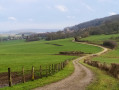
Tour du Mont, starting from Noroy-lès-Jussey

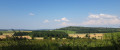
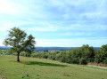
Pass through the beautiful hilltop village of Noroy-lès-Jussey and enjoy the panoramic view over Montigny-lès-Cherlieu and its national forest.
Follow the old vineyard paths that wind past meadows and orchards.
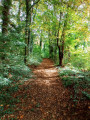
Enjoy a lovely walk beneath the canopy of trees covering Mont de Noroy. You’ll discover remnants of its wine-growing past and perhaps be lucky enough to spot a European golden oriole.

Details

39521319
Creation:
Last update:
Last review:
  • Walking
    Activity: Walking
  • ↔
    Distance: 4.41 mi
  • ◔
    Average duration: 2h 20 
  • ▲
    Difficulty: Easy

  • ⚐
    Back to start: Yes
  • ↗
    Ascent: + 348 ft
  • ↘
    Descent: - 354 ft

  • ▲
    Highest point: 1,168 ft
  • ▼
    Lowest point: 922 ft
  • ⚐ Country: France
  • ⚐ City: Jussey (70500)
  • ⚑
    Start/End: N 47.812415° / E 5.840703°
  • ❏
    IGN map(s): Ref. 3320SB
  • Hour-by-hour weather

Photos

Description of the walk

Park at the large junction of Rue de Marrant and Grande Rue in Noroy-lès-Jussey.

(S/E) Above the large, oblong wash house, take the small Rue Nicouchot. At the end, you’ll see another wash house; walk up to the left past it for a few metres. Then turn right onto the Grande Rue – this is also the D159 – which leads to the village exit at the crossroads marked by a wayside cross beneath a walnut tree.

(1) Turn left onto a wide path leading to all the former vineyard plots, now converted into orchards or overgrown with woodland. You’ll reach the entrance to the woods, where you’ll see a sign reading: “Le tour du Mont”.

(2) Head left up into the woods and follow the blue circle markings. You’ll reach a crossroads (where there’s a pile of stone gathered from fields – see definition in Practical Information).

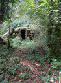
(3) Take the path leading uphill to the left and carry on. You’ll pass some old vineyard buildings or huts, then reach a Y-junction.

(4) Follow the blue signposts to the right and carry on until you reach a wider track, then a Y-junction.

(5) Turn left onto the Chemin des Biquettes towards the woods. Carry on until you reach the Virgin of Noroy, who watches over the village.

(6) Enter the woods again. Note that 100 metres further on, on the left, there is a small hollow, evidence of limestone quarrying. Carry on through the woods until you reach a clearing marked by tree trunks.

(7) Go round them on the left, then head back to the Y-junction you passed on the way out.

(4) Turn right to return to the original junction, which you also passed on the way out.

(3) Head diagonally to the right and, following the route in reverse, return to the car park at Noroy-lès-Jussey (S/E).

Waypoints

  1. S/E : mi 0 - alt. 1,001 ft - Junction of Rue de Marrant and Grande Rue
  2. 1 : mi 0.24 - alt. 1,010 ft - Calvary beneath a walnut tree
  3. 2 : mi 0.9 - alt. 968 ft - Entrance to the woods
  4. 3 : mi 1.22 - alt. 968 ft - Pile of stone gathered from fields
  5. 4 : mi 1.49 - alt. 1,086 ft - Crossroads at the circular loop
  6. 5 : mi 2.05 - alt. 1,115 ft - Turn left at the fork
  7. 6 : mi 2.26 - alt. 1,145 ft - Our Lady of Noroy
  8. 7 : mi 2.63 - alt. 1,112 ft - Crossroads on the left
  9. 8 : mi 3.47 - alt. 935 ft - Toncs
  10. 9 : mi 3.69 - alt. 958 ft - Junction on a stony path
  11. S/E : mi 4.41 - alt. 1,001 ft - Junction of Rue de Marrant and Grande Rue

Notes

Stay on the paths through the forest and follow the Blue Circles.
Between (1) and (2), the old mining plots stretched across the whole of the southern part of Noroy, from east to west.
Between (2) and (3), you can see the open-cast iron mines, of which there are many on the mountain.
(3) piles of stone gathered from fields: old dry-stone walls, used to mark the boundaries of the vineyard plots.
In the woods, there are old pits of varying sizes left over from iron ore mining, even though they have been filled in, as well as cavities left from limestone quarrying.
Foxholes and other burrows can also be found, as well as the golden oriole, a pretty, bright-yellow bird visible from spring until the end of August.

Worth a visit

(S/E) In Noroy-lès-Jussey, you can walk around La Bridelle, starting from the top of the village at the wayside cross. This is the other hill that surrounds it. As well as being a geodetic point, it was a prehistoric settlement site. You’ll emerge to the west of Noroy with a view of Saint-Marcel and walk past vineyards that have returned to their original location.
To the south, near Montigny-lès-Cherlieu, you can visit:
- the ruins of the great Cistercian Abbey of Cherlieu, with a picnic table by the private pond.
- Bougey Castle.

Reviews and comments

4.5 / 5
Based on 2 reviews

Reliability of the description
4.5 / 5
Ease of following the route
4.5 / 5
Route interest
4.5 / 5
Pierre68
Pierre68

Overall rating : 5 / 5

Date of your route : Mar 04, 2024
Reliability of the description : ★★★★★ Very good
Ease of following the route : ★★★★★ Very good
Route interest : ★★★★★ Very good
Very busy route : Yes

A lovely walk, though there were indeed a few too many fallen trees in places (the last storm, perhaps?) and mud at the top of the hill, caused by the previous day’s rain and the forestry vehicles that had churned up the track.
That said, I found this walk very enjoyable and its heritage fascinating. It certainly deserves to be showcased! And to think that this piece of history is under threat from the potential opening of a quarry on the hill!

Machine-translated

randonneur 70
randonneur 70

Overall rating : 4 / 5

Date of your route : Jan 08, 2024
Reliability of the description : ★★★★☆ Good
Ease of following the route : ★★★★☆ Good
Route interest : ★★★★☆ Good
Very busy route : Yes

A really lovely route. It’s a shame that the trees that have fallen over the years haven’t been cleared away.
A large section of the route towards the end has been badly damaged by forestry work.
A well-wooded route, ideal in hot weather.

Machine-translated

Other walks in the area

For more walks, use our search engine .

The GPS track and description are the property of this route's author. Please do not copy them without permission.