A route taking in three villages in the Haute-Marne

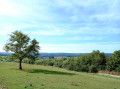
A lovely walk through varied, rolling countryside: woods, pastures, meadows and farmland, passing through three villages in the Haute-Marne with beautiful views.

Details

n°2401333
Creation:
Last update:
Last review:
  • Walking
    Activity: Walking
  • ↔
    Distance: 8.44 mi
  • ◔
    Average duration: 4h 40 
  • ▲
    Difficulty: Moderate

  • ⚐
    Back to start: Yes
  • ↗
    Ascent: + 935 ft
  • ↘
    Descent: - 919 ft

  • ▲
    Highest point: 1,171 ft
  • ▼
    Lowest point: 764 ft
  • ⚐ Country: France
  • ⚐ City: Guyonvelle (52400)
  • ⚑
    Start/End: N 47.854053° / E 5.711103°
  • Accessible from the train station Gare de Pisseloup.
  • ❏
    IGN map(s): Ref. 3219SB, 3220SB, 3319SB, 3320SB
  • Hour-by-hour weather

Description of the walk

Park at Place de l’Église in Guyonvelle.

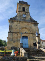
(S/E) To the right of Saint-Luc Church in Guyonvelle, take a shaded path that descends steeply. Cross the Ruisseau du Moulin via a footbridge. Pass the next footbridge on your left, which marks another path. Continue along a grassy path between two pastures that winds round Vaudrémont Hill, noting two large trees by the side of the path. You’ll reach a crossroads of footpaths.

(1) Take the first path on the left, which descends to the stream. Cross it over two railway sleepers, then head down between two meadows towards the village of Velles, following the Ruisseau de Guyonvelle along its right bank. At the end of the path, first turn left then right to enter the village of Velles.

(2) Turn left onto Rue du Faubourg, heading due east towards the hill. Pass between a wash house on your left and a wayside cross on your right. Then begin a steep climb up the hillside; at the top, as you emerge from the forest, the path is barely visible. Look out for the large aerial and climb straight up to it.

(3) Turn right onto a wide dirt track; at the next crossroads, take the path opposite to rejoin the road a little further down. Turn left onto it, head down to the main street and turn left onto it to reach the church in the village of Pisseloup.

(4) Head back up to the left; at the end of the street, turn left again onto a sunken track leading to the summit. Ignore the ‘Chemin de la Vierge’ on the right and continue along this long track, which opens out onto a road. Follow it to the right for 100 metres to reach the junction with a footpath leading into the Bois de la Voie de Vaux.

(5) Take this path to the right, continuing north-east until you reach another, slightly wider path; turn right, then after about thirty metres, at the mark of two yellow lines, turn left and head downhill.

(6) You’ll reach a tarmac road; follow it to the right (the cross-country path opposite is impassable), follow the circular path until, a little further down on the right, you come to a cross-country path leading onto a road at the crossroads of the hamlet of La Folie.

(7) Leave the hamlet’s road on your right and continue due north until you reach the church in the village of Vaux la Douce.

(8) Turn left and head uphill along a grassy path. Cross a road and continue on a long, gradual climb through the woods; keep going straight along this path, passing through all the crossroads, until you reach the Champ Rotard farm.

(9) Turn right towards the Bois des Dames, heading due north; ignore a path on the right; the track curves widely to the left before joining a wide, stony track.

(10) Carry on straight ahead to reach the village of Guyonvelle, then turn right to return to the car park at the church where you started (S/E).


Waypoints

  1. S/E : mi 0 - alt. 1,109 ft - Place de l’Église in Guyonvelle
  2. 1 : mi 0.93 - alt. 899 ft - Crossroads
  3. 2 : mi 1.93 - alt. 787 ft - The village of Velles
  4. 3 : mi 2.37 - alt. 1,014 ft - Branch
  5. 4 : mi 3.22 - alt. 768 ft - Pisseloup church and wayside cross
  6. 5 : mi 4.33 - alt. 1,086 ft - Crossroads
  7. 6 : mi 4.97 - alt. 1,020 ft - Turn right onto the tarmac road
  8. 7 : mi 5.37 - alt. 860 ft - La Folie crossroads
  9. 8 : mi 5.96 - alt. 869 ft - Church of Vaux-la-Douce
  10. 9 : mi 6.94 - alt. 1,083 ft - Crossroads at the Champ Rotard farm
  11. 10 : mi 8.1 - alt. 1,158 ft - Wide, stony path
  12. S/E : mi 8.44 - alt. 1,109 ft - Place de l’Église in Guyonvelle

Notes

This is a hike with significant elevation gain; good walking shoes are essential as the paths are unpaved or stony and poorly maintained – walking poles are recommended
In Velles, the wash house provides good shelter in the event of bad weather
In Pisseloup, there is a bus shelter on the right as you enter

Worth a visit

(2) Velles: A stopover lodge with horses; a little further on to the right, a basket-weaving workshop; then to the left, a metal sculpture workshop.
Ahead of you, in a small square, is a remarkable circular drinking trough; in the background is the church.
Lovely views from the open hilltops
If they are open, do visit the basket-weaving and metalwork workshops in Velles

Reviews and comments

3.8 / 5
Based on 2 reviews

Reliability of the description
4 / 5
Ease of following the route
4 / 5
Route interest
3.5 / 5
ThéoP
ThéoP

Overall rating : 3 / 5

Date of your route : Jun 29, 2025
Reliability of the description : ★★★☆☆ Average
Ease of following the route : ★★★☆☆ Average
Route interest : ★★★☆☆ Average
Very busy route : No

While visiting the tree house, we decided to go for a hike in the afternoon.
This hike looked nice with a variety of terrain.
The problem: the trails and paths on the route are no longer passable. Nature has reclaimed its rights and everything is overgrown. Several times we really struggled to follow the trail. The directions mention passages that are impossible to find. The route is precise, but sometimes we really wondered: do we really have to go through there?

Machine-translated

RandoLuc
RandoLuc

I’m glad this walk helped you have a lovely day!

Machine-translated

KEKEK
KEKEK

Overall rating : 4.7 / 5

Date of your route : Oct 08, 2023
Reliability of the description : ★★★★★ Very good
Ease of following the route : ★★★★★ Very good
Route interest : ★★★★☆ Good
Very busy route : No

A varied walk, taking in woodland, idyllic meadows and charming villages, with a mix of flat terrain and hills…
Very detailed description.
Thank you!

Machine-translated

Other walks in the area

For more walks, use our search engine .

The GPS track and description are the property of this route's author. Please do not copy them without permission.