The Route des Moines through the Morimond Forest

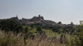
A pleasant walk around the site of the former Morimond Abbey and through the woods of the same name. Morimond Abbey, a Cistercian abbey founded in 1115, is the mother house of more than seven hundred monasteries for men and women in France and Europe. The route also takes you past the Morimond Lakes, a series of artificial lakes created by the Cistercian monks to supply water to the abbey’s various outbuildings: gardens, mills, sawmill, nail-making workshop, and so on.

Details

23279283
Creation:
Last update:
Last review:
  • Walking
    Activity: Walking
  • ↔
    Distance: 6.00 mi
  • ◔
    Average duration: 3h 00 
  • ▲
    Difficulty: Easy

  • ⚐
    Back to start: Yes
  • ↗
    Ascent: + 279 ft
  • ↘
    Descent: - 279 ft

  • ▲
    Highest point: 1,424 ft
  • ▼
    Lowest point: 1,184 ft

Description of the walk

Park at the side of the D139 road near the Sainte-Ursule Chapel.

(S/E) Walk past the Sainte-Ursule Chapel to reach the small road leading to the former abbey.
Walk round the ruins of the old abbey to the south (see section: During the walk). Continue straight on until you reach the edge of the Étang de Morimond (note the site of the old mill).

(1) At the pond, turn right and follow it on your left-hand side. The road soon gives way to a path running alongside the pond. Follow it to a passage between Morimond Pond and the Old Pond. Turning left, cross the wooded embankment and continue along the path which enters the Bois de Morimond, veering right for about fifty metres before turning left and heading straight on towards the east.
After about five hundred metres, the track joins the Route Forestière du Bois de France.

(2) Cross it and continue straight ahead on a forest road that climbs very gently. Further on, the road turns to the right, passes a barrier restricting motor vehicle traffic just before reaching a junction with the Route Forestière de Vaudainvilliers.

(3) Take the road on the left, which bends shortly afterwards and continues eastwards downhill to cross the Flambart, then climbs up the other side of the valley and reaches another barrier with a car park beside it. Pass through the barrier and continue straight on until you reach a T-junction of forest tracks. To the left, nearby, lies the site of an ancient Gallo-Roman settlement.

(4) Take the track on the left-hand side, which leads straight on towards a forest track heading north-west. Pass through the barrier restricting motor vehicle access just before turning left at the junction to head west. After about five hundred metres, the path reaches a clearing and runs along the edge of the woodland on the right-hand side until it reaches a forester’s cottage. From there, the path leads across fields towards the Ferme de Vaudainvilliers (private property), which is about five hundred metres away.

(5) The path gives way to a road leading to the Vaudainvilliers Farm. Follow the small road to a T-junction with the D139. Turn left onto the D139 and follow it carefully. The road soon runs alongside the Morimond State Forest.

(6) After about one hundred and fifty metres, take the path on the right for nearly sixty metres until you reach a forest track. Turn right for about one hundred metres, then left onto the path heading west. At the next crossroads, on the edge of the plateau where the Morimond Forest is situated, turn left onto the path leading down towards the Flambart. At the edge of the woods, turn left before reaching the Flambart. Discover the quarries that supplied the stone for the abbey’s construction. Follow the Flambart until you reach the D139 road.

(7) Take the D139 road, which crosses the Flambart, and you will reach the car park about a hundred metres further on (S/E).


Waypoints

  1. S/E : mi 0 - alt. 1,217 ft - Chapelle Sainte-Ursule (Fresnoy-en-Bassigny)
  2. 1 : mi 0.39 - alt. 1,220 ft - Étang de Morimond
  3. 2 : mi 1.12 - alt. 1,322 ft - Path x Forest track
  4. 3 : mi 1.66 - alt. 1,375 ft - Vaudainvilliers Forest Road
  5. 4 : mi 2.44 - alt. 1,424 ft - T-junction of forest tracks
  6. 5 : mi 4.25 - alt. 1,362 ft - Vaudainvillers Farm (private property)
  7. 6 : mi 4.84 - alt. 1,312 ft - Road x Path
  8. 7 : mi 5.83 - alt. 1,207 ft - Path x Road - Flambart (rivière)
  9. S/E : mi 6 - alt. 1,217 ft - Chapelle Sainte-Ursule (Fresnoy-en-Bassigny)

Notes

The car park is situated beside the D139 road near the Sainte-Ursule Chapel, at the entrance to the former Morimond Abbey. Alternatively, follow the road towards the Étang de Morimond; there is a large car park on the left, just before the Auberge farmhouse and before the lake.
Access: From Montigny-le-Roi, take the D417 heading east towards Dammartin-sur-Meuse. At the village of Meuse, turn left onto the D429 and continue to Fresnoy-en-Bassigny. Turn left again to take the D139 northwards for 2.5 to 3 km.

This walk across varied terrain requires suitable footwear.

This walk presents no real difficulty in terms of navigation as it is signposted in blue and yellow. In addition, it is advisable to follow the directions in the description and on the map, whilst keeping a close eye on the landscape. The waypoints (with their GPS coordinates and the distance from the starting point) serve as aids for walkers exploring the route for the first time.

This is a reprint of the ‘Route des Moines’ walk guide published by the Bourbonne-les-Bains and Haute-Marne Tourist Office.

Worth a visit

Morimond Abbey
Morimond is a former Cistercian abbey,the fourth daughter of Cîteaux, probably founded between 1117 and 1118.
The Association des Amis de Morimond was founded in 1990 under the active chairmanship of Jean Favre. It owns part of the estate. It is a signatory to the European Charter of Cistercian Abbeys and Sites. Its activities are wide-ranging: restoration of the Chapel of Saint Ursula; organisation of symposia (1992: Chaumont; 2003: Langres); annual archaeological excavations since 1994; an annual concert in the chapel; a country-style meal in a venue closely linked to the Abbey (barn, priory); lectures and exhibitions, etc.
Projects: the association is continuing to develop the site: maintenance of the archaeological garden, restoration of its ruins, with the restoration of the gatehouse being a priority, etc.
In 2017, it celebrated the900th anniversary of the Abbey’s foundation.

Largely destroyed during the Revolution, part of the gatehouse and the Chapel of the Guests – Sainte-Ursule (15th century) – still remain.
The north gatehouse is currently being restored.
A section of the wall of the abbey church (12th century) remains, as does the façade of the library. Furthermore, a U-shaped canal and the ponds created by the monks along the course of the Flambart can still be seen.
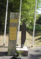
Archaeological excavations have revealed the foundations of buildings that are no longer standing. Since 2013, an archaeological garden has been created, featuring ten information panels detailing the excavations carried out.
The site is signposted with modern signage in several languages (French, German, English, Italian).
Source: walking guide published by the Haute-Marne Tourist Office.

Free access all year round (site discovery trail).
Tour available on the free IDVizit app!
To find out more and download the detailed visitor guide:
Source: internet

Fresnoy-en-Bassigny
Places and monuments
Castle, built in the 18th century and listed as a Historic Monument on 9 March 1987.
Morimond Abbey, founded in 1115 or 1117.
Church of Notre-Dame-de-la-Nativité, built in the 15th century; sacristy built in the 18th century; listed as a Historic Monument on 23 September 1925.
Sainte-Ursule Chapel, built in the 15th century.
A Roman road runs through the municipal area and, near this road, about 1 km from Fresnoy, lies a small marsh known as la Nonnerie, the bottom of which is paved. In 1839, the remains of buildings still stood near this marsh which, according to tradition, were part of a convent.
Source: Wikipedia (excerpts)

Reviews and comments

4.1 / 5
Based on 4 reviews

Reliability of the description
4 / 5
Ease of following the route
3.8 / 5
Route interest
4.5 / 5
Titjojo
Titjojo

Overall rating : 3.3 / 5

Date of your route : Jul 14, 2025
Reliability of the description : ★★★★☆ Good
Ease of following the route : ★★★☆☆ Average
Route interest : ★★★☆☆ Average
Very busy route : No

A pleasant hike, mostly in the shade, which is welcome in hot weather. At point 6, you have to leave the road, but it's impossible to see where to do so, as it's hidden by vegetation. A little further on, we decided to turn left onto the forest path to rejoin the road. It seems that the rest of the route is difficult to follow, as the paths are a little overgrown.

Machine-translated

PIERRE HUGUES
PIERRE HUGUES

Overall rating : 4 / 5

Date of your route : May 12, 2024
Reliability of the description : ★★★★☆ Good
Ease of following the route : ★★★☆☆ Average
Route interest : ★★★★★ Very good
Very busy route : No

A pleasant route, with no difficulties until you reach the road.
There were no signposts on the steep path at the end of the route.
We had to retrace our steps.

Machine-translated

pgetrochon
pgetrochon

Hello,

Thank you for your message and for your determination to explore this route.
The reduced number of visitors to certain routes following the pandemic has made some sections more difficult to navigate, as nature has reclaimed its territory. We know that this can happen quickly.
Regarding the Gallo-Roman site, I’ve swapped the order of two sentences in the description, which has made your search fruitless. My sincere apologies. It’s taken from the document published by the tourist office that mentions it. It’s close to the point (4). I’ve corrected my text. Personally, I haven’t looked for it myself.
The map shows the old pond to the south-east of the Grand Étang de Morimond, and the route runs along the ‘dike’ separating them between point (1) and point (2)
Kind regards
Pascal

Machine-translated

amostini
amostini

Overall rating : 4.3 / 5

Date of your route : Jul 21, 2022
Reliability of the description : ★★★★☆ Good
Ease of following the route : ★★★★☆ Good
Route interest : ★★★★★ Very good
Very busy route : Yes

We did this route for the second time, but this time we completed the whole thing, as last time we’d returned directly via the D139. In this final section of the walk, the paths are not maintained, the signposting is inadequate and, as a result, the route is difficult to follow. We took a wrong turn, but it wasn’t a problem thanks to the GPS track.
We did this route again to find the Gallo-Roman site and the embankment you mention in point 3. We found absolutely nothing, not even the embankment of a first pond.
The site is described in different places:
In fact, it is first mentioned on a signpost along the route between points 2 and 3, before the Flambart crossing.
You, however, place it at the junction with the first forest road between points 3 and 4, after the Flambart pass.
The Bourbonne Tourist Office’s information sheet places it at point 11, which corresponds in your description to the junction with the second forest road between points 3 and 4.
Could you provide me with further details?

Machine-translated

amostini
amostini

Overall rating : 5 / 5

Date of your route : Jun 27, 2022
Reliability of the description : Not used / Not applicable
Ease of following the route : ★★★★★ Very good
Route interest : ★★★★★ Very good
Very busy route : No

The route is well signposted, very interesting and varied. It takes you to the ruins of the abbey. I went for a walk after the rain; the place was deserted… peaceful and serene. The lake, surrounded by the forest, is magnificent; you can extend this walk by walking round the lake. It’s private property, so don’t forget to pop into the refreshment kiosk to round off the day – the owners are very friendly.
Thanks, Étienne, for this walk

Machine-translated

Other walks in the area

For more walks, use our search engine .

The GPS track and description are the property of this route's author. Please do not copy them without permission.