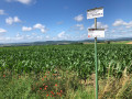
Rosières-sur-Mance circular via Saint-Marcel

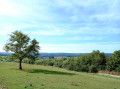
A walk in a peaceful corner of the Haute-Saône, amongst pastures and wind turbines.

Details

26289441
Creation:
Last update:
Last review:
  • Walking
    Activity: Walking
  • ↔
    Distance: 5.69 mi
  • ◔
    Average duration: 3h 00 
  • ▲
    Difficulty: Easy

  • ⚐
    Back to start: Yes
  • ↗
    Ascent: + 407 ft
  • ↘
    Descent: - 410 ft

  • ▲
    Highest point: 1,047 ft
  • ▼
    Lowest point: 748 ft

Photos

Description of the walk

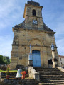
Park near the church in Rosières-sur-Mance, on Rue de l’Église or Rue du Château.

(S/E) Walk past the church on your right, then the cemetery, and continue along a grassy path. Ignore the first path leading down to the left and carry on until you reach a wayside cross.

(1) Carry on straight ahead, ignoring the path on the right. After about a hundred metres, turn left onto a quiet country lane. Head downhill, passing fruit trees on your right and an old vineyard followed by walnut trees on your left.

(2) At the next junction, take the road on the right which goes uphill. At the Stop sign, cross the D44 (caution: busy road) and follow it to the right for about a hundred metres.

(3) Take a dirt track on the left. Head downhill and stay on the main track between fenced pastures.

(4) At the foot of a wind turbine, follow a gravel track to the left which runs past the base of the wind turbines. Ignore the side tracks and continue to the D45.

(5) Follow the road to the left. After about 200 m, take thefirst left onto Rue du Cornot. Walk past a farm and through the orchards. At the Stop sign, follow the D44 to the left for about 200 m.

(6) When the road bends to the left, turn right. At the Fork in the road shortly afterwards, take the left-hand track. Head due north until you reach a pond (picnic tables). Walk along the left-hand side of the pond through the woodland and continue north for about 400 m.

(7) Then turn left onto a path that climbs through the woods. At the top, turn right to reach a small road.

(8) Follow the road to the left. At the cross, carry on straight ahead along the road.

(9) When the road bends to the left, turn right onto the Patis de la Chèvre, a path that descends through the pastures. Pass by the foot of the Sainte-Anne Cross, ignore a path coming from the left and continue downhill. Pass by the foot of another cross and continue downhill.

(10) Return to the tarmac road and continue along Rue de la Chèvre. At the Stop sign, turn right onto Grande Rue. After about a hundred metres, turn left to cross a small square, then right onto Rue du Ruisseau. Take thefirst left, Rue Gilbert. After a few dozen metres, turn right onto a path that winds its way through the gardens. This will take you back to the church and the starting point (S/E).

Waypoints

  1. S/E : mi 0 - alt. 751 ft - Église Saint-Siméon (Rosières-sur-Mance)
  2. 1 : mi 0.33 - alt. 915 ft - Calvary
  3. 2 : mi 0.67 - alt. 896 ft - Junction
  4. 3 : mi 0.92 - alt. 971 ft - Start of the path
  5. 4 : mi 1.73 - alt. 889 ft - Wind turbine
  6. 5 : mi 2.8 - alt. 820 ft - D45 road
  7. 6 : mi 3.22 - alt. 883 ft - Junction
  8. 7 : mi 4.03 - alt. 971 ft - Crossroads
  9. 8 : mi 4.33 - alt. 1,033 ft - Small road
  10. 9 : mi 4.91 - alt. 1,010 ft - Patis de la Chèvre
  11. 10 : mi 5.42 - alt. 781 ft - Rue de la Chèvre
  12. S/E : mi 5.69 - alt. 751 ft - Église Saint-Siméon (Rosières-sur-Mance)

Reviews and comments

4.2 / 5
Based on 3 reviews

Reliability of the description
4.3 / 5
Ease of following the route
4.3 / 5
Route interest
4 / 5
randonneur 70
randonneur 70

Overall rating : 4 / 5

Date of your route : Feb 18, 2025
Reliability of the description : ★★★★☆ Good
Ease of following the route : ★★★★☆ Good
Route interest : ★★★★☆ Good
Very busy route : No

A pleasant walk, easy to do; some of the paths are muddy in places, but that’s all part of the experience.

Machine-translated

acounamatata69
acounamatata69

Overall rating : 4 / 5

Date of your route : Sep 16, 2024
Reliability of the description : ★★★★☆ Good
Ease of following the route : ★★★★☆ Good
Route interest : ★★★★☆ Good
Very busy route : No

A walk along a dirt track; watch out for hunters at the start of the route (there was a driven hunt taking place), though they were very quick to alert their colleagues to our presence by phone. We stopped for lunch by the pond – a very beautiful, peaceful spot. We highly recommend it.

Machine-translated

le saut de bonneille

Overall rating : 4.7 / 5

Date of your route : Nov 06, 2022
Reliability of the description : ★★★★★ Very good
Ease of following the route : ★★★★★ Very good
Route interest : ★★★★☆ Good
Very busy route : No

An easy route with no difficulties at all, and I really enjoyed it at this time of year as there were no hunters around

Machine-translated

Other walks in the area

For more walks, use our search engine .

The GPS track and description are the property of this route's author. Please do not copy them without permission.