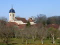
La Rochelle Castle

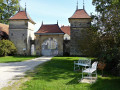
The village of La Rochelle takes its name from ‘Roche’, in the medieval sense of a hilltop on which a fortified castle stands.
This small village is clustered around the castle square; the water from its fountains adds to its charm and authenticity.

Details

16201423
Creation:
Last update:
Last review:
  • Walking
    Activity: Walking
  • ↔
    Distance: 5.88 mi
  • ◔
    Average duration: 3h 05 
  • ▲
    Difficulty: Moderate

  • ⚐
    Back to start: Yes
  • ↗
    Ascent: + 413 ft
  • ↘
    Descent: - 423 ft

  • ▲
    Highest point: 1,214 ft
  • ▼
    Lowest point: 860 ft

Photos

Description of the walk

Parking: La Rochelle Town Hall car park.

(S/E) Turn left and follow Rue de l’Enfer for 800–900 metres.

(1) Then turn left and continue along the path marked ‘No Entry’.

(2) When you reach the edge of the woods, turn left again to walk alongside them and stay on this path until you reach the village of Charmes Saint-Valbert.
Pass close to the town hall as you head down through the village and, after the church, turn left, then left again a few metres further on when you reach the Grande Rue.

(3) Leave the village; you then have two options when you reach the wayside cross:
- Either follow the D17 carefully to the next village, Molay, as shown on the attached map.
- Or you can head straight across the plain and, after a steep climb, walk part of the way round the Bois de la Roche Morey, before descending to the village of Molay via a path that leads down to the left.

(4) On arriving in the village of Molay, after crossing the small bridge and admiring the little statues of cows and calves in various places, turn left onto the Grande Rue, then 200 metres further on, turn right towards La Rochelle – Cornot.
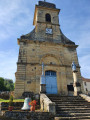
Before leaving the village, turn left and head up the tarmac road towards the church and cemetery at Laitre.

(5) Then turn left onto a lovely path through the Bois du Poix, which leads to the entrance to the village of La Rochelle, where there are several pretty fountains.
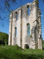
Pass under the old gate and turn left to explore the castle.
You can also admire the village square with its stone monuments
After passing the chapel, return to the town hall, which was your starting point (S/E).

Waypoints

  1. S/E : mi 0 - alt. 1,089 ft - Car park in front of La Rochelle Town Hall
  2. 1 : mi 0.67 - alt. 1,135 ft - Path with ‘No Entry’ sign
  3. 2 : mi 1.15 - alt. 1,207 ft - Edge of the woods
  4. 3 : mi 2.71 - alt. 860 ft - Calvaire, Charmes-Saint-Valbert
  5. 4 : mi 4.31 - alt. 899 ft - Village of Molay - Rigotte (cours d'eau)
  6. 5 : mi 4.85 - alt. 1,112 ft - Eglise de Laitre
  7. S/E : mi 5.88 - alt. 1,086 ft - Car park in front of La Rochelle Town Hall

Worth a visit

La Rochelle Castle is open to the public in July and August.

Reviews and comments

4.4 / 5
Based on 3 reviews

Reliability of the description
5 / 5
Ease of following the route
5 / 5
Route interest
3.3 / 5
leoderynck
leoderynck

Overall rating : 4.7 / 5

Date of your route : Mar 20, 2026
Reliability of the description : ★★★★★ Very good
Ease of following the route : ★★★★★ Very good
Route interest : ★★★★☆ Good
Very busy route : No

We shortened it. At Charmes, we continued north-east (towards Les Essarts) and didn’t go via Molay. A total of 6 km.
Please note that the paths have been altered slightly to allow access to the wind turbines. Please disregard this.

Machine-translated

randonneur 70
randonneur 70

Overall rating : 4.3 / 5

Date of your route : Dec 10, 2025
Reliability of the description : ★★★★★ Very good
Ease of following the route : ★★★★★ Very good
Route interest : ★★★☆☆ Average
Very busy route : No

A pleasant hike in the heart of the Haute-Saône. It's true that there are some tarmac roads to cover, especially between points 3 and 4, but with maps and GPS, it's possible to find other routes from point 3, which will certainly lengthen the hike.
Unfortunately, Laitre Church has been closed for several months due to theft.
The Château de la Rochelle is worth seeing.

Machine-translated

le saut de bonneille

Overall rating : 4.3 / 5

Date of your route : Nov 14, 2021
Reliability of the description : ★★★★★ Very good
Ease of following the route : ★★★★★ Very good
Route interest : ★★★☆☆ Average
Very busy route : No

An easy route
Quite a long drive, but manageable as I did it during the hunting season, so it was safer
You have to cross a woodland, but you stay on the road

Machine-translated

Other walks in the area

For more walks, use our search engine .

The GPS track and description are the property of this route's author. Please do not copy them without permission.