La Bove and La Cona

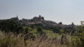
Starting from Bourmont, a charming little village in the Haut-Marne region, you’ll go on a short walk through the surrounding forest.

Details

11833897
Creation:
Last update:
Last review:
  • Walking
    Activity: Walking
  • ↔
    Distance: 6.84 mi
  • ◔
    Average duration: 3h 40 
  • ▲
    Difficulty: Moderate

  • ⚐
    Back to start: Yes
  • ↗
    Ascent: + 594 ft
  • ↘
    Descent: - 597 ft

  • ▲
    Highest point: 1,562 ft
  • ▼
    Lowest point: 1,010 ft
  • ⚐ Country: France
  • ⚐ City: Bourmont (52150)
  • ⚑
    Start/End: N 48.192693° / E 5.586972°
  • ❏
    IGN map(s): Ref. 3218SB
  • Hour-by-hour weather

Photos

Description of the walk

The starting point is the town hall square in the village of Bourmont.
Follow the green and yellow signposts to the left of the town hall.

(S/E) From the car park, turn right onto the street leading to Boulevard des États-Unis and follow it as far as the wayside cross.

(1) At the wayside cross, take the path leading uphill to the left, until you reach the entrance to the Parc des Roches.

(2) Enter Parc des Roches and stroll through these historic gardens along the various winding paths; you might even be lucky enough to spot a few rock climbers.

(3) On leaving the park, follow the white path to the right until you reach a fork.

(4) Be careful not to miss the turn-off to the left a few metres further on, after passing a gate that probably leads to the gardens. Follow the signposts through the Bois de la Belle Fontaine until you come down onto another white track.

(5) Continue to the left until you rejoin the D16.

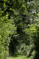
(6) Cross the road to the left, taking care, then rejoin the path through the Bois des Usages on the right, almost directly opposite. A lovely walk through the forest awaits you until you reach another path.

(7) Cross to the left, then follow the path on the right. This north-westerly path turns north-east, then back north-west to reach the entrance to the canyon.

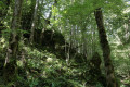
(8) Follow this path through the Gonaincourt “canyon” (caution: may be slippery in wet weather).
On leaving the woods, take the path that leads down to the village of Gonaincourt.

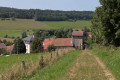
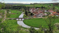
(9) Walk past the church (which is open to visitors), cross the railway line and then, at the end of the street, turn left. You will then pass the wash house, which has been beautifully restored.

(10) Carry on straight ahead where a small wooden sign points towards Bourmont.
Walk alongside the railway line, go under the bridge, then keep to the right. Continue straight on along this road, which will take you back to the village where you started.

(11) Take Rue des Anciens Fossés, where you can see the old ramparts surrounding the village.

(12) Be careful not to miss the signpost, which turns left and leads you up a flight of small steps back to the starting point (S/E).

Waypoints

  1. S/E : mi 0 - alt. 1,381 ft - Town hall square in the village of Bourmont
  2. 1 : mi 0.14 - alt. 1,385 ft - Calvaire
  3. 2 : mi 0.21 - alt. 1,411 ft - Entrance to the Parc des Roches
  4. 3 : mi 0.54 - alt. 1,493 ft - Exit from the park
  5. 4 : mi 1.03 - alt. 1,522 ft - Bois de la Belle Fontaine
  6. 5 : mi 1.66 - alt. 1,552 ft - White path junction
  7. 6 : mi 1.86 - alt. 1,532 ft - Crossing the D16
  8. 7 : mi 3.19 - alt. 1,434 ft - Exit from the woods
  9. 8 : mi 4.34 - alt. 1,352 ft - Entrance to the canyon
  10. 9 : mi 4.99 - alt. 1,089 ft - Gonaincourt Church
  11. 10 : mi 5.25 - alt. 1,014 ft - Starting from Gonaincourt. Near the - Meuse (fleuve)
  12. 11 : mi 6.57 - alt. 1,299 ft - On the ramparts
  13. 12 : mi 6.78 - alt. 1,348 ft - Small flights of stairs
  14. S/E : mi 6.84 - alt. 1,385 ft - Town hall square in the village of Bourmont

Worth a visit

During this walk, you can wander through the Parc des Roches and explore the various trails.

Do take a stroll through this village and climb up to the old abbey, where you’ll be treated to a lovely view of the surrounding plain.

In the neighbouring village of Illoud, at the “divine cheese dairy”, you can visit the workshop where a famous oval-shaped cheese is made.

Reviews and comments

4.6 / 5
Based on 3 reviews

Reliability of the description
4.7 / 5
Ease of following the route
4.7 / 5
Route interest
4.3 / 5
User 19038363

Overall rating : 4.7 / 5

Date of your route : May 18, 2026
Reliability of the description : ★★★★★ Very good
Ease of following the route : ★★★★★ Very good
Route interest : ★★★★☆ Good
Very busy route : No

We didn’t see anyone on the way; it was cold

Machine-translated

jeandede
jeandede

Overall rating : 4 / 5

Date of your route : Apr 01, 2024
Reliability of the description : ★★★★☆ Good
Ease of following the route : ★★★★☆ Good
Route interest : ★★★★☆ Good
Very busy route : Yes

A lovely walk
but in one spot it wasn’t very clear.

Machine-translated

josette Meunier
josette Meunier

Overall rating : 5 / 5

Date of your route : Apr 11, 2022
Reliability of the description : ★★★★★ Very good
Ease of following the route : ★★★★★ Very good
Route interest : ★★★★★ Very good
Very busy route : Yes

A lovely walk through a beautiful forest – well worth a go

Machine-translated

Other walks in the area

For more walks, use our search engine .

The GPS track and description are the property of this route's author. Please do not copy them without permission.