Country:
 City:
City:



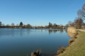
Lac des Récollets car park in Bulgnéville.
(S/E) At the information sign marking the starting point, take the path running alongside Lac des Récollets as far as the junction.
(1) Turn left to continue round the lake and reach the arboretum. Carry on to the second crossroads.
(2) Turn right and you’ll come out at a car park (with picnic tables). Walk along the right-hand side of the car park and continue straight ahead. The tarmac road passes under the dual carriageway and becomes a footpath. Walk past the Fontaine du Naingrecourt, keep going straight on and then enter the woodland. At the end of the path, turn right. At the junction, carry on straight ahead to the car park situated on a bend in the D294. Walk along the left-hand side of the car park and the D294 until you reach the end of the bend.
(3) Take the forest track on the left. Caution! It’s a steep downhill slope, which can be slippery at times! Keep going straight ahead to reach the Upper Lake of La Folie.
(4) Turn right and walk along the lake to the dividing dyke. Turn right and follow the Route des Lacs. Pass under the D165 and continue straight on along Rue Claude Gelée until you reach Rue Maurice Barrès (the first street).
(5) Turn right, reach a roundabout and take the path on the left. Walk alongside the ZA de la Chaille industrial estate. Enter the forest, reach a forest track and turn right until you reach the recycling centre. Turn left and follow the track, which climbs steadily, until you are near the edge of the forest, ignoring a junction on the left.
(6) Turn right, then left onto a forest track running along the edge of the woodland. At the junction, turn right at the right-angle bend. You’ll reach a crossroads.
(7) Turn left, then left again. You’ll reach the D14; first turn left then right to rejoin a track. Turn left at the bend to reach a Fork in the road.
(8) Turn right and, at the end of the track, take the track on the right, running alongside the high-voltage power line. Then, stay on this side of the track until you reach the signpost.
(9) Leave the track and take the footpath on the left. At the end of the footpath, turn right then left and join the track leading to Lac du Conge in Saulxures-les-Bulgnéville (caution: slippery path!). When you reach the lake, turn left to walk around it. Head towards the Royal Air Force memorial (a bomber shot down by a German fighter on 29 July 1944). Then walk back along the lake to reach the car park and the information board.
(10) Follow the road for a few metres, then at the signpost, turn onto a path. Pass under a high-voltage power line and continue through the woodland. When you reach a track, turn right until you come to a slight bend.
(11) Leave the track and take a path on the left. At the junction, turn left. At the end, turn right then left. Take a path crossing a stream and a track (often overgrown with ferns) and continue straight on.
(12) Turn right. When you reach a junction, turn left. The forest track gradually heads north and emerges at the edge of the forest.
(13) Turn right and head for “Le Rond des Gendarmes”. Turn left onto a path crossing a stream, then right onto a steep track leading back to the start of the fitness trail.
(14) Turn left to reach the entrance to Bulgnéville via a track suitable for vehicles. Pass between the two stadiums. When you reach the road, turn left. At the junction, take Rue François Mitterrand. Pass the two roundabouts, and at the end of the street, turn left for a few metres. Turn right onto a path leading back to Lac des Récollets and the starting point (S/E).



 Tourist office

 Easy
Easy 
 Difficult
 Visorando Member