Les Balcons de la Folie in Contrexéville

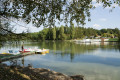
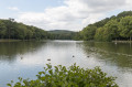
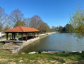
Suitable for everyone, this route will allow you to discover the diversity of the landscapes and the rich variety of flora and fauna found in the aquatic and woodland environments.

Details

43192518
Creation:
Last update:
Last review:
  • Walking
    Activity: Walking
  • ↔
    Distance: 3.10 mi
  • ◔
    Average duration: 1h 40 
  • ▲
    Difficulty: Easy

  • ⚐
    Back to start: Yes
  • ↗
    Ascent: + 289 ft
  • ↘
    Descent: - 289 ft

  • ▲
    Highest point: 1,407 ft
  • ▼
    Lowest point: 1,109 ft

Photos

Description of the walk

Car park at the Lacs de la Folie site.

(S/E) This route is almost entirely the same as routes nos. 21, 22 and 23, and, at the very start, as route no. 2. Facing the starting sign, take the path that runs along the lake to the left. Let route no. 2 branch off to the right until you reach a bend.

(1) Turn left to cross the small bridge and reach a Fork in the road.

(2) Turn right onto the short, straight path. Continue, keeping to the left, up the wide, ascending trench (gas pipeline crossing). After marker no. 42, turn right onto the small, ascending path. Continuing on, enter the lane. Pass the tarmac road on your right to reach a crossroads.

(3) Turn left into the coniferous woodland. At the end, turn right. Take the gravel forest track on the right. At the end of this, head straight down a small path which quickly veers to the left. Cross a wide track. Opposite, the path turns left after a small ditch, which it follows before branching off to the right.

(4) At the opening near the lake, continue to the left. Pass routes nos. 21, 22 and 23 on your left. Continue round the lake. Return to the start by taking the dividing embankment on the right (S/E).

Waypoints

  1. S/E : mi 0 - alt. 1,119 ft - Lacs de la Folie (Contrexeville)
  2. 1 : mi 0.35 - alt. 1,132 ft - Junction, bridge on the left
  3. 2 : mi 0.43 - alt. 1,129 ft - Fork in the road, straight forest track - Arceau (ruisseau) - Affluent du Vair
  4. 3 : mi 1.43 - alt. 1,407 ft - Crossroads, Allée de Résineux
  5. 4 : mi 2.39 - alt. 1,129 ft - Junction: turn left along the lake
  6. S/E : mi 3.1 - alt. 1,119 ft - Lakes

Worth a visit

Things to see along the way:
- Lacs de la Folie (fishing, swimming, swimming pool, picnic areas, pedalos).
- Flora and fauna.

Find a wide range of activities in Contrexéville right here: https://www.contrextourisme.com/

Reviews and comments

5 / 5
Based on 2 reviews

Reliability of the description
5 / 5
Ease of following the route
5 / 5
Route interest
5 / 5
User 17280893

Overall rating : 5 / 5

Date of your route : Sep 05, 2025
Reliability of the description : ★★★★★ Very good
Ease of following the route : ★★★★★ Very good
Route interest : ★★★★★ Very good
Very busy route : No

Thank you. Your explanations were very clear and the signage on site was perfect.
The scenery near Lac de la Folie is very pleasant, and it is easy to park at the start of the trail.
It's an easy circuit, which suited us perfectly (we are 81 and 77 years old)
We even found some ceps along the way.
Thank you again.

Machine-translated

Marylore
Marylore

Overall rating : 5 / 5

Date of your route : Mar 24, 2025
Reliability of the description : ★★★★★ Very good
Ease of following the route : ★★★★★ Very good
Route interest : ★★★★★ Very good
Very busy route : Yes

This route, which showcases the diversity of the landscapes, is accessible to everyone!
Around the lakes – accessible to people with reduced mobility

Machine-translated

Other walks in the area

For more walks, use our search engine .

The GPS track and description are the property of this route's author. Please do not copy them without permission.