


Refine your search for walks in Grézolles
Grézolles walks


 Along the Aix to Grézolles
 Visorando Member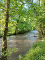
 5.23 mi
 +495 ft
 -469 ft
 2h 50
2h 50
 Easy
Easy
 Departure from Grézolles (Loire)
Walk in Grézolles, along the Aix, to the Moulin du Gué, then back to the village after a visit to the Sainte-Barbe Chapel.
Le circuit de l'Aix par la campagne de Saint-Julien-d'Oddes
 7.53 mi
+4,652 ft
-4,836 ft
7h 30
7.53 mi
+4,652 ft
-4,836 ft
7h 30
 Moderate
Departure from Saint-Julien-d'Oddes (Loire)
Moderate
Departure from Saint-Julien-d'Oddes (Loire)
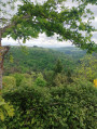
Ce circuit parcours la campagne de Saint-Julien-d'Oddes au milieu d'une végétation luxuriante. La Rivière l'Aix nous accompagne jusqu'à la centrale hydroélectrique de Chizonnet.
Circular Cornes d'Urfé starting from Saint-Marcel d'Urfé
 9.92 mi
+1,883 ft
-1,893 ft
6h 10
Moderate
Departure from Saint-Marcel-d'Urfé (Loire)
9.92 mi
+1,883 ft
-1,893 ft
6h 10
Moderate
Departure from Saint-Marcel-d'Urfé (Loire)
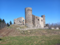
Circular through the countryside and forest to discover Les Cornes d'Urfé.
Between agriculture and heritage in Saint-Marcel-d'Urfé
 11.77 mi
+1,969 ft
-1,978 ft
7h 10
Moderate
Departure from Saint-Marcel-d'Urfé (Loire)
11.77 mi
+1,969 ft
-1,978 ft
7h 10
Moderate
Departure from Saint-Marcel-d'Urfé (Loire)
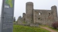
A hike to an altitude of nearly 1,000 metres, through a farming landscape where you will encounter ancient heritage.
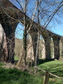
Isable Valley and Padègue Viaduct in Saint-Polgues
 6.93 mi
+774 ft
-791 ft
3h 50
Moderate
Departure from Saint-Polgues (Loire)
6.93 mi
+774 ft
-791 ft
3h 50
Moderate
Departure from Saint-Polgues (Loire)
A pleasant hike along the Isable river, passing by the Padègue viaduct.
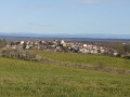
Route of the huts from the Saint-Germain-Laval Architects’ Festival
 3.74 mi
+564 ft
-541 ft
2h 15
Easy
Departure from Saint-Germain-Laval (Loire)
3.74 mi
+564 ft
-541 ft
2h 15
Easy
Departure from Saint-Germain-Laval (Loire)
This summer 2021, Saint-Germain-Laval is hosting the Festival des Cabanes d’Architectes, organised in partnership with the Festival des Cabanes and La Soierie associations, both based in Faverges. This route will allow you to discover the three huts, the historic village and the banks of the River Aix...
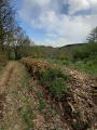
Circular walk through the Cierve woods via the Pêt de l'Âne, starting from Dancé.
 3.45 mi
+636 ft
-617 ft
2h 10
Easy
Departure from Dancé (Loire)
3.45 mi
+636 ft
-617 ft
2h 10
Easy
Departure from Dancé (Loire)
Starting from Dancé church, head for the Pêt de l'Âne, a magnificent viewpoint over the longest meander of the Loire. Here you will find the marked hiking trails along the banks of the Loire. You can return via the Cierve woods, which have beautiful undergrowth. From the path leading to La Madone, there is a beautiful panoramic view: to the east, the Monts du Lyonnais; to the south, the Monts du Pilat; and to the west, the Monts du Forez with Pierre-sur-Haute and the Monts de la Madeleine.
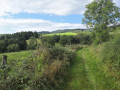
A hilly circular walk starting from Le Ménard
 7.53 mi
+1,309 ft
-1,286 ft
4h 35
Moderate
Departure from Saint-Jean-Saint-Maurice-sur-Loire (Loire)
7.53 mi
+1,309 ft
-1,286 ft
4h 35
Moderate
Departure from Saint-Jean-Saint-Maurice-sur-Loire (Loire)
This varied walk offers some stunning views over the Roannaise plain and the Beaujolais hills.
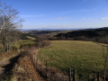
Circular loop starting from Les Moulins Chérier
 11.13 mi
+1,696 ft
-1,680 ft
6h 35
Moderate
Departure from Cherier (Loire)
11.13 mi
+1,696 ft
-1,680 ft
6h 35
Moderate
Departure from Cherier (Loire)
A beautiful walk alternating between open views and paths along the Isable river.
The Michonnette route starting from Les Moulins Cherier
 Association / Club / Walk leader
 6.53 mi
+1,312 ft
-1,329 ft
4h 10
Moderate
Departure from Cherier (Loire)
6.53 mi
+1,312 ft
-1,329 ft
4h 10
Moderate
Departure from Cherier (Loire)
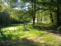
Explore three hamlets to the south and east of the village of Cherier: Le Bouchet, Tour and Mézire. The route follows the valleys of the Isable and the very pretty Michonnette valley, a small stream renowned for its trout and crayfish. There are beautiful viewpoints at the Croix du Bouchet and above Mézire. The elevation changes are quite steep: a 100-metre climb to reach the Croix du Bouchet and, in particular, the ascent of the ‘Trapillon’, which has been fitted with 35 steps.
 The Monts de la Madeleine near Cherier
 16.13 mi
+2,484 ft
-2,470 ft
4 hrs
16.13 mi
+2,484 ft
-2,470 ft
4 hrs
 Difficult
Departure from Cherier (Loire)
Difficult
Departure from Cherier (Loire)
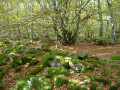
A very varied route linking two villages, climbing to the highest point (1,155 m), alternating between long, steady climbs and flat, rolling sections at altitude, with stunning views. Red mountain bike markings on a white background.
Banks of the Loire near Pinay and Saint-Jodard
 4.90 mi
+830 ft
-827 ft
3h 00
Moderate
Departure from Saint-Jodard (Loire)
4.90 mi
+830 ft
-827 ft
3h 00
Moderate
Departure from Saint-Jodard (Loire)
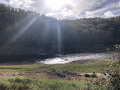
A beautiful walk offering views of the Loire upstream from the Villerest Dam, with a glimpse of the Château de la Roche. It is not particularly difficult, but half of it is along the road, especially between Pinay, Saint-Jodard and the return to La Vourdiat.
The banks of the Loire offer some good spots for a picnic and a quiet break (so please respect the fishermen who are also enjoying the same setting).
Les Monts de la Madeleine (Villemontais)
 5.62 mi
+1,145 ft
-1,148 ft
3h 35
Easy
Departure from Villemontais (Loire)
5.62 mi
+1,145 ft
-1,148 ft
3h 35
Easy
Departure from Villemontais (Loire)
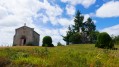
Walk in the Monts de la Madeleine between Villemontais and Chérier.
15/05/2024: Route modified to avoid passing through private property at Ripouroux.
The mountain-pass route starting from Palogneux
 5.72 mi
+961 ft
-942 ft
3h 30
Moderate
Departure from Palogneux (Loire)
5.72 mi
+961 ft
-942 ft
3h 30
Moderate
Departure from Palogneux (Loire)
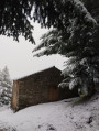
Starting from the village of Palogneux, this forest route passes by the Saint-Roch Chapel on its way to the hamlet of Boissel. It then returns to the village via the Col du Las and the Col de la Grande Roue.
The basalt columns of Puy de Chavanne and the Ligeay waterfalls
 10.68 mi
+1,827 ft
-1,844 ft
6h 30
Moderate
Departure from Palogneux (Loire)
10.68 mi
+1,827 ft
-1,844 ft
6h 30
Moderate
Departure from Palogneux (Loire)
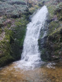
Starting from the village of Palogneux, this route takes you past the basalt columns of the Puy de Chavanne, before continuing on to the Ligeay waterfalls. The route then follows a circular route along theGR®89to the village of Les Places, before returning to the village via the Goutte Crémière and the Épeurios.
From Puy de Chavanne to the Ligeay Waterfalls via the Bois de Grand Val
 7.97 mi
+1,476 ft
-1,473 ft
4h 55
Moderate
Departure from Palogneux (Loire)
7.97 mi
+1,476 ft
-1,473 ft
4h 55
Moderate
Departure from Palogneux (Loire)
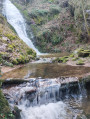
Starting from the village of Palogneux, this route takes you past the basalt columns of the Puy de Chavanne, then on to the fabulous Ligeay waterfalls. The return journey takes you through the Bois de Grand Val.
From Cherier (Le Point du Jour) to the campsite at Saint-Just-en-Chevalet
13.04 mi
+1,788 ft
-2,667 ft
7h 35
Difficult
Departure from Cherier (Loire)
First stage of a 5-day route through the Monts de la Madeleine, the Bois Noirs and the northern Livradois. Most of the day is spent on the lovely paths of the commune of Cherier, offering a range of views from the tops of its hills, amidst unspoilt countryside. At the end of the route, the path descends to Saint-Just-en-Chevalet, after passing through the charming hamlet of Fonthieur.
Roannaise coast and mountains
 50.15 mi
+7,923 ft
-7,907 ft
4 days
Difficult
Departure from Cherier (Loire)
50.15 mi
+7,923 ft
-7,907 ft
4 days
Difficult
Departure from Cherier (Loire)
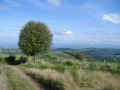
A 4-day hiking tour from lodge to lodge in the Monts de la Madeleine (low mountain range) west of the town of Roanne. Immerse yourself in nature, often still wild, by taking as many small paths as possible.
From Point du Jour to Saint-Haon-le-Châtel
 14.49 mi
+1,686 ft
-3,130 ft
8h 10
Difficult
Departure from Cherier (Loire)
14.49 mi
+1,686 ft
-3,130 ft
8h 10
Difficult
Departure from Cherier (Loire)
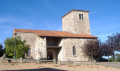
Departure from a high point in the Monts de la Madeleine, in Cherier, at a place called Le Point du Jour (870 m, 14-bed stopover lodge with meals) to descend to the Côte Roannaise, cross its vine-covered hillsides and arrive at the medieval village of Saint-Haon-le-Châtel (14-bed stopover lodge with meals). This route gives priority to small paths with no motor vehicle traffic and beautiful views of the Roanne plain.
The Sail-sous-Couzan Castle circular route
 7.78 mi
+1,539 ft
-1,526 ft
4h 55
Moderate
Departure from Sail-sous-Couzan (Loire)
7.78 mi
+1,539 ft
-1,526 ft
4h 55
Moderate
Departure from Sail-sous-Couzan (Loire)
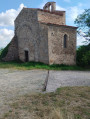
This circular walk begins at the sparkling mineral water spring in the village of Sail-sous-Couzan, almost directly opposite the ‘Fontfort’ kiosk, its former site. Running mainly through woodland, the route takes us to the fortified castle and the Chapel of Notre-Dame de Couzan.
Walk around Sail-sous-Couzan
 4.57 mi
+843 ft
-830 ft
2h 50
Easy
Departure from Sail-sous-Couzan (Loire)
4.57 mi
+843 ft
-830 ft
2h 50
Easy
Departure from Sail-sous-Couzan (Loire)
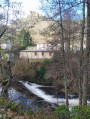
A walk in Sail-sous-Couzan offering the chance to discover the Baume dam and the Grotte des Fées.
Goutelas Castle and Bélizar’s Tomb
2.13 mi
+410 ft
-404 ft
1h 20
Easy
Departure from Marcoux (Loire) (Loire)
Goutelas Castle and Bélizar’s Tomb: a walk through woodland and vineyards, with views over the plain...
The Gorge du Désert and the Châtelus from Saint-Alban-les-Eaux
 4.32 mi
+1,181 ft
-1,161 ft
3h 00
Moderate
Departure from Saint-Alban-les-Eaux (Loire)
4.32 mi
+1,181 ft
-1,161 ft
3h 00
Moderate
Departure from Saint-Alban-les-Eaux (Loire)
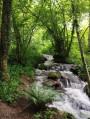
Starting from the village of Saint-Alban-les-Eaux, known for its sparkling mineral springs, this route passes via La Madone and the Montouse Dam to reach the Gorges du Désert and the waterfall. Views from Le Châtelus and the viewpoint on the way back.
The Gorge du Désert, starting from Saint-Alban-les-Eaux
 2.72 mi
+636 ft
-614 ft
1h 50
Easy
Departure from Saint-Alban-les-Eaux (Loire)
2.72 mi
+636 ft
-614 ft
1h 50
Easy
Departure from Saint-Alban-les-Eaux (Loire)
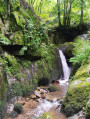
Starting from the village of Saint-Alban-Les-Eaux, known for its carbonated springs, this route passes via La Madone and the Montouse Dam before continuing on to the Gorge du Désert. It allows you to reach the waterfall without too much difficulty and then return to the village via Le Châtelus.
Around the Roc de l’Olme
4.80 mi
+886 ft
-896 ft
3h 00
Easy
Departure from Chalmazel (Loire)
A short route mainly through the forest, where the autumn sun plays through the foliage.
From the summit of the climbing rock, a unique panorama unfolds before you.
Parigny Circular Loop
5.13 mi
+177 ft
-138 ft
2h 30
Easy
Departure from Parigny (Loire)
A walk with no particular difficulties. We are on a plateau here, so there is little elevation gain and some lovely panoramic views of the town of Roanne in the distance. There are some pretty little sections near beautiful, well-maintained but private ponds. The route is half on dirt tracks and half on small local lanes or tarmac paths. There are very few sections on main roads.
Route des Loges on the Hautes Chaumes
9.32 mi
+1,368 ft
-1,398 ft
5h 30
Moderate
Departure from Chalmazel (Loire)
The lodges or shepherd's huts, located on the Hautes Chaumes, were summer pasture buildings from May to October.
To get to the start of the hike, after passing the hamlet of Nermond, 200 m away, in a straight line, at the crossroads of this road with the Route de la Combe on the right, turn more to the right and take a stony path, heading for the calvary. Park at the bottom or in the cornfields on the left-hand side of the uphill path.
From the Loge des Gardes to Point du Jour
11.96 mi
+1,368 ft
-2,044 ft
6h 40
Moderate
Departure from Laprugne (Allier)
Departure from the Loge des Gardes sports centre. Start the day in the beautiful beech undergrowth of the Assise State Forest, above 1,000 metres altitude, before descending to the more open plateaus of La Tuilière and Cherier, with beautiful views. End at the Refuge du Point du Jour lodge (overnight stay and meals made with farm produce) (altitude 870 metres).