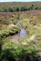
The Grand Moulin

Your walk will take you to the edge of the Hautes Chaumes plateau where, depending on the season, the blueberry patches display their wild berries.

Details

n°29962469
Creation:
Last update:
Last review:
  • Walking
    Activity: Walking
  • ↔
    Distance: 6.68 mi
  • ◔
    Average duration: 4h 10 
  • ▲
    Difficulty: Moderate

  • ⚐
    Back to start: Yes
  • ↗
    Ascent: + 1,227 ft
  • ↘
    Descent: - 1,227 ft

  • ▲
    Highest point: 4,219 ft
  • ▼
    Lowest point: 3,110 ft

Description of the walk

Car park at the Nermond wayside shrine.

(S/E) Head towards Nermond; at the first junction, go straight on.

(1) Turn right onto Route de la Combe. At the entrance to this hamlet, turn left and continue along the path leading uphill past an ‘Écogîte’ house; ignore the turnings to the left and right; further on, pass the hamlet of Le Trêve.

(2) Turn right and carry on towards the hamlet of La Rouérie.

(3) Turn left, pass the first house on your right, then turn left onto a grassy path. When you reach a forest track, turn right; further on, turn left, walk alongside a cattle paddock on your right, then head towards La Fontête.

(4) Turn left, continue along the Route du Cheix; as you enter the forest, turn right onto a steep, ascending dirt track. Do not take any side tracks to the left or right. Continue alongside a vast meadow.

(5) Turn right. At the next junction, continue along the path at the edge of the forest, passing the hamlets of Laparent, Chanoland and the ruins of Les Rochettes.

(6) Carry on straight ahead along a stony path climbing through a deciduous woodland. Stay on the main path; as you emerge from the woodland, continue along a heather-covered path leading onto the Hautes Chaumes plateau.

(7) Turn left and continue along the heather-lined path; further on, ignore the path branching off to the right.

(8) Turn left, pass the renovated shepherd's hut on your right; 20 metres further on, take a path leading down into the fir woodland and reach the ruined Rochettes crossroads.

(6) Carry on straight ahead. Stay on the main path until you reach a forest track.

(9) Cross over and head down a steep, stony and difficult path. 360 metres further on, you can take either the path on the left or the one on the right; both lead to the same place.

(10) Turn right, follow the dirt track, then a tarmac road to La Rouérie.

(3) Continue along the reverse route of the outward journey to Le Trêve.

(2) Pass the hamlet of Le Trêve on your left and carry on along the tarmac road until you reach the original junction.

(1) Follow the route back in the opposite direction to the one taken on the way there, heading towards the wayside shrine (S/E).

Waypoints

  1. S/E : mi 0 - alt. 3,261 ft - The Calvary
  2. 1 : mi 0.17 - alt. 3,228 ft - Initial junction for the A/R route
  3. 2 : mi 0.42 - alt. 3,268 ft - Le Trêve. Junction for the A/R route
  4. 3 : mi 0.7 - alt. 3,228 ft - Junction of the first circular loop
  5. 4 : mi 1.39 - alt. 3,524 ft - La Fontête
  6. 5 : mi 2.06 - alt. 3,747 ft - Water tower
  7. 6 : mi 2.78 - alt. 3,901 ft - Les Rochettes (ruins). Junction for the second circular route
  8. 7 : mi 3.54 - alt. 4,213 ft - Le Fossat
  9. 8 : mi 3.98 - alt. 4,127 ft - Elevation 1258
  10. 9 : mi 4.99 - alt. 3,563 ft - Forest track
  11. 10 : mi 5.42 - alt. 3,179 ft - The Grand Moulin - Source du Lignon
  12. S/E : mi 6.68 - alt. 3,261 ft - The Calvary

Notes

Water point at a place called Chanoland.
Shelter at the Fossat shepherd's hut (7).

Worth a visit

The gates to the livestock pens consist of live electric swing arms; do not touch them with your hands – they are safe.
From the wayside shrine, a unique panorama unfolds before you, taking in the Lignon valley, the village of Chalmazel and the Monts du Forez.

Reviews and comments

4.7 / 5
Based on 1 review

Reliability of the description
5 / 5
Ease of following the route
5 / 5
Route interest
4 / 5
pierre huraux
pierre huraux

Overall rating : 4.7 / 5

Date of your route : Jul 19, 2024
Reliability of the description : ★★★★★ Very good
Ease of following the route : ★★★★★ Very good
Route interest : ★★★★☆ Good
Very busy route : No

An easy walk. A short stretch of tarmac at the start (and therefore on the way back: same route).
Plenty of sections through woodland, so it’s pleasant on hot days (apart from the end of the return leg: a tarmac road with no shade for a good kilometre).
Actual walking time: 4 hours without rushing!

Machine-translated

Other walks in the area

For more walks, use our search engine .

The GPS track and description are the property of this route's author. Please do not copy them without permission.