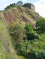
The Sail-sous-Couzan Castle circular route

This circular walk begins at the sparkling mineral water spring in the village of Sail-sous-Couzan, almost directly opposite the ‘Fontfort’ kiosk, its former site. Running mainly through woodland, the route takes us to the fortified castle and the Chapel of Notre-Dame de Couzan.

Details

56915797
Creation:
Last update:
Last review:
  • Walking
    Activity: Walking
  • ↔
    Distance: 7.78 mi
  • ◔
    Average duration: 4h 55 
  • ▲
    Difficulty: Moderate

  • ⚐
    Back to start: Yes
  • ↗
    Ascent: + 1,539 ft
  • ↘
    Descent: - 1,526 ft

  • ▲
    Highest point: 2,648 ft
  • ▼
    Lowest point: 1,378 ft

Photos

Description of the walk

The route starts in Sail-sous-Couzan. Park on the Route de Saint-Just, near the Place du Kiosque.

(S/E) With your back to the bandstand, walk alongside the River Chagnon for a few metres, then take the Montée des Curistes on the left, right next to a craft brewery. At the junction, turn right onto Rue des Roches, then turn left at the flower-decorated cross onto Chemin de Miolin.

(1) At the fork in the road, turn left into the forest, heading north-west, until you reach a crossroads.

(2) Continue along the left-hand path, which climbs towards a gate, then into the forest, heading west.

(3) Keep going straight ahead along the path.

(4) At the Y-junction, turn left and continue to a road in the hamlet of Poizat.

(5) In the hamlet, keep left onto the Chemin de Poizat. Cross the Route de Combette (D97) with care to take the path opposite.

(6) Cross the bridge over the Chagnon and continue through the Bois de Moizieux, heading south-east, then turn north-west uphill.

(7) Back in the forest, at the Y-junction, turn right uphill and join a road at Poyet.

(8) Follow it to the right as far as the hamlet of Moizieux.

(9) At the fork in the road, turn left, pass through the hamlet and follow this road to a junction.

(10) Turn left onto the Route de Mazet, pass the farm and then, at the Y-junction, turn left onto the Chemin des Seigneurs until you reach a fork.

(11) Pass the Croix du Mi, keep to the left and, a little further on, rejoin the Route de Poyet. Turn right, then left, following the sign for Couzan Castle.

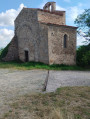
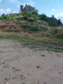
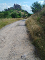
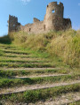
(12) At the crossroads, on the right, you’ll see the easily recognisable ruined castle. Continue straight on to reach the Notre-Dame de Couzan Chapel.

(13) Behind the chapel, carefully take a stony, downhill path.
- See alternative route in the ‘Practical Information’ section.

(14) Turn right, just before the road, to see the statue of the Virgin Mary and the cross. Retrace your steps and then turn right onto the Chemin de Couzan. Turn left onto Rue des Clématites, then left again to walk alongside the Route de Saint-Georges (D6), taking care.

(15) Walk past the church, then take the Route de Saint-Just on the left, which will lead you back to the car park (S/E).

Waypoints

  1. S/E : mi 0 - alt. 1,385 ft - Sail-sous-Couzan, Place du Kiosque
  2. 1 : mi 0.27 - alt. 1,516 ft - Junction in the forest
  3. 2 : mi 0.74 - alt. 1,801 ft - Junction at Le Pendant
  4. 3 : mi 1.49 - alt. 2,060 ft - Le Grand Miolin
  5. 4 : mi 1.77 - alt. 2,205 ft - Y-junction at Les Épeurios
  6. 5 : mi 2.49 - alt. 2,306 ft - Poizat hamlet
  7. 6 : mi 2.87 - alt. 2,126 ft - Bridge over the Chagnon
  8. 7 : mi 3.83 - alt. 2,431 ft - La Font du Loup
  9. 8 : mi 4.03 - alt. 2,579 ft - The Route du Poyet
  10. 9 : mi 4.13 - alt. 2,615 ft - Moizieux hamlet
  11. 10 : mi 4.49 - alt. 2,644 ft - Le Mazet junction
  12. 11 : mi 5.24 - alt. 2,418 ft - The Croix de Mi
  13. 12 : mi 6.91 - alt. 1,929 ft - The ruined fortified castle of Couzan
  14. 13 : mi 7.03 - alt. 1,909 ft - The Chapel of Notre Dame de Couzan
  15. 14 : mi 7.38 - alt. 1,565 ft - La Madone
  16. 15 : mi 7.69 - alt. 1,381 ft - St Andrew’s Church
  17. S/E : mi 7.78 - alt. 1,385 ft - Sail-sous-Couzan, Place du Kiosque

Notes

The sparkling mineral water spring is situated on the site of the former sparkling water bottling plant, a windowless building marked with a Green Cross; the door is marked ‘1’.

(13) The path is stony and slopes downwards; there is an option to turn left onto the Chemin de Couzan, which is easily accessible.

Worth a visit

(12) The castle, a listed historic monument, is open in July and August from 2.30 pm to 6.30 pm.
(13) The chapel is a listed historic monument.

Reviews and comments

4.8 / 5
Based on 2 reviews

Reliability of the description
5 / 5
Ease of following the route
5 / 5
Route interest
4.5 / 5
GEORGIA
GEORGIA

Overall rating : 4.7 / 5

Date of your route : Jan 26, 2025
Reliability of the description : ★★★★★ Very good
Ease of following the route : ★★★★★ Very good
Route interest : ★★★★☆ Good
Very busy route : No

Our duo took 3 hours and 5 minutes to complete this magnificent circular route without stopping.
We’re in pretty good shape.

Machine-translated

Philippe7653
Philippe7653

Overall rating : 5 / 5

Date of your route : Aug 19, 2024
Reliability of the description : ★★★★★ Very good
Ease of following the route : ★★★★★ Very good
Route interest : ★★★★★ Very good
Very busy route : No

A very pleasant walk.
The landscape is very varied, with woodland and pasture.
You’ll be able to discover some superb scenery

Machine-translated

Other walks in the area

For more walks, use our search engine .

The GPS track and description are the property of this route's author. Please do not copy them without permission.