Country:

 City:
City:


Start from the Point du Jour farm (in the commune of Cherier) where vehicles are left for the 5 days.
(S) Set off due south along the Chemin de la Murette. Follow the signposts for the Tour des Monts de la Madeleine all day long; this route was initiated by Chamina and is now maintained by the local authority groups through which it passes: the signposts feature a blue sunset on a yellow background with the initials ‘MM’.
(1) At La Murette, continue south, taking the tarmac road between the two houses. At the next junction, keep left, then turn right, then right again before the house to take the Chemin du Merle, which leads to Bonnabaud.
(2) At the bottom of the hamlet, turn left onto the path leading to the village of Les Moulins.
(3) At Les Moulins, turn left onto the path that goes round the sports ground. Then turn right onto the path that runs alongside the town hall and descends past the old girls’ school to the D.41.
(4) Follow it for a few metres to the left and, just after the bridge over the Isable, take the path up the hill on the right. A short but steep climb at the start, followed by a flat section, along this historic path which linked the two villages of the commune back when people travelled on foot, taking the shortest route.
(5) On reaching the ruined hamlet of Frédifont, turn right onto the path that joins the Route des Gouttes. Follow it to the left as far as Trêve Millot.
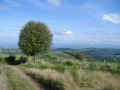
(6) At the Roanne/Thiers monument, on the footpath, turn right onto the dirt track which leads, through the Bois de la Rivolette, to the hamlet of Le Bouchet. At the cross, there is a lovely view to the west and a picnic table.
(7) At the D53, cross the road and head downhill opposite, then at the cross near a chalet, turn left onto the Chemin d’Écoche.
(8) Before the first house in the hamlet of Écoche, turn right onto the track leading down to the foot of a steep climb, known as the Trapillon, which has been fitted with steps to make it easier to climb. You’ll come back out onto the D53 at the Croix Policon, which is a lovely spot for a picnic.
(9) Follow the D53 to the left and take the first path on the left, known as the Chemin des Grandes Côtes.
(10) When you reach the D41, turn left and follow this road, which runs alongside the Isable, to the small square at the Pont du Tuin.
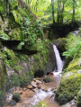
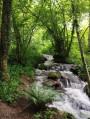
(11) Cross the Isable via the Pont du Tuin and follow the Chemin de la Michonnette – a pretty stream teeming with crayfish – to the hamlets of Le Rochat and then Le Tour.
(12) At the top of this hamlet, turn left onto the road leading to La Vialle and then to Vigouronne. Don’t miss the Pierre Barre menhir on the left between these two hamlets.
(13) At the junction, keep to the right.
(14) In Vigouronne, leave the tarmac road and continue along the dirt track. After crossing the stream, turn right onto the path which climbs alongside the woodland and leads to the Croix de Vigouronne.
(15) Cross the road and take the path opposite, leaving the Croix de Vigouronne on your right. You’ll find the signposts again as you emerge from the woods; turn left onto a forest track and, at the bottom of the descent, turn right onto the path leading to the Route de la Mèlerie at La Mataude. Follow this road to the right.
(16) At La Mataude (where there is a ‘pierre des morts’ at the crossroads), turn left, heading due south, onto a section of the Route Napoléon, then leave it a little further on to the left to take the unpaved path to Fonthieur (with some very beautiful stone houses, well restored in keeping with their original style). Also worth noting is the beautiful view over the Monts du Lyonnais, the Alps, Pierre-sur-Haute…
(17) At the Croix des Chavannes, turn right, leaving the Chemin de l’Allée on your right, then at the cross, turn right to rejoin the Route Napoléon, which descends steeply towards Saint-Just-en-Chevalet. Follow this road downwards.
(18) After the first few scattered houses, turn right onto the Chemin de l’Ancien Champ de Foire, which offers a lovely view and leads directly, on the left, to Vieux Saint-Just. Places of interest: the Fontaine de la Conche, the chapel and the rural craft centre, with a wide selection of handcrafted items (free entry every afternoon).
(19) Head back down and turn left onto the Chemin des Remparts de l’ancien château; follow this roundabout to join the path which, running alongside the gardens, leads to a flight of steps between the houses. Take these steps to the right, then another flight of steps after crossing the main road.
(20) At the bottom of the steps, turn left to stock up on supplies at the supermarket; otherwise, turn right onto the tarmac road, then immediately left onto the pedestrian path leading down to the campsite below (E).
 Association / Club / Walk leader
 Moderate
  Visorando Member

 Easy
Easy