Circular walk from Sail-sous-Couzan to Montaubourg

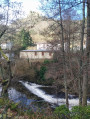
Circular walk around Sail-sous-Couzan which passes by the Montaubourg volcano, then returns via the Baume dam and the Grotte des Fées, offering, along the way, some beautiful views of Sail Castle.

Details

n°45676747
Creation:
Last update:
Last review:
  • Walking
    Activity: Walking
  • ↔
    Distance: 9.55 mi
  • ◔
    Average duration: 5h 50 
  • ▲
    Difficulty: Moderate

  • ⚐
    Back to start: Yes
  • ↗
    Ascent: + 1,640 ft
  • ↘
    Descent: - 1,644 ft

  • ▲
    Highest point: 2,178 ft
  • ▼
    Lowest point: 1,365 ft

Photos

Description of the walk

Park in the car park at the town hall square in Sail-sous-Couzan.

(S/E) Cross the small bridge towards Le Colombier. Turn right onto Impasse du Vieux Marancey, then left onto Impasse des Chênes. Head towards the Le Colombier neighbourhood.

(1) Opposite, take the small path leading uphill on the left. Continue uphill until you reach a T-junction in the forest.

(2) Turn 90° to the left, leave the forest and you’ll soon come to a three-way junction. Take the path on the right to reach the hamlet of Montaillard.

(3) Continue straight ahead, due south, along the road. Keep left at the three-way junction, re-enter the forest and complete this climb at the Croix du Treyve crossroads.

(4) Leave the road and head straight ahead, downhill, until you reach another junction by a small stream.

(5) Take the path on the left, continuing downhill; carry on along this path, then follow the Goutte du Petit Pont stream before reaching the pine woods housing estate.

(6) Turn right – almost 180° – onto the uphill track called Impasse des Œurs, walk past the houses, then arrive at the junction for the Montaubourg volcano.

(7) Turn left to begin the walk around the ‘volcano’, either clockwise or anti-clockwise. Back at the crossroads, turn left, climb slightly to reach the hamlet of Prélion.

(8) Take the path at a 90° angle to the right, turn right again about 200 metres further on, and reach the junction with the small stream you passed on the way out.

(5) Carry on straight ahead to reach the Croix de Treyve.

(4) Turn left into the woods, rejoin the road and follow it to complete the climb to the hamlet of Chorigneux.

(9) Turn right onto the street, then leave it to take a path on the right leading down into the woods. Ignore any paths branching off to the right or left. Then take a hairpin bend to the right, before reaching the southern end of the Baume Dam.

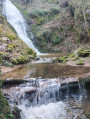
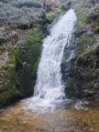
(10) Walk along the right bank of the reservoir. Pass the hamlet of La Baume and, shortly after the cross and the dog breeding centre, reach the Grotte des Fées.

(11) Carry on, turn left at the T-junction, then right at Le Goutard to head up along the edge of the woodland and return to the T-junction you passed on the way out.

(2) Follow the same route as on the way out, but in the opposite direction, to return to the town hall car park (S/E).

Waypoints

  1. S/E : mi 0 - alt. 1,375 ft - Town hall car park
  2. 1 : mi 0.14 - alt. 1,404 ft - Marancey Colombier
  3. 2 : mi 0.55 - alt. 1,627 ft - Junction marking the end of the circular loop
  4. 3 : mi 1.1 - alt. 1,811 ft - Montaillard
  5. 4 : mi 1.71 - alt. 1,919 ft - Croix du Treyve
  6. 5 : mi 1.86 - alt. 1,890 ft - Crossroads by the stream
  7. 6 : mi 2.87 - alt. 1,483 ft - Pine woods
  8. 7 : mi 3.53 - alt. 1,893 ft - Montaubourg Volcano junction
  9. 8 : mi 4.46 - alt. 1,936 ft - Prélion
  10. 9 : mi 6.09 - alt. 2,169 ft - Chorigneux
  11. 10 : mi 7.58 - alt. 1,483 ft - La Baume Dam
  12. 11 : mi 8.21 - alt. 1,411 ft - Grotte des Fées
  13. S/E : mi 9.55 - alt. 1,378 ft - Town hall car park

Worth a visit

Reviews and comments

3.7 / 5
Based on 2 reviews

Reliability of the description
3.5 / 5
Ease of following the route
4 / 5
Route interest
3.5 / 5
Jmichel42
Jmichel42

Please note: after Chorigneux there is an error. You will need to follow the dotted 630M line. If you stay on the main path hoping to go further down, as shown by the red line on the map, this is not possible. You will need to turn back for 100M.

Machine-translated

Pascal Odin
Pascal Odin

Overall rating : 3.3 / 5

Date of your route : Aug 11, 2025
Reliability of the description : ★★★☆☆ Average
Ease of following the route : ★★★★☆ Good
Route interest : ★★★☆☆ Average
Very busy route : No

Difficulties finding the way once you leave the village with only the "details" description on the app.
Luckily, there is GPS guidance. The first part of the trail is a small, little-used path that is not maintained.
The first part is not very interesting (apart from the views of Sail Castle) until Chorigneux.
The second part is magnificent and very wild, from the BEAUME dam to La Grotte aux Fées.
Return to the village via the same path with the same drawbacks.

Machine-translated

richardd
richardd

Overall rating : 4 / 5

Date of your route : Jun 16, 2025
Reliability of the description : ★★★★☆ Good
Ease of following the route : ★★★★☆ Good
Route interest : ★★★★☆ Good
Very busy route : Yes

A lovely walk, ending with the castle

Machine-translated

Other walks in the area

For more walks, use our search engine .

The GPS track and description are the property of this route's author. Please do not copy them without permission.