The Gorge du Désert and the Châtelus from Saint-Alban-les-Eaux

Starting from the village of Saint-Alban-les-Eaux, known for its sparkling mineral springs, this route passes via La Madone and the Montouse Dam to reach the Gorges du Désert and the waterfall. Views from Le Châtelus and the viewpoint on the way back.

Details

54615295
Creation:
Last update:
Last review:
  • Walking
    Activity: Walking
  • ↔
    Distance: 4.32 mi
  • ◔
    Average duration: 3h 00 
  • ▲
    Difficulty: Moderate

  • ⚐
    Back to start: Yes
  • ↗
    Ascent: + 1,181 ft
  • ↘
    Descent: - 1,161 ft

  • ▲
    Highest point: 2,165 ft
  • ▼
    Lowest point: 1,414 ft

Photos

Description of the walk

The start is in Saint-Alban-les-Eaux; park on Place Saint-Louis opposite the Church of the Sacred Heart.
On this square is the Fontaine aux Lions.

(S/E) Opposite the church, turn left and follow Rue du Lavoir.

(1) At the fork, take the Chemin du Désert on the right, then turn onto a small path with a railing on the left. Follow the River Mantouse, turn right to rejoin the Chemin du Désert, then turn left.

(2) Climb the steps to reach the statue of the Madonna on the right. Turn left again along the railing, turn left and carefully follow the Route de la Fon.

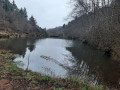
(3) Turn right onto the small path leading to the Montouse Dam. Cross the bridge, follow the river on your left, then cross another bridge and follow it on your right.

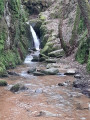
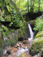
(4) Follow the Montouse through the Gorge du Désert.

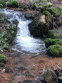
(5) As you approach a hut, the waterfall is on the right. Returning towards the hut, climb a steep slope and follow the path marked by a yellow and white sign. Cross the streams and the bridge.

(6) At the sign for Haut de Saudet (elevation 659), turn right.

(7) Pass through the hamlet of Saudet and keep to the right on the Chemin du Châtelus.

(8) Turn right to go round Châtelus (elevation 581), then return to the crossroads.

(8) Take Chemin du Petit Châtelus opposite. Cross the D51 carefully and take the cul-de-sac opposite leading to the viewpoint (pylon).

(9) Retrace your steps to return to the crossroads.

(8) Turn left onto Chemin du Châtelus and join Chemin de la Bataille.

(10) Turn right, then left onto Chemin des Marronniers. Cross Rue du Lavoir to return to the car park (S/E).


Waypoints

  1. S/E : mi 0 - alt. 1,421 ft - Saint-Alban-Les-Eaux, Place du Saint-Louis - Église du Sacré-Coeur (Saint-Alban-les-Eaux)
  2. 1 : mi 0.08 - alt. 1,414 ft - Chemin du Désert
  3. 2 : mi 0.46 - alt. 1,476 ft - The Madonna
  4. 3 : mi 0.63 - alt. 1,572 ft - Barrage de la Montouse
  5. 4 : mi 1.08 - alt. 1,663 ft - The Desert Gorges
  6. 5 : mi 1.33 - alt. 1,808 ft - The waterfall
  7. 6 : mi 1.9 - alt. 2,156 ft - Le Haut de Saudet, 659 m
  8. 7 : mi 2.07 - alt. 2,087 ft - Le Saudet
  9. 8 : mi 2.56 - alt. 1,880 ft - Crossroads
  10. 9 : mi 3.26 - alt. 2,133 ft - Viewpoint
  11. 10 : mi 4.09 - alt. 1,539 ft - Chemin des Marronniers
  12. S/E : mi 4.32 - alt. 1,421 ft - Saint-Alban-Les-Eaux, Place du Saint-Louis - Église du Sacré-Coeur (Saint-Alban-les-Eaux)

Notes

(5) When it rains, the path to the waterfall is very wet.

Worth a visit

(S/E) The mineral water park.

Reviews and comments

5 / 5
Based on 4 reviews

Reliability of the description
5 / 5
Ease of following the route
5 / 5
Route interest
5 / 5
Rebel88
Rebel88

Overall rating : 5 / 5

Date of your route : Apr 04, 2026
Reliability of the description : ★★★★★ Very good
Ease of following the route : ★★★★★ Very good
Route interest : ★★★★★ Very good
Very busy route : No

What steep little climbs, and such clear, cool water. A lovely waterfall and a charming village.
Pop into Anna’s grocery shop when you arrive; there are lots of products to discover.

Machine-translated

User 18371553

Overall rating : 5 / 5

Date of your route : Sep 01, 2025
Reliability of the description : ★★★★★ Very good
Ease of following the route : ★★★★★ Very good
Route interest : ★★★★★ Very good
Very busy route : No

Magnificent dry stream hike

Machine-translated

anne ubrig
anne ubrig

Overall rating : 5 / 5

Date of your route : Jan 24, 2025
Reliability of the description : ★★★★★ Very good
Ease of following the route : ★★★★★ Very good
Route interest : ★★★★★ Very good
Very busy route : No

A lovely walk that must be particularly pleasant in summer, as the path winds its way up through the forest and follows the stream.

Machine-translated

Fred76
Fred76

Overall rating : 5 / 5

Date of your route : Aug 12, 2024
Reliability of the description : ★★★★★ Very good
Ease of following the route : ★★★★★ Very good
Route interest : ★★★★★ Very good
Very busy route : No

A lovely walk through the woods along the river. We did this trail in very hot weather, so it was lovely to be in the shade of the trees. There are some good climbs to tackle, offering stunning views
Very well signposted

Machine-translated

Other walks in the area

For more walks, use our search engine .

The GPS track and description are the property of this route's author. Please do not copy them without permission.