The Gorge du Désert, starting from Saint-Alban-les-Eaux

Starting from the village of Saint-Alban-Les-Eaux, known for its carbonated springs, this route passes via La Madone and the Montouse Dam before continuing on to the Gorge du Désert. It allows you to reach the waterfall without too much difficulty and then return to the village via Le Châtelus.

Details

55296679
Creation:
Last update:
Last review:
  • Walking
    Activity: Walking
  • ↔
    Distance: 2.72 mi
  • ◔
    Average duration: 1h 50 
  • ▲
    Difficulty: Easy

  • ⚐
    Back to start: Yes
  • ↗
    Ascent: + 636 ft
  • ↘
    Descent: - 614 ft

  • ▲
    Highest point: 1,988 ft
  • ▼
    Lowest point: 1,414 ft

Photos

Description of the walk

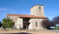
Head to Saint-Alban-Les-Eaux and park in Place Saint-Louis opposite the Church of the Sacred Heart.

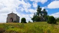
(S/E) Opposite the church, turn left and follow the road. Turn right onto the Chemin du Désert, then turn left onto a small path with a railing. Turn right to rejoin the Chemin du Désert further on, then the Route de La Fon. Climb the steps to reach the Madone.

(1) Turn left again, following the railing, and join the Route de la Fon; walk carefully along the right-hand side of the road until you reach a junction with a path.

(2) Turn right onto this path and head for the Montouse Dam. Cross the bridge and follow the right bank of the River Montouse. Then cross the river twice to reach the Gorges du Désert junction.

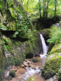
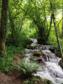
(3) Carry on straight ahead until you reach a hut, where you’ll find the waterfall on your right.

(4) Turn back to the previous junction.

(3) Take the path on the left and cross the bridge. Continue along this path, ignoring the tracks to the right and left. At the end of this path, you’ll find the Chemin du Châtelus.

(5) Take this path straight ahead, then turn right onto Rue des Marronniers and cross Rue du Lavoir to reach the car park at Place Saint-Louis (S/E).

Waypoints

  1. S/E : mi 0 - alt. 1,421 ft - Car park at Place Saint-Louis - Église du Sacré-Coeur (Saint-Alban-les-Eaux)
  2. 1 : mi 0.43 - alt. 1,453 ft - Staircase
  3. 2 : mi 0.63 - alt. 1,562 ft - Barrage de la Montouse
  4. 3 : mi 1.22 - alt. 1,716 ft - Waterfall junction
  5. 4 : mi 1.35 - alt. 1,781 ft - The waterfall
  6. 5 : mi 2.27 - alt. 1,680 ft - Châtelus Path
  7. S/E : mi 2.72 - alt. 1,421 ft - Car park at Place Saint-Louis - Église du Sacré-Coeur (Saint-Alban-les-Eaux)

Notes

(3) When it rains, the path to the waterfall is very wet.
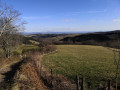
Between (3) and (5), there are views: on the right is the Châtelus and on the left is the path leading to the viewpoint.

Worth a visit

(S/E) The Mineral Waters Park.

Reviews and comments

5 / 5
Based on 2 reviews

Reliability of the description
5 / 5
Ease of following the route
5 / 5
Route interest
5 / 5
User 26941169

Overall rating : 5 / 5

Date of your route : Aug 17, 2025
Reliability of the description : ★★★★★ Very good
Ease of following the route : ★★★★★ Very good
Route interest : ★★★★★ Very good
Very busy route : Yes

Short, easy route that is simple to follow. Suitable for families with young children.

Machine-translated

anne ubrig
anne ubrig

Overall rating : 5 / 5

Date of your route : Jan 24, 2025
Reliability of the description : ★★★★★ Very good
Ease of following the route : ★★★★★ Very good
Route interest : ★★★★★ Very good
Very busy route : No

a lovely walk

Machine-translated

Other walks in the area

For more walks, use our search engine .

The GPS track and description are the property of this route's author. Please do not copy them without permission.