Parigny Circular Loop

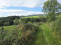
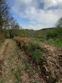
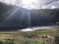
A walk with no particular difficulties. We are on a plateau here, so there is little elevation gain and some lovely panoramic views of the town of Roanne in the distance. There are some pretty little sections near beautiful, well-maintained but private ponds. The route is half on dirt tracks and half on small local lanes or tarmac paths. There are very few sections on main roads.

Details

71993456
Creation:
Last update:
Last review:
  • Walking
    Activity: Walking
  • ↔
    Distance: 5.13 mi
  • ◔
    Average duration: 2h 30 
  • ▲
    Difficulty: Easy

  • ⚐
    Back to start: Yes
  • ↗
    Ascent: + 177 ft
  • ↘
    Descent: - 138 ft

  • ▲
    Highest point: 1,155 ft
  • ▼
    Lowest point: 1,004 ft

Description of the walk

Park in the town hall car park.

(S/E) Take Rue de la Place, then turn right onto Chemin du Bois de la Porte, and follow it to the railway line.

(1) There is a pedestrian crossing to cross the railway tracks, but the spring-loaded gates close automatically. Be careful and make sure no train is visible (even on the horizon) or audible. Turn immediately right onto Chemin des Perrets and follow it to the end.

(2) First turn right then left onto Route de Commelle, which runs alongside the railway line. You’ll come to a junction with another pedestrian crossing on your right.

(3) Cross the railway line with the same caution and following the same safety instructions as before. Then turn left onto Chemin du Maroc and follow it to the end, passing, a few hundred metres on your left, four private ponds surrounded by grounds superbly landscaped by the owner.

(4) Head left onto Chemin de Vers Bois and carry on straight ahead until you reach the railway line.

(5) Cross the railway line again, taking the same precautions as before, then turn left onto Chemin du Forestier. This road follows the railway line for a while before veering off to the right, passing through the hamlet of Le Forestier and reaching Commelle.

(6) Turn left onto Rue Pasteur, then turn left again at the Church of Saint-Jacques-et-Philippe to join the Route de Parigny. Pass under the power line and continue for about a hundred metres.

(7) Turn left onto Chemin Sebrin, which, a little further on, becomes Chemin de l’Étang Béraud. Follow the railway line until you reach the pedestrian crossing you used on the way there.

(3) Cross the railway line again, then turn right onto Chemin du Maroc. Cross the small road and continue straight ahead along Chemin des Écureuils to reach Rue des Remparts, near the waste disposal and refuelling point for motorhomes.

(8) Turn left and head for the town hall car park (S/E).

Waypoints

  1. S/E : mi 0 - alt. 1,063 ft - Town Hall car park
  2. 1 : mi 0.47 - alt. 1,155 ft - Crossing railway tracks
  3. 2 : mi 0.72 - alt. 1,125 ft - Route de Commelle
  4. 3 : mi 1.01 - alt. 1,119 ft - Crossing railway tracks
  5. 4 : mi 1.93 - alt. 1,010 ft - Chemin de Vers Bois
  6. 5 : mi 2.58 - alt. 1,024 ft - Crossing railway tracks
  7. 6 : mi 3.52 - alt. 1,119 ft - Commelle, Rue du Pasteur
  8. 7 : mi 3.8 - alt. 1,099 ft - Chemin Sebrin
  9. 8 : mi 5.01 - alt. 1,099 ft - Rue des Remparts
  10. S/E : mi 5.13 - alt. 1,073 ft - Town Hall car park

Notes

Warning

You will cross the railway tracks four times. Trains do not run every two minutes, but you should take the necessary precautions and follow the safety instructions on the signs near the pedestrian crossings used to cross the tracks.
Once you’ve decided to cross, do not stop on the tracks; cross them and leave the area via the gate opposite.
If you have judged that it is safe to cross, do not change your mind and turn back when you are halfway across. Leave the area to get to safety, and if you really do want to turn back, make sure you can cross the tracks again safely.

Worth a visit

There are some beautiful stone houses in Parigny itself (S/E).

On the outskirts of Parigny, heading towards Roanne, is the Château d’Ailly, which can be hired for seminars, receptions or weddings.

A few kilometres away is the town of Roanne, with its marina and canal, pedestrianised streets, theatre, and so on.

A little closer by is the town of Le Coteau, separated from Roanne by a bridge spanning the Loire. In March 2024, the local council developed the banks of the Rhins, a small river which flows into the Loire, installing some excellent sports facilities (skate park, pump track, tennis court, fitness trail, sun loungers, tables and benches, a maze, water features (in Bécot Park, accessible from the banks of the Rhins), slides, etc.).

Some lovely places to visit not far from Parigny:

* Villerest, with its dam and lake, its walking trails, lakeside picnic areas and, above all, the narrow streets of old Villerest.
* Saint Jean - Saint-Maurice-sur-Loire, which overlooks the Loire, whose gorges were submerged by the waters of the lake created when the Villerest dam was built in the 1980s. A very pretty village to explore on foot, of course, to reach the tower, a remnant of the castle that no longer stands.
* The Château de la Roche, a few kilometres away, where the waters of the Loire lap at its base but which, at times of high water, may be more or less submerged.
* The Côte Roannaise, with its typical villages such as Saint-Alban-les-Eaux, Renaison, Saint-Haon-le-Châtel (a must-see), Saint-Haon-le-Vieux, Ambierle, Le Crozet, and so on. The Côte Roannaise is teeming with winegrowers who, over the years, have produced wines of great renown.
* Ouches, home to restaurateur Michel Troigros, who settled there a few years ago after several decades spent in Roanne – first with Pierre and Jean Troigros, then with Michel, and now with his children, including César, who has also made a name for himself.

Reviews and comments

3.8 / 5
Based on 3 reviews

Reliability of the description
4 / 5
Ease of following the route
4.3 / 5
Route interest
3 / 5
User 22940738

Overall rating : 4.3 / 5

Date of your route : Mar 08, 2026
Reliability of the description : ★★★★☆ Good
Ease of following the route : ★★★★★ Very good
Route interest : ★★★★☆ Good
Very busy route : Yes

A very easy route with very little elevation gain

Machine-translated

User 28213767

We end up on a busy main road
The traffic is fast
We have to walk in the ditch if we take the route through the woods, going around the castle. About 1.5 km of road (blue) to get back to the village: a shame

Machine-translated

CHRISTIAN PRAT
CHRISTIAN PRAT

Start and finish in the heart of the village of Parigny, accessible only by small country roads! ?

Machine-translated

User 28213767

Overall rating : 2.7 / 5

Date of your route : Jan 12, 2026
Reliability of the description : ★★★☆☆ Average
Ease of following the route : ★★★★☆ Good
Route interest : ★☆☆☆☆ Very disappointing
Very busy route : No

We end up on a busy main road
The traffic is fast
We are forced to walk in the ditch

Machine-translated

CHRISTIAN PRAT
CHRISTIAN PRAT

Overall rating : 4.3 / 5

Date of your route : May 03, 2025
Reliability of the description : ★★★★★ Very good
Ease of following the route : ★★★★☆ Good
Route interest : ★★★★☆ Good
Very busy route : No

A lovely walk with some sections along wide, wooded or tree-lined paths. However, over 50 per cent of the route is on tarmac roads (due to the urban sprawl of nearby Roanne).
Best done in mid-season but not during a heatwave, as there are long stretches with no shade.
There’s not much in the way of heritage, but the scenery is interesting in places (the Ailly Forest).
It’s nice to watch the passenger and freight trains go by.
However, we calculated a cumulative elevation gain of +101 metres and the same again on the descent. Nevertheless, over the course of the walk, this works out as a fairly flat route with no significant inclines.

Machine-translated

Other walks in the area

For more walks, use our search engine .

The GPS track and description are the property of this route's author. Please do not copy them without permission.