Route of the huts from the Saint-Germain-Laval Architects’ Festival

This summer 2021, Saint-Germain-Laval is hosting the Festival des Cabanes d’Architectes, organised in partnership with the Festival des Cabanes and La Soierie associations, both based in Faverges. This route will allow you to discover the three huts, the historic village and the banks of the River Aix...

Details

9438546
Creation:
Last update:
Last review:
  • Walking
    Activity: Walking
  • ↔
    Distance: 3.74 mi
  • ◔
    Average duration: 2h 15 
  • ▲
    Difficulty: Easy

  • ⚐
    Back to start: Yes
  • ↗
    Ascent: + 564 ft
  • ↘
    Descent: - 541 ft

  • ▲
    Highest point: 1,535 ft
  • ▼
    Lowest point: 1,207 ft

Photos

Description of the walk

Park in the car park at Place Jules Ferry in Saint-Germain-Laval.

(S/E) Walk down Place San Germano, follow it along, then turn left onto Chemin des Côtes.

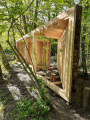
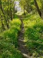
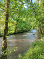
(1) After thefirst bend on the right, turn left – near an old outbuilding – onto a path that leads down into the woods. Follow it as far as L’Aix to discover thefirst architects’ cabin, ‘Face Cachée’.

(2) Return to the previous junction.

(1) Carry on to the left along the Chemin des Côtes until you reach the junction with Rue du Docteur Boel.

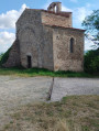
(3) Turn left onto Boulevard des Vingtains to find thesecond hut, Fenêtre sur Cours. Take a moment to push open the chapel door and admire its architecture.
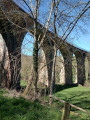
Continue up the path, passing the Roman Bridge on your left, and walk through the hamlet of Baffy until you reach the D38; follow this road until you come to a T-junction.

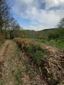
(4) Then take the dirt track on the right towards Les Millières. Follow it and continue uphill along the tarmac road.

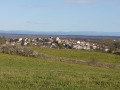
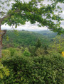
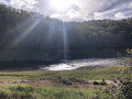
(5) On the plateau, take the dirt track to the right to reach thethird hut, Première Demeure, which offers a panoramic view of the village and the surrounding hills.
Return to the Chemin des Millières, continue along it to the right and take thefirst path on the right towards Les Chanées until you reach the D38. Cross the road and continue down towards the Chemin de Baffy; take this on your left to head back up to the village.

(6) Follow Boulevard des Vingtains to the right for a few metres before turning left into Rue Neuve, then right into Rue Vernin; then take a few steps to the left to reach the church of La Madeleine, which offers a beautiful view from its esplanade. Do not hesitate to explore the surrounding alleyways to discover the remains of the old fortified village.

(7) Head to the Place de l’Hôtel de Ville, surrounded by historic mansions, via Rue de la Madeleine, which runs alongside the castle, then turn right onto Rue Saint Pierre and left onto Rue du Marché.
To reach the car park (S/E), walk down Rue Boissieu, then take Rue de La Fabrique opposite until you reach Place Jules Ferry.


Waypoints

  1. S/E : mi 0 - alt. 1,398 ft - Car park
  2. 1 : mi 0.24 - alt. 1,339 ft - Junction 1st hut
  3. 2 : mi 0.34 - alt. 1,224 ft - 1st cabin
  4. 3 : mi 0.63 - alt. 1,381 ft - Boulevard Gardens, along the - Aix (rivière) - Affluent de la Loire
  5. 4 : mi 1.68 - alt. 1,293 ft - Chemin des Millières
  6. 5 : mi 2.21 - alt. 1,509 ft - Junction 3°°e°° cabin
  7. 6 : mi 3.38 - alt. 1,385 ft - Boulevard des Vingtains
  8. 7 : mi 3.49 - alt. 1,444 ft - How to get to Place de l’Hôtel de Ville
  9. S/E : mi 3.74 - alt. 1,398 ft - Car park

Worth a visit

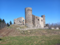
This walk was created as part of the Festival des Cabanes d’architectes to enable visitors to discover the three huts as well as the village and its surroundings: the banks of the Aix, the panoramic view of the village, the Forez plain and, from west to east, the Monts du Lyonnais, Pilat, Forez and Madeleine.

But don’t leave without visiting the village itself, with its beautiful 14th- and 16th-century houses, the Récollets convent, and 17th- and 18th-century mansions – including the Ramey de Sugny mansion, which now serves as the town hall.
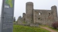
Stroll through our picturesque narrow streets and you’ll discover the remains of the fortified village; look up and you’ll see the ‘génoises’ – those hollow-tile roofs emerging from the façades in double or triple rows – as well as the triangular pediments, some with a ‘eye’ opening and others without, characteristic of the southern influence.
For your visit, you can follow the signposted walking route, marked with information boards, starting at the junction of the D1 and D8, or the children’s and family route, starting from the town hall. Further information is available at the town hall or on the website
Find out more

Reviews and comments

4.1 / 5
Based on 3 reviews

Reliability of the description
4 / 5
Ease of following the route
4.3 / 5
Route interest
4 / 5
Alex-c
Alex-c

Overall rating : 3.7 / 5

Date of your route : Feb 12, 2024
Reliability of the description : ★★★★☆ Good
Ease of following the route : ★★★★☆ Good
Route interest : ★★★☆☆ Average
Very busy route : No

Hello, the huts are no longer there, which is a shame as they were nice to visit.
At the first hut site, you can continue to the left along the River Aix after the reservoir. It’s a fascinating path with sculptures and water features set amongst the rocks.
Otherwise, there’s still Notre Dame de Laval and the Baffy Bridge.

Machine-translated

mmuron
mmuron

Thank you
I hope this walk has given you the chance to discover our village and the surrounding area.

Machine-translated

luc chabanne
luc chabanne

In a way, you have to go round the care home and past the nursery and primary school.
It’s true that an extra sign at the start would be helpful, especially as Place San Germinano – or something like that – doesn’t have any road signs at all.
The rest of the route is very well signposted with red arrows.

Machine-translated

luc chabanne
luc chabanne

Overall rating : 5 / 5

Date of your route : Jul 20, 2021
Reliability of the description : ★★★★★ Very good
Ease of following the route : ★★★★★ Very good
Route interest : ★★★★★ Very good
Very busy route : No

Very suitable for families with children aged 6 and over; not suitable for pushchairs.
It’s more than just a walk – there’s a bit of culture too, which is lovely.

Machine-translated

chantof
chantof

Thank you,
Kind regards.

Machine-translated

mmuron
mmuron

Hello, you need to get off at Place San Germano, as indicated, walk along the square – the signpost is on the left at the end of the square, in front of the school
Enjoy your walk

Machine-translated

chantof
chantof

Overall rating : 3.7 / 5

Date of your route : Jul 18, 2021
Reliability of the description : ★★★☆☆ Average
Ease of following the route : ★★★★☆ Good
Route interest : ★★★★☆ Good
Very busy route : No

After the start and the square, there are no signposts. It’s not clear where to go.

Machine-translated

Other walks in the area

For more walks, use our search engine .

The GPS track and description are the property of this route's author. Please do not copy them without permission.