


Refine your search for walks in Argentine (Savoie)
Argentine (Savoie) walks
 The Rochebrune Battery
 Visorando Member
 4.05 mi
 +1,722 ft
 -1,706 ft
 3h 20
3h 20
 Moderate
 Departure from Saint-Georges-des-Hurtières (Savoie)
A circular route in the Hurtières massif to the north of the Belledonnes massif.
This is a route that explores the region’s military and mining history.
Yellow markings on trees and rocks, numerous directional signs with little or no elevation information.
Belt of redoubts and batteries around Fort de Montgilbert
 6.32 mi
+1,342 ft
-1,322 ft
4h 05
Moderate
Departure from Montendry (Savoie)
6.32 mi
+1,342 ft
-1,322 ft
4h 05
Moderate
Departure from Montendry (Savoie)
Circular forest path starting from Fort de Montgilbert, following the belt of redoubts and batteries built along a ridge to defend the entrance to the Maurienne valley and passing through a sensitive peat bog site.
Le Grand Arc from Tioulévé
 8.19 mi
+4,242 ft
-4,236 ft
7h 30
8.19 mi
+4,242 ft
-4,236 ft
7h 30
 Difficult
Departure from Montsapey (Savoie)
Difficult
Departure from Montsapey (Savoie)
With clear skies and no clouds on the horizon, on the morning of 27 August 2018, I decide to discover a superb viewpoint over the Alps. Perched between Belledonne and Lauzière, just above the confluence of the Isère and Arc rivers, the Grand Arc massif is exceptional in its domain. High mountains less than an hour from Chambéry!
The Lac Noir du Grand Arc via the Char de la Turche
5.93 mi
+2,717 ft
-2,690 ft
5h 05
Moderate
Departure from Montsapey (Savoie)
A beautiful loop on the southern slope of the Grand Arc, passing by the dark Lac Noir.
At the start, a discovery trail allows hikers to step back in time.
Directional signs and yellow markings.
Col de Basmont
 2.91 mi
+1,883 ft
-1,880 ft
3h 00
2.91 mi
+1,883 ft
-1,880 ft
3h 00
 Easy
Departure from Montsapey (Savoie)
Easy
Departure from Montsapey (Savoie)
A pleasant walk to the Col de Basmont (1,791m), to fill your bag with blueberries, with the added bonus of views over the Beaufortin, the Chartreuse, Belledonne and the Aravis, amongst others.
The Bellacha loop via Col de Basmont
6.93 mi
+4,268 ft
-4,268 ft
6h 55
Difficult
Departure from Montsapey (Savoie)
Ascent of Bellacha via a wild trail on the way up, following the north-west and north ridges of Bellachat. The return route is via the Col de l'Arc and Col de Basmont passes, which offer different landscapes and avoid the descent via the ascent route, which is not always easy to find. This loop is not recommended in the opposite direction.
Lac Branlay
 3.74 mi
+1,352 ft
-1,352 ft
2h 55
Moderate
Departure from La Léchère (Savoie)
3.74 mi
+1,352 ft
-1,352 ft
2h 55
Moderate
Departure from La Léchère (Savoie)
A beautiful family hike with panoramic views of the Lauzière massif and Mont Blanc in a wild and unspoilt environment.
Circular Arpettaz starting from the Logis des Fées
 Local authority4.57 mi
+1,339 ft
-1,345 ft
3h 15
Moderate
Departure from La Léchère (Savoie)
Local authority4.57 mi
+1,339 ft
-1,345 ft
3h 15
Moderate
Departure from La Léchère (Savoie)
The high-altitude lakes and the highest peaks of the Lauzière give this route its unique character.
Grand Chat loop
5.66 mi
+1,657 ft
-1,654 ft
4h 05
Moderate
Departure from Saint-Alban-des-Hurtières (Savoie)
A beautiful hike in the north of the Belledonne Massif. The ridge route offers sweeping views of the surrounding mountains. A few information boards mark the route.
Pointe de Rognier with return via the Mollards ridge
 7.55 mi
+3,196 ft
-3,196 ft
6h 15
Difficult
Departure from Saint-Alban-des-Hurtières (Savoie)
7.55 mi
+3,196 ft
-3,196 ft
6h 15
Difficult
Departure from Saint-Alban-des-Hurtières (Savoie)
This is a beautiful hike at the northern end of the Belledonne massif. With the help of an orientation table, discover the 360° view that awaits you at the top of this peak.
As indicated in the paragraph "During the hike or nearby", part of the hike can be done with young children, with an elevation gain of about 600m.
Sarvatan Pass as seen from the Col de la Madeleine road
 2.70 mi
+1,772 ft
-1,772 ft
2h 45
Difficult
Departure from Montgellafrey (Savoie)
2.70 mi
+1,772 ft
-1,772 ft
2h 45
Difficult
Departure from Montgellafrey (Savoie)
Difficult hike: the path climbs quite steeply and, on a short stretch just before the pass, the path is very narrow. After crossing meadows with characteristic flora, you end up in a more rocky, wild environment. Once you’ve rounded the first ridges, you immediately feel far from civilisation, were it not for the presence of a few marmots.
Crossing the Col de Sarvatan-Col de Monjoie via the two pass trail
 5.37 mi
+2,402 ft
-2,395 ft
4h 35
Moderate
Departure from Montgellafrey (Savoie)
5.37 mi
+2,402 ft
-2,395 ft
4h 35
Moderate
Departure from Montgellafrey (Savoie)
This loop south of the Lauzière allows you to explore both sides of the chain, climbing directly to the Pas de Sarvatan, then crossing the western slope via a well-marked trail before descending from the Col de Monjoie through beautiful meadows.
Montjoie Pass
 3.91 mi
+1,434 ft
-1,430 ft
3h 05
Moderate
Departure from Montgellafrey (Savoie)
3.91 mi
+1,434 ft
-1,430 ft
3h 05
Moderate
Departure from Montgellafrey (Savoie)
Family hike to the Col de Monjoie (but it's still uphill) then a short off-trail exploration towards the peaks that border it.
Mont Bellacha from Lachat
 Tourism professional
 7.20 mi
+2,740 ft
-2,740 ft
5h 40
Difficult
Departure from Bonneval (Savoie) (Savoie)
7.20 mi
+2,740 ft
-2,740 ft
5h 40
Difficult
Departure from Bonneval (Savoie) (Savoie)
A lovely little hike for the start of the season or for exploring the high mountains with the family, which starts off along some forgotten paths.
Route du Logis des Fées
 7.25 mi
+3,543 ft
-3,543 ft
6h 25
Difficult
Departure from La Léchère (Savoie)
7.25 mi
+3,543 ft
-3,543 ft
6h 25
Difficult
Departure from La Léchère (Savoie)
A hike in the Lauziere massif that will take you past the surrounding peaks, the Logis des Fées refuge, Lake L'Arpettaz and Lake Branlay along well-maintained paths.
The Knights of Huile
 3.94 mi
+302 ft
-289 ft
2h 05
Easy
Departure from Bourget-en-Huile (Savoie)
3.94 mi
+302 ft
-289 ft
2h 05
Easy
Departure from Bourget-en-Huile (Savoie)
The perfect family outing, this route will introduce you to the Bourget-en-Huile and Pontet marshes.
You will learn about the flora and fauna, the marshes, how they were formed and how they are being restored. There is also information about the woods and mining, castles and even Hannibal. All this is provided by information points along the route. A booklet offering a fun approach to the trail is on sale at the Chalet du Verney.
Col de Montjoie as seen from Saint François Longchamp.
4.50 mi
+1,893 ft
-1,893 ft
3h 45
Moderate
Departure from Montgellafrey (Savoie)
An easy half-day route through the mountain pastures above Saint François Longchamp.
The Pissus and Lac du Loup circular loop
4.20 mi
+1,640 ft
-1,611 ft
3h 20
Moderate
Departure from Bonneval (Savoie) (Savoie)
Circular route through the Lauzière massif, which gives this area its distinctive rugged, rocky character.
Circular Pissus - Lakes and Col du Loup
 4.63 mi
+2,260 ft
-2,283 ft
4h 05
Moderate
Departure from Bonneval (Savoie) (Savoie)
4.63 mi
+2,260 ft
-2,283 ft
4h 05
Moderate
Departure from Bonneval (Savoie) (Savoie)
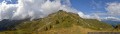
A lovely hike in the Lauzière massif, with views of the peaks and glaciers of the Vanoise, not to mention the inevitable Mont Blanc.
You will also recognise the characteristic silhouette of the Cheval Noir along the way.
Circular Lac de la Léchère and Croix du Grand Praz, starting from Longchamp 1650
9.65 mi
+2,333 ft
-2,362 ft
6h 30
Difficult
Departure from Saint-François-Longchamp (Savoie)
A lovely mountain hike, without any major difficulties, featuring a wide variety of terrain: mountain pastures, forests, wide paths and streams. A stunning view of the valley from the Croix du Grand-Praz. The Col de Montjoie will be on your left on the return from the lake, with the Cheval Noir on the other side.
Le Col du Paradis depuis Saint-François-Longchamp
 6.80 mi
+1,608 ft
-1,608 ft
4h 30
Moderate
Departure from Saint-François-Longchamp (Savoie)
6.80 mi
+1,608 ft
-1,608 ft
4h 30
Moderate
Departure from Saint-François-Longchamp (Savoie)
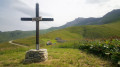
Une jolie randonnée dans la montagne à vaches (celles qui font le Beaufort). Belle vue sur la vallée de l'Arc et le massif des Grandes Rousses. Presque tout le parcours est au soleil.
Pic du Cheval Noir
 Association / Club / Walk leader
 5.05 mi
+3,130 ft
-3,133 ft
5h 05
Difficult
Departure from Saint-François-Longchamp (Savoie)
5.05 mi
+3,130 ft
-3,133 ft
5h 05
Difficult
Departure from Saint-François-Longchamp (Savoie)
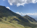
Discover a peak with a 360° view of the Savoie mountains.
The Balcons de Saint-François-Longchamp
 4.37 mi
+1,348 ft
-1,322 ft
3h 10
Easy
Departure from Saint-François-Longchamp (Savoie)
4.37 mi
+1,348 ft
-1,322 ft
3h 10
Easy
Departure from Saint-François-Longchamp (Savoie)
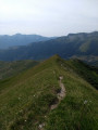
This route takes you through what I consider to be one of the most beautiful areas in the municipality: Les Balcons. It boasts a rich diversity of flora, fauna and geology, as well as varied landscapes and terrain. All this in a place that feels wild and far from civilisation.
See the ‘Practical information’ section regarding the path after the (3).
The Col de Montjoie
6.94 mi
+2,051 ft
-2,080 ft
5h 00
Moderate
Departure from Montgellafrey (Savoie)
An easy hike to the Col de Montjoie. Unobstructed views, particularly of the Aiguilles d'Arves and the Glacier de l'Etendard.
Lac de la Grande Léchère mountain hut – Montartier Lakes
10.81 mi
+4,577 ft
-3,084 ft
8h 55
Difficult
Departure from Montgellafrey (Savoie)
A lovely climb through the upper pastures where the cows that produce the milk for Beaufort cheese graze, with views of the Vanoise, the Thabor Massif, the Aiguilles d’Arves and the foothills of the Écrins. Then the route changes direction, offering views of Belledonne, the Chartreuse and the Bauges, before setting up camp at the Montartier Lakes.
Cheminées des Fées, starting from Saint-François-Longchamp
 2.59 mi
+856 ft
-863 ft
1h 55
Moderate
Departure from Saint-François-Longchamp (Savoie)
2.59 mi
+856 ft
-863 ft
1h 55
Moderate
Departure from Saint-François-Longchamp (Savoie)
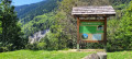
The ‘demoiselles coiffées’ (topped rock formations), known locally as the Cheminées des Fées, are a unique feature resulting from the erosion of the landscape by water runoff.
Alpine pastures and waterfalls of Valmorel
 5.83 mi
+1,253 ft
-1,532 ft
3h 45
Moderate
Departure from Les Avanchers-Valmorel (Savoie)
5.83 mi
+1,253 ft
-1,532 ft
3h 45
Moderate
Departure from Les Avanchers-Valmorel (Savoie)
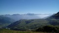
A short hike with moderate elevation gain, suitable for a family outing with young children. The route takes you through working mountain pastures, offering beautiful views of the surrounding mountains, and passes by the foot of three stunning waterfalls.
The Col du Paradis from the Sainte-Anne Chapel
 5.63 mi
+1,703 ft
-1,677 ft
4h 05
Difficult
Departure from Saint-François-Longchamp (Savoie)
5.63 mi
+1,703 ft
-1,677 ft
4h 05
Difficult
Departure from Saint-François-Longchamp (Savoie)
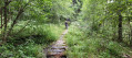
Discover the Paradis mountain pastures, above Saint-François-Longchamp, the bells of the cattle herds in the green summer pastures, with magnificent views of the surrounding mountains, the passage through the hamlet of La Perrière, then a return via the path through the Pézières Forest, with its complicated passages through muddy waterways or a tiny, vertiginous path. Beautiful emotions await you.
The Dent du Corbeau circular loop via La Thuile
 3.63 mi
+2,024 ft
-2,008 ft
3h 25
Moderate
Departure from Sainte-Hélène-sur-Isère (Savoie)
3.63 mi
+2,024 ft
-2,008 ft
3h 25
Moderate
Departure from Sainte-Hélène-sur-Isère (Savoie)
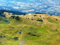
A circular walk in the Grand Arc massif offering magnificent panoramic views of the Albertville valley and the Lauzière massif, whilst enjoying the beautiful La Thuile mountain pastures with their many small lakes. This walk was completed with children aged five and ten.
Towards the Grand Arc from the Refuge de la Thuile
4.73 mi
+2,201 ft
-2,201 ft
4h 05
Difficult
Departure from Sainte-Hélène-sur-Isère (Savoie)
A beautiful hike in an area that is very open right from the start, with panoramic views of the Chartreuse, the Bauges, the Aravis and the Beaufortain. On the ridge, the views extend to include Mont Blanc, the Vanoise and the Écrins...
Tour des Chatermes
 4.83 mi
+2,861 ft
-2,861 ft
4h 45
Difficult
Departure from Saint-Rémy-de-Maurienne (Savoie)
4.83 mi
+2,861 ft
-2,861 ft
4h 45
Difficult
Departure from Saint-Rémy-de-Maurienne (Savoie)
A beautiful, unspoilt route around Les Chatermes with panoramic views of Les Grands Moulins and the Pointe de Rognier.
A circular route around the Dent du Corbeau from Saint-Paul-sur-Isère
5.25 mi
+2,556 ft
-2,536 ft
4h 40
Difficult
Departure from Saint-Paul-sur-Isère (Savoie)
A beautiful, little-known summit at the northern end of the Lauzière massif.The approach via the Tarentaise, which is much less frequented, guarantees peace and quiet and the chance to spot chamois.