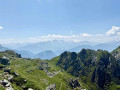
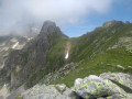
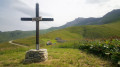
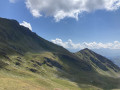
Col de Montjoie as seen from Saint François Longchamp.

An easy half-day route through the mountain pastures above Saint François Longchamp.

Details

677859
Creation:
Last update:
Last review:
  • Walking
    Activity: Walking
  • ↔
    Distance: 4.50 mi
  • ◔
    Average duration: 3h 45 
  • ▲
    Difficulty: Moderate

  • ⚐
    Back to start: Yes
  • ↗
    Ascent: + 1,893 ft
  • ↘
    Descent: - 1,893 ft

  • ▲
    Highest point: 7,441 ft
  • ▼
    Lowest point: 5,538 ft

Description of the walk

On leaving Saint François Longchamp, park in the Pérelle neighbourhood opposite a Technical Services building after a hairpin bend in the road.

(S/E) Start climbing up the path opposite, pass in front of a water tank building and reach a junction.

(1) Ignore the path branching off to the left and continue along the grassy track. Carry on climbing this track, which will bend off in a north-westerly direction. Reach a junction at an altitude of around 1,900 metres.

(2) Continue climbing to the right until you reach the junction with the path coming from the Lauzière chairlift, at an altitude of 1,930 metres.

(3) Carry on to the left. After a winding section, pass a tiny lake and reach another junction at Crête Maxet.

(4) Continue climbing straight ahead and, after crossing a scree slope, reach the Col de Montjoie.

(5) From the pass, descend back to the junction on the ridge.

(4) Then turn right. Go round the Maxet ridge.

(6) At the junction at around 2015m, at a place called Mère de l’Eau, head down to the left to return to the crossroads at 1900m that you passed on the way up.

(2) Head down to the right along the route you took on the way up and return to the car park (S/E).

Waypoints

  1. S/E : mi 0 - alt. 5,548 ft - Car park in the Pérelle area
  2. 1 : mi 0.13 - alt. 5,591 ft - Junction
  3. 2 : mi 0.69 - alt. 6,211 ft - Junction
  4. 3 : mi 0.96 - alt. 6,335 ft - Junction at an altitude of 1,930 m.
  5. 4 : mi 1.63 - alt. 6,988 ft - Junction
  6. 5 : mi 2.2 - alt. 7,441 ft - Col de Montjoie
  7. 6 : mi 3.02 - alt. 6,654 ft - Mère de l’Eau
  8. S/E : mi 4.5 - alt. 5,548 ft - Car park

Notes

Shelter at the Col de Montjoie, with RTM signs about natural hazards.

Reviews and comments

4.6 / 5
Based on 3 reviews

Reliability of the description
4.3 / 5
Ease of following the route
4.7 / 5
Route interest
4.7 / 5
User 3178264

Overall rating : 4.7 / 5

Date of your route : Aug 24, 2025
Reliability of the description : ★★★★☆ Good
Ease of following the route : ★★★★★ Very good
Route interest : ★★★★★ Very good
Very busy route : Yes

Difficult section starting from Pérelle: steep climb and return via the same route; it is better to start from the Lauzière chairlift.
Otherwise, a very nice hike with breathtaking views.
Return via Mère Eau is very good.

Machine-translated

alethpretet@live.fr
alethpretet@live.fr

Overall rating : 5 / 5

Date of your route : Aug 07, 2023
Reliability of the description : ★★★★★ Very good
Ease of following the route : ★★★★★ Very good
Route interest : ★★★★★ Very good
Very busy route : No

A route starting from the Lauzière chairlift, between St François Longchamp and the Col de la Madeleine (parking available).
A lovely route through a small valley, followed by a climb over rocky terrain, after which the path becomes less comfortable.
The return route via Mère de l’Eau is very pleasant.
Superb views of the Aiguilles d’Arves, the Saint Sorlin glacier, the Etendard, … and the Bauges from the pass

Machine-translated

Bisserain73
Bisserain73

This review is odd because there is no mention of WPT (7) or (8) in my description.

Machine-translated

vaugrenard
vaugrenard

Overall rating : 4 / 5

Date of your route : Jul 08, 2020
Reliability of the description : ★★★★☆ Good
Ease of following the route : ★★★★☆ Good
Route interest : ★★★★☆ Good
Very busy route : No

An easy walk with some lovely views. Best done in fine weather in the morning.

Machine-translated

Other walks in the area

For more walks, use our search engine .

The GPS track and description are the property of this route's author. Please do not copy them without permission.