


 Country:

 City:
City:


You’ll start off at the upper edge of the ‘combat zone’, where the forest ends and the high-altitude grasslands begin – the realm of the black grouse and Tarine cattle.
(S/E) From the Logis des Fées mountain hut, follow the ascending track north-eastwards to the first hairpin bend.
(1) Leave the track and take the chamois path on the right. Continue straight on along this balcony-like path until you reach the Belvédère des Chamois, marked by a signpost.
(2) After enjoying the view and perhaps spotting some chamois, turn back.
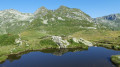
(1) On your return from this detour, head back onto the track by climbing up to the right. Follow it, taking three tight bends, to reach Lac de l’Arpettaz at an altitude of 1,945 metres.
(3) Facing the lake, take the path on the left, which becomes steeper; keep going straight on. You’ll reach the Grand Plan, the highest point of the route (2,110 m).
(4) Then head down into the Combe du Bridan towards Lac du Branlay at the 2,032-metre altitude. Keep to the left and walk for about twenty metres along the lakeshore. From here, the Pic de Rognolet towers above at 2,659 metres, and the Valmorel ski resort beckons.
(5) Head down the main path on the left, then cross one of the tributaries of the Ruisseau du Bridan. Continue straight down towards the valley, staying on the main path. Pass the Chalet d’Alpage du Queigey on your right. This brings you to the lowest point of the route, at 1,760 m, marked by a signpost indicating ‘Queigey’.
(6) Then turn left onto the path that climbs up the southern slope of the Combe du Bridan to the Refuge du Logis des Fées (S/E).

 Visorando Member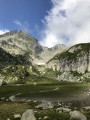

 Difficult
  Tourism professional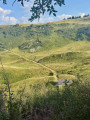
 Local authority
 Very difficult
  Easy
Easy 
