


 Country:

 City:
City:


(S) Take the path that runs alongside the annexe of the Refuge du Logis des Fées and continue to the first junction above the Bridan chalets, heading towards Celliers.
(1) Turn left, cross the road several times, and rejoin it at the lowest point.
(2) Turn right onto the road and follow it for about a hundred metres until you reach the D213.
(3) Cross it and continue along the path, which gradually levels out before beginning the ascent – a rather uninspiring climb, despite a final, somewhat strenuous steep section – before emerging at the Col de la Madeleine, a major tourist attraction.
(4) At the southern car park, turn left onto the track that runs along the mountainside past the chairlifts to the lower station of the Frêne chairlift.
(5) Turn right towards the Col du Cheval Noir, heading due south. Join the ascent to the pass after passing the Cours d’en Haut. From here, the climb gradually steepens and the condition of the path deteriorates just as gradually. Get your walking poles, hands and knees ready. You’ll need to be patient and careful here, as the climb is long despite the gentle gradient on the rough section. You’ll then reach the Col du Cheval Noir.
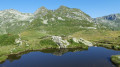
(6) Turn right and descend towards the first lake (E), which is more suitable for camping than the other.
 Local authority
 Moderate
  Visorando Member
 Tourism professional
 Very difficult
  Easy
Easy 
