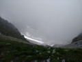
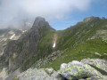
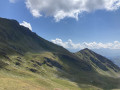
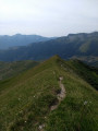
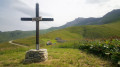
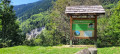
Sarvatan Pass as seen from the Col de la Madeleine road

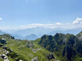
Difficult hike: the path climbs quite steeply and, on a short stretch just before the pass, the path is very narrow. After crossing meadows with characteristic flora, you end up in a more rocky, wild environment. Once you’ve rounded the first ridges, you immediately feel far from civilisation, were it not for the presence of a few marmots.

Details

1280767
Creation:
Last update:
Last review:
  • Walking
    Activity: Walking
  • ↔
    Distance: 2.70 mi
  • ◔
    Average duration: 2h 45 
  • ▲
    Difficulty: Difficult

  • ⚐
    Back to start: Yes
  • ↗
    Ascent: + 1,772 ft
  • ↘
    Descent: - 1,772 ft

  • ▲
    Highest point: 8,002 ft
  • ▼
    Lowest point: 6,220 ft

Photos

Description of the walk

You park at the bottom of the Lauzière chairlift, just before the Col de la Madeleine.

(S/E) You first pass beneath the chairlift’s lower station. The path then heads westwards. It begins with an easy walk to a signpost.

(1) As indicated, the Col de Sarvatan path branches off to the right. As it’s not a very busy route, it isn’t very well marked at the start. It’s signposted along the entire route with a yellow line. You’ll have no trouble following it from there on. The path soon starts to climb and there’s hardly any respite before the summit.

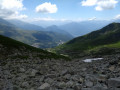
(2) After following it for a while, you’ll need to cross a scree slope. The cairns are more visible than the yellow markings (don’t forget to add to them). The ‘right’ path across this scree slope isn’t obvious… The exit from the scree slope, however, is clearly visible, so you can head straight for it. After that, the route heading north-west is obvious.

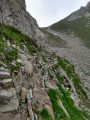
(3) You’re not far from the pass now, but for a short stretch (a few metres), the path becomes very narrow, running along the side of a steep slope. There’s always room to place one foot flat, and you can steady yourself on the left using your hands on good handholds in the rock. After a final grassy slope, you reach the pass. A small low wall on the left provides shelter from the wind, which is often strong here.

(5) The return journey follows the same route back to the chairlift departure point (S/E).
Waypoints

  1. S/E : mi 0 - alt. 6,230 ft - Car park at the Lauzière chairlift
  2. 1 : mi 0.4 - alt. 6,362 ft - Signpost
  3. 2 : mi 0.79 - alt. 6,985 ft - Crossing the scree slope
  4. 3 : mi 1.2 - alt. 7,723 ft - Directly below the pass
  5. 4 : mi 1.35 - alt. 8,002 ft - Col de Sarvatan
  6. S/E : mi 2.7 - alt. 6,230 ft - Car park at the Lauzière chairlift

Notes

The path is marked in yellow. Where the markings are unclear, such as when crossing the scree slope, cairns are used to reinforce the markings.

There may be snowfields on the path. Personally, I prefer to avoid them and go round them.

Reviews and comments

4.8 / 5
Based on 3 reviews

Reliability of the description
5 / 5
Ease of following the route
4.7 / 5
Route interest
4.7 / 5
PUBOL
PUBOL

Overall rating : 5 / 5

Date of your route : Jul 24, 2026
Reliability of the description : ★★★★★ Very good
Ease of following the route : ★★★★★ Very good
Route interest : ★★★★★ Very good
Very busy route : No

It’s always a treat to do Sarvatan, despite the difficulty
A breathtaking landscape
A great workout

Machine-translated

mg.co
mg.co
• Edited:

Overall rating : 4.7 / 5

Date of your route : Jul 10, 2022
Reliability of the description : ★★★★★ Very good
Ease of following the route : ★★★★☆ Good
Route interest : ★★★★★ Very good
Very busy route : No

A really lovely hike. Not many people out and about because of the difficulty. We really enjoyed the scenery, and in the end decided to take the route round the back to the Col de Montjoie. Stunning, and less challenging on the way down. We’d definitely recommend it.

Machine-translated

maumorando21
maumorando21

Overall rating : 4.7 / 5

Date of your route : Aug 13, 2021
Reliability of the description : ★★★★★ Very good
Ease of following the route : ★★★★★ Very good
Route interest : ★★★★☆ Good
Very busy route : No

Return via the Col de Montjoie. An easy route to follow. Between the two passes, you have to go down and then back up again, which adds an extra 200 metres of elevation gain.
A lovely walk enjoyed in fine weather.

Machine-translated

Other walks in the area

For more walks, use our search engine .

The GPS track and description are the property of this route's author. Please do not copy them without permission.