Mont Bellacha from Lachat

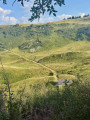
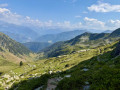
A lovely little hike for the start of the season or for exploring the high mountains with the family, which starts off along some forgotten paths.

Details

23916789
Creation:
Last update:
Last review:
  • Walking
    Activity: Walking
  • ↔
    Distance: 7.20 mi
  • ◔
    Average duration: 5h 40 
  • ▲
    Difficulty: Difficult

  • ⚐
    Back to start: Yes
  • ↗
    Ascent: + 2,740 ft
  • ↘
    Descent: - 2,740 ft

  • ▲
    Highest point: 8,130 ft
  • ▼
    Lowest point: 6,050 ft

Photos

Description of the walk

Access via the Tarentaise and the ascent of the Col de la Madeleine. Just before Villard-Benoît, turn right towards Lachat and park on the right-hand side next to the chalet.

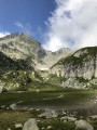
(S/E) Take the track heading west to the right of the car park and leave it shortly after an altitude of 1959 metres; follow old tracks – some well-trodden, others less so – to reach the Lacs du Loup.

(1) At the lakes, head up the slope opposite and, at the junction, turn right to go round the rocky outcrop and reach the junction of the circular route.

(2) ‘Note the descent route via La Cave on the right; follow this on the way back.’
Continue straight ahead along the path. At the altitude of 1965, ignore a path on the right and pass beneath the Pas de la Mule and the Pointe des Marmottes Noires (didn’t spot a single one).

(3) Carry on to a lovely little chalet on a flat area. The pyramidal summit you can see is Mont de la Perrière; the Bellacha is hidden behind it.

(4) After the chalet, the route remains obvious as you traverse beneath the Perrière.

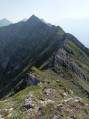
(5) Carry on, and the Bellacha comes into view; the final slopes present no particular difficulties.

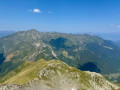
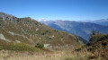
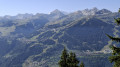
(6) At the summit, admire the magnificent 360° panorama, then descend back to the junction of the circular route.

(2) Turn left towards La Cave, where a refreshing spring awaits you.

(7) Ignore a path on the left and carry on along the track which climbs a little further on.

(8) Turn right to rejoin the road leading to the car park (S/E).

Waypoints

  1. S/E : mi 0 - alt. 6,306 ft - Chalet de Lachat
  2. 1 : mi 0.67 - alt. 6,312 ft - Lacs du Loup
  3. 2 : mi 1.24 - alt. 6,490 ft - Junction of the circular loop
  4. 3 : mi 2.5 - alt. 7,149 ft - Beneath the - Pointe des Marmottes Noires
  5. 4 : mi 2.87 - alt. 7,467 ft - The chalet
  6. 5 : mi 3.4 - alt. 7,756 ft - Beneath the - Mont de la Perrière
  7. 6 : mi 3.72 - alt. 8,130 ft - Mont Bellacha
  8. 7 : mi 6.58 - alt. 6,070 ft - La Cave. Source
  9. 8 : mi 6.91 - alt. 6,191 ft - Junction
  10. S/E : mi 7.2 - alt. 6,306 ft - Chalet de Lachat

Notes

After passing beneath Les Teurs and before the junction with the path leading up from Gelon, the path is no longer passable and a diversion has been put in place, adding 70 metres of elevation gain.

Reviews and comments

4.4 / 5
Based on 3 reviews

Reliability of the description
4.3 / 5
Ease of following the route
4 / 5
Route interest
5 / 5
Michel.at
Michel.at
fletcher_fr
fletcher_fr

Thank you for your feedback.
It would be helpful if you could send me your GPX track so that I can amend the route.
Happy hiking, Guy

Machine-translated

JCParavy
JCParavy

Overall rating : 4.7 / 5

Date of your route : Aug 12, 2026
Reliability of the description : ★★★★★ Very good
Ease of following the route : ★★★★☆ Good
Route interest : ★★★★★ Very good
Very busy route : No

We completed the hike, roughly following the route, in good conditions given the heatwave in the lowlands, but the misty weather meant we couldn’t see very far (Mont Blanc and the Vanoise were barely visible, and the Écrins not at all).
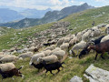
There were cows at Lachat, which we had to go round to reach the Lacs du Loup, then a flock of sheep and goats near the little shepherd’s hut at Les Marmottes Noires: we had to be patient when the flock was on the path, given the sheepdogs keeping watch over them, but the shepherds weren’t far away.
I can confirm that just before the Pissus junction (on the ascent), the section crossing a slope where the ground is slippery is no longer part of the signposted path; instead, the path takes a detour higher up via a new track – very beautiful but also very steep – which involves a 70-metre climb… ...which is all for nothing as you descend again to the junction at 1,965 metres. The old route, which has become treacherous, can be taken with care, but only when the ground is dry.
Down below, the blueberries were ripe.
A lovely hike, highly recommended. Please note, it’s longer than the elevation gain suggests, as there are numerous short ascents and descents.

Machine-translated

Michel.at
Michel.at

Hello,

I don’t agree with the ‘thumbs up’ comment on this walk: at the start of the season, there are snowfields and with children… What’s more, the access road and the final 9 km of winding road are bound to take their toll…
Furthermore, below Les Teurs, a section of the path sloping across sandy scree is no longer passable. You have to take a track (somewhat cleared) which climbs to the left towards Les Teurs and takes you over a hump before descending again to rejoin the path.
There is little signposting on this little-used route. The alpine farmer advised us against approaching the Lacs du Loup from the south. We took this route on the way back, and three-quarters of the journey from the Lacs du Loup to the mountain pasture is entirely off-trail.

Machine-translated

jimv
jimv

Overall rating : 4.3 / 5

Date of your route : Aug 09, 2025
Reliability of the description : ★★★★☆ Good
Ease of following the route : ★★★★☆ Good
Route interest : ★★★★★ Very good
Very busy route : No

A beautiful hike, but the trail is difficult to follow without a map
The signs indicate a 4.5-hour climb! This is far from the estimate on the website. The climb took 4 hours and the descent 3 hours (not including breaks to pick blueberries)
Thanks to the author

Machine-translated

gilloua73
gilloua73

Overall rating : 4.3 / 5

Date of your route : Aug 21, 2023
Reliability of the description : ★★★★☆ Good
Ease of following the route : ★★★★☆ Good
Route interest : ★★★★★ Very good
Very busy route : No

Sometimes, you need to pay attention to the ground markings, as they’re very poorly marked – especially where the scree slopes cross the path. Look carefully into the distance to spot the path. Otherwise, it’s a magnificent walk, with a spectacular 360-degree view from the summit. Between the Tarentaise and Maurienne valleys’s simply sublime.

Machine-translated

Other walks in the area

For more walks, use our search engine .

The GPS track and description are the property of this route's author. Please do not copy them without permission.