Route in Saint-Georges-d’Hurtières

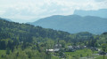
A short walk climbing from Lac d’Huretières to the village of Saint-Georges.
The lake, a former gravel pit, features a leisure area and a protected area.
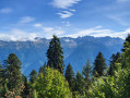
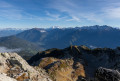
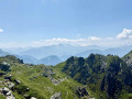
Along the way, there are beautiful views of the Lauzière mountain range.

Details

n°553953
Creation:
Last update:
Last review:
  • Walking
    Activity: Walking
  • ↔
    Distance: 7.14 mi
  • ◔
    Average duration: 4h 00 
  • ▲
    Difficulty: Moderate

  • ⚐
    Back to start: Yes
  • ↗
    Ascent: + 827 ft
  • ↘
    Descent: - 833 ft

  • ▲
    Highest point: 1,952 ft
  • ▼
    Lowest point: 1,106 ft

Description of the walk

(S/E) Park in the large car park at Lac d’Hurtières, then set off along the western shore of the lake.

(1) At a small bar, turn left towards a wide track outside the site.

(2) When you reach the track, turn right and walk for 1 km.

(3) At the junction, turn right; 250 metres further on, turn left and continue to the next junction.

(4) Leave the track and take the level path that runs alongside a small stream without crossing it. (Several wooden footbridges allow you to cross the stream’s branches.) Return to the track.

(5) Turn left onto the stony track for a short climb, until you reach a road.

(6) Head left up the road and continue until you reach a junction.

(7) Turn right and continue uphill; after 4 hairpin bends, you’ll find a path on the left 30 metres before the end of the road.

(8) Continue uphill, joining the path. Near a sewage treatment plant, join a wider track and follow it to reach a road.

(9) Turn left onto the road and join the D73. Continue to the left until you reach the church at Saint-Georges-d’Hurtières.

(10) Turn left and head downhill, passing to the left of the Town Hall. Continue down the path that follows on from the road, passing alongside a fitness trail, then carry on downhill along a footpath.
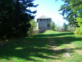
You’ll come out onto a wider track near a barn.

(11) Turn right to continue downhill and rejoin the road.

(12) Turn right onto the road, then leave it 60 metres further on to take a footpath on the left. Head downhill to rejoin the track.

(4) Follow the same route back along the track you took on the way out, which leads back to the car park (S/E)

Waypoints

  1. S/E : mi 0 - alt. 1,158 ft - Lake car park
  2. 1 : mi 0.17 - alt. 1,152 ft - Building
  3. 2 : mi 0.27 - alt. 1,152 ft - Track
  4. 3 : mi 0.93 - alt. 1,142 ft - Bend
  5. 4 : mi 1.52 - alt. 1,125 ft - Watercourses
  6. 5 : mi 2.36 - alt. 1,109 ft - Track
  7. 6 : mi 2.59 - alt. 1,253 ft - Road
  8. 7 : mi 2.87 - alt. 1,381 ft - Junction
  9. 8 : mi 3.32 - alt. 1,581 ft - Path
  10. 9 : mi 3.84 - alt. 1,926 ft - Road
  11. 10 : mi 4.25 - alt. 1,923 ft - Church
  12. 11 : mi 5.06 - alt. 1,457 ft - Track and barn
  13. 12 : mi 5.27 - alt. 1,352 ft - Road
  14. S/E : mi 7.14 - alt. 1,158 ft - Lake car park

Worth a visit

Panorama information board near the Church of Saint-Georges.

Reviews and comments

4.3 / 5
Based on 2 reviews

Reliability of the description
5 / 5
Ease of following the route
5 / 5
Route interest
3 / 5
User 408825

Overall rating : 4.7 / 5

Date of your route : Sep 22, 2025
Reliability of the description : ★★★★★ Very good
Ease of following the route : ★★★★★ Very good
Route interest : ★★★★☆ Good
Very busy route : No

we did it in 3 hours walking at a normal pace

Machine-translated

Robert Gardette
Robert Gardette

Overall rating : 4 / 5

Date of your route : Jul 02, 2020
Reliability of the description : ★★★★★ Very good
Ease of following the route : ★★★★★ Very good
Route interest : ★★☆☆☆ Disappointing
Very busy route : No

In its lower reaches, the route runs alongside a small river called ‘la Glaire’. This watercourse creates a marshy area where mosquitoes breed, and they are a real nuisance.

Machine-translated

Other walks in the area

For more walks, use our search engine .

The GPS track and description are the property of this route's author. Please do not copy them without permission.