Cheminées des Fées, starting from Saint-François-Longchamp

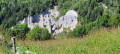
The ‘demoiselles coiffées’ (topped rock formations), known locally as the Cheminées des Fées, are a unique feature resulting from the erosion of the landscape by water runoff.

Details

62433003
Creation:
Last update:
Last review:
  • Walking
    Activity: Walking
  • ↔
    Distance: 2.59 mi
  • ◔
    Average duration: 1h 55 
  • ▲
    Difficulty: Moderate

  • ⚐
    Back to start: Yes
  • ↗
    Ascent: + 856 ft
  • ↘
    Descent: - 863 ft

  • ▲
    Highest point: 4,459 ft
  • ▼
    Lowest point: 3,596 ft

Photos

Description of the walk

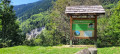
Head into the Maurienne Valley as far as La Chambre, then take the D213 – the Col de la Madeleine road – towards Saint-François-Longchamp. After the hamlet of L’Epalud, park in the Cheminées des Fées car park.

(S/E) Head down the D213 towards l’Epalud and you’ll soon reach a Y-junction.

(1) Turn right onto the Chemin des Demoiselles and continue down the path until you reach the Bugeon stream.

(2) Turn left, skirting a reservoir on your left. You’ll reach a viewpoint facing the ‘Demoiselles Coiffées’.

(3) Continue downhill to reach the junction with the Route du Bon Mollard.

(4) Turn left onto this road and begin the winding ascent; after the bends, you’ll find a grassy path leading towards Planet.

(5) Turn left onto this path towards Planet and the Sainte-Anne Chapel. At the first house, you’ll reach a tarmac road and spot a house decorated with flowers. Take the path between the flower-decorated house and the bus shelter. Climb a staircase made of logs, walk past the town hall, then take the grassy path to reach the Route du Col de la Madeleine. Turn left onto this road for a few metres until you reach a path junction.

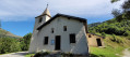
(6) Turn right onto this path, signposted: Station Haute. Please note that the path is not very visible as the grass covers part of it. Continue to the Chapelle Sainte-Anne. Cross the D213 and, shortly afterwards, reach the Ruisseau de l’Ourtier.

(7) Cross the stream, then turn right and, at the Epalud junction, continue left onto the D213 to reach the Chemin des Fées junction, which you passed on the way there.

(1) Return to the D213, heading in the opposite direction to the outward journey, and this will take you to the Cheminées des Fées car park (S/E).

Waypoints

  1. S/E : mi 0 - alt. 4,459 ft - Cheminées des Fées car park
  2. 1 : mi 0.1 - alt. 4,400 ft - Crossroads marking the end of the circular loop
  3. 2 : mi 0.41 - alt. 4,232 ft - Torrent du - Bugeon (torrent)
  4. 3 : mi 0.7 - alt. 3,934 ft - Viewpoint
  5. 4 : mi 1.08 - alt. 3,596 ft - Junction towards Le Bon Mollard
  6. 5 : mi 1.66 - alt. 3,914 ft - House decorated with flowers. Fork in the road
  7. 6 : mi 1.88 - alt. 4,124 ft - D213. Fork in the road
  8. 7 : mi 2.14 - alt. 4,213 ft - Ourtier stream
  9. S/E : mi 2.59 - alt. 4,452 ft - Cheminées des Fées car park

Worth a visit

(3) The closest viewpoint to the Cheminées des Fées.
Between (6) and (7) Sainte-Anne Chapel: enjoy the view of the ‘Demoiselles’ from here.

Reviews and comments

4.7 / 5
Based on 2 reviews

Reliability of the description
5 / 5
Ease of following the route
5 / 5
Route interest
4 / 5
Cessou73
Cessou73

Overall rating : 4.3 / 5

Date of your route : May 03, 2026
Reliability of the description : ★★★★★ Very good
Ease of following the route : ★★★★★ Very good
Route interest : ★★★☆☆ Average
Very busy route : Yes

Peaceful and good for keeping fit. I’d say it’s great practice before tackling longer hikes!

Machine-translated

User 19921719

Overall rating : 5 / 5

Date of your route : Aug 21, 2025
Reliability of the description : ★★★★★ Very good
Ease of following the route : ★★★★★ Very good
Route interest : ★★★★★ Very good
Very busy route : No

A very beautiful hike. You descend for about an hour and then begin the climb back up gently, following switchbacks, then flat ground and small climbs that are not too difficult. Definitely worth doing

Machine-translated

Other walks in the area

For more walks, use our search engine .

The GPS track and description are the property of this route's author. Please do not copy them without permission.