Lac de la Grande Léchère mountain hut – Montartier Lakes

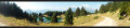
A lovely climb through the upper pastures where the cows that produce the milk for Beaufort cheese graze, with views of the Vanoise, the Thabor Massif, the Aiguilles d’Arves and the foothills of the Écrins. Then the route changes direction, offering views of Belledonne, the Chartreuse and the Bauges, before setting up camp at the Montartier Lakes.

This walk is part of a multi-day hike: Tour de la Lauzière

Details

99322463
Creation:
Last update:
Last review:
  • Walking
    Activity: Walking
  • ↔
    Distance: 10.81 mi
  • ◔
    Average duration: 8h 55 
  • ▲
    Difficulty: Difficult

  • ⚐
    Back to start: No
  • ↗
    Ascent: + 4,577 ft
  • ↘
    Descent: - 3,084 ft

  • ▲
    Highest point: 7,451 ft
  • ▼
    Lowest point: 5,518 ft

Description of the walk

(S) Turn back from the refuge and head up the track until you reach the junction for Col Montjoie, the crossroads you passed the previous day.

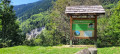
(1) Head left up a gentle slope along the easy track running alongside the Ruisseau de la Grande Rigole. Reach the end of this track at the Chalet des Bergers.

(2) Continue straight on along the path that follows and reach a junction with a signpost.

(3) Turn left towards the Col de Montjoie, continue the ascent along this well-marked grassy ridge path and reach the Col de Montjoie

(4) Descend westwards along a stony path for a long descent until you reach the junction at the Col Sarvatan.

(5) Continue left, first downhill then along a ridge path, until you reach the first hairpin bends of the climb to the Croix de la Coutire.

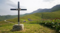
(6) Turn right onto a very steep climb with sharp hairpin bends until you reach the ridge of the Croix de la Coutire.

(7) Ignore the path leading to the cross and head down to the right along a narrow track towards the Cabane de la Ruche. Pass it and continue down a gentle slope to the Chalet Pierre du Chasseur.

(8) Resume the climb and pass the Crête des Rochers des Hirondelles before descending to the Chalet de l’Arbesserie.

(9) Climb gently towards Champ Rosse. Reach the crossroads at the Chalet de Côte Enverse.

(10) Keep to the right, cross Champ Rosse and then descend to the Chalet de la Balme dessus.

(11) Stay on the ledge and continue towards Lac de Clartan. First, pass the north-west ridge of the Roche Noire – take care: steep sections – to reach the fork at the Montartier shelter.

(12) Turn right at the ruins and head for the Lacs de Montartier (E), today’s destination.

Waypoints

  1. S : mi 0 - alt. 5,518 ft - Lac de la Granche Léchère
  2. 1 : mi 0.65 - alt. 5,735 ft - Junction towards the Col Motjoie
  3. 2 : mi 2.6 - alt. 6,647 ft - Cabane des Bergers
  4. 3 : mi 2.9 - alt. 6,975 ft - Maxet Ridge
  5. 4 : mi 3.44 - alt. 7,411 ft - Col de Montjoie
  6. 5 : mi 4.18 - alt. 6,785 ft - Junction towards the Col de Sarvatan
  7. 6 : mi 5.32 - alt. 6,496 ft - Ascent to the Croix de Coutire
  8. 7 : mi 5.54 - alt. 6,745 ft - Croix de la Coutire
  9. 8 : mi 6.8 - alt. 6,339 ft - Chalet de Pierre du Chasseur
  10. 9 : mi 7.47 - alt. 6,152 ft - Chalet de l'Arbesserie
  11. 10 : mi 7.81 - alt. 6,198 ft - Crossroads towards L’Enverse
  12. 11 : mi 9.37 - alt. 6,234 ft - Chalet de la Balme above
  13. 12 : mi 10.51 - alt. 6,654 ft - Junction towards the Montartier Lakes
  14. E : mi 10.81 - alt. 7,011 ft - Lacs de Montartier

Notes

(8) Chalet Pierre du Chasseur (basic shelter).
(9) Spring at the Chalet de l’Arbesserie, situated below.
(E) Montartier Lakes: campsite.

Other walks in the area

For more walks, use our search engine .

The GPS track and description are the property of this route's author. Please do not copy them without permission.