The Balcons de Saint-François-Longchamp

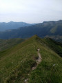
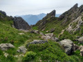
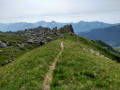
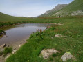
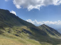
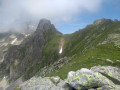
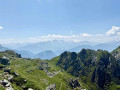
This route takes you through what I consider to be one of the most beautiful areas in the municipality: Les Balcons. It boasts a rich diversity of flora, fauna and geology, as well as varied landscapes and terrain. All this in a place that feels wild and far from civilisation.
See the ‘Practical information’ section regarding the path after the (3).

Details

2486158
Creation:
Last update:
Last review:
  • Walking
    Activity: Walking
  • ↔
    Distance: 4.37 mi
  • ◔
    Average duration: 3h 10 
  • ▲
    Difficulty: Easy

  • ⚐
    Back to start: Yes
  • ↗
    Ascent: + 1,348 ft
  • ↘
    Descent: - 1,322 ft

  • ▲
    Highest point: 7,372 ft
  • ▼
    Lowest point: 6,112 ft

Photos

Description of the walk

Park in a lay-by on the road marked as a car park on the map, below the Chalets du Cours d’en Haut.

(S/E) Follow this road until you reach the signpost indicating the Lac Bleu path at a three-way junction.

(1) Turn left and carry on to Lac Bleu. The path climbs more or less alongside a ski lift and continues further up.

(2) If you wish, without adding much to the walk, you can visit Lac Blanc, but our route takes us via Lac Bleu, which has an impressive blue colour despite the water’s clarity. A very beautiful spot. Follow the path alongside this lake and rejoin the grey path you left at the top of the chairlift, on the other side.

(3) The IGN map shows a path leading off opposite towards Les Balcons. This is what’s shown on the attached map. For my part, I climbed higher up this grey path until I reached a flat area. You then need to cross the track towards the start of the path, which is clearly visible opposite, on the slope.

(4) It’s a lovely path along the mountainside. However, there’s a very short section where it becomes narrower and slopes steeply. This is no doubt due to the crumbly nature of the ground. Depending on its condition on the day you’re walking, it might be wiser to turn back.
On that particular day, it was safe to cross. Afterwards, you make your way between sinkholes—still covered in snow in July—and rocky outcrops, before reaching a flatter section with a small lake (a large pool).

(5) The path then follows the edge of the ledge. There’s a bit of a ‘run’ before reaching a lovely stretch near the Roche Cornue.

(6) This is followed by the start of the descent along the fairly narrow ridge to the top of the ski lift.

(7) The descent continues to the right along a well-marked path that is very uneven due to livestock grazing.

(8) Join the gravel road and follow it back.

(1) Carry on straight ahead towards the (S/E) .

Waypoints

  1. S/E : mi 0 - alt. 6,155 ft - Car park
  2. 1 : mi 0.09 - alt. 6,201 ft - Crossroads of the circular loop
  3. 2 : mi 0.97 - alt. 7,031 ft - Lac Bleu / Lac Blanc junction
  4. 3 : mi 1.14 - alt. 7,083 ft - Access trail to Les Balcons
  5. 4 : mi 1.36 - alt. 7,169 ft - Narrow section
  6. 5 : mi 2.15 - alt. 7,201 ft - On the edge of the balcony
  7. 6 : mi 2.49 - alt. 7,142 ft - Exit ridge
  8. 7 : mi 2.66 - alt. 6,923 ft - The top of the “Grand Schuss” ski lift
  9. 8 : mi 3.45 - alt. 6,217 ft - Return via the road
  10. S/E : mi 4.37 - alt. 6,155 ft - Car park

Notes

Apart from the lakes, there is no drinking water along the route.
I’ve noted in the description thatpart of the trail may be very exposed, depending on any landslides that may occur in the area. If this is the case, don’t hesitate to turn back.
It seems you can bypass this section by going via the top of the chairlift.

Reviews and comments

3.8 / 5
Based on 4 reviews

Reliability of the description
4.3 / 5
Ease of following the route
3.5 / 5
Route interest
3.8 / 5
aldesr
aldesr

Overall rating : 4.7 / 5

Date of your route : Jul 11, 2024
Reliability of the description : ★★★★★ Very good
Ease of following the route : ★★★★★ Very good
Route interest : ★★★★☆ Good
Very busy route : Yes

Hello, the walk starts at the top of the Madeleine chairlift (accessible from the Col, with views of Mont Blanc), passes by the lakes, and ends at the top of the Grand Schuss ski lift.

It’s an easy walk if you want to enjoy the mountains on this side of the slope. In other words, without constantly having the SFL apartment blocks and the bottom of the slopes in view.

Nothing out of the ordinary about the route suggested here. It’s the classic ‘Rocher Blanc’ route towards the lakes (and the Cheval Noir), signposted from the car park on the Buffaz gravel road.

However, in my opinion, it’s much prettier if you turn off at the Chalets du Cours d’En Haut to follow a pastoral path along this stream, which joins the ridge closer to the Madeleine chairlift. This less-frequented route is not signposted towards the lakes, the Madeleine or the Cheval Noir.

Machine-translated

POULIN Gérard
POULIN Gérard ★

Hello annasteeljo,
One of Visorando’s aims is to provide a route with a description that is as comprehensive and accurate as possible. Signposting is a bonus when it is continuous and in perfect condition. Local authorities are not obliged to provide signposting.

Machine-translated

annasteeljo
annasteeljo

Overall rating : 2.7 / 5

Date of your route : Oct 20, 2021
Reliability of the description : ★★★☆☆ Average
Ease of following the route : ★★★☆☆ Average
Route interest : ★★☆☆☆ Disappointing
Very busy route : No

No efforts have been made by the municipality of St François to mark out trails. Only skiing is catered for, and it is a pity that hiking is not being developed in a location that will soon suffer the effects of global warming...

Machine-translated

TIQUET
TIQUET

Overall rating : 4 / 5

Date of your route : Jul 23, 2020
Reliability of the description : ★★★★☆ Good
Ease of following the route : ★★★★☆ Good
Route interest : ★★★★☆ Good
Very busy route : No

From (3), take the track leading to the top of the Soleil Rouge chairlift, then head down alongside the chairlift poles to rejoin the path.

Machine-translated

henri57
henri57 ★

Hello,

Thank you for taking the time to give your feedback.

‘Route on map’ does not refer to assessing the signposting, but rather to checking whether the route as shown on the map matches the actual terrain.

No route, thank you GPS

I take it that the route is ‘correct’

See you soon

Machine-translated

ciom5511
ciom5511

Overall rating : 4 / 5

Date of your route : Feb 10, 2020
Reliability of the description : ★★★★★ Very good
Ease of following the route : ★★☆☆☆ Disappointing
Route interest : ★★★★★ Very good

No route, thanks GPS

Machine-translated

Other walks in the area

For more walks, use our search engine .

The GPS track and description are the property of this route's author. Please do not copy them without permission.