


skyppyy38360

 Visorando Member
 Premium user
 - Location: Sassenage (38360)
- Gender: man
- Website: https://www.facebook.com/Randonnees.et.randonnees/
Sign up:
Published route(s)
 Promenade des Batteries via Château de Sassenage - Le Furon
 5.64 mi
 +1,033 ft
 -1,030 ft
 3h 30
3h 30
 Average
 Departure from Sassenage (Isère)
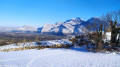
A well-known local walk, presenting no difficulty. It takes you to the heights of Sassenage, as well as some pleasant neighbourhoods and the village centre. The "Batteries" are a defensive structure from the "iron belt" of the late 19th century: several battery emplacements, now empty of their artillery pieces. Find out about their former function.
From Sassenage to Engins via the Pont Charvet, returning along the left bank of the Furon
 8.59 mi
+2,720 ft
-2,720 ft
6h 20
8.59 mi
+2,720 ft
-2,720 ft
6h 20
 Difficult
Departure from Sassenage (Isère)
Difficult
Departure from Sassenage (Isère)
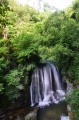
Explore the Gorges du Furon from Sassenage, via the Chemin des Cuves and, a little further up, the Pont Charvet (Resistance memorial).
Do not attempt in wet weather: very steep paths for 2 hours with an 800-metre elevation gain.
After that, the route via Engins and back to Sassenage is straightforward.
Vercors: Circular Central trail, via the GR®91 and Bacha de l'Ours
 10.73 mi
+1,867 ft
-1,867 ft
6h 35
Difficult
Departure from Saint-Agnan-en-Vercors (Drôme)
10.73 mi
+1,867 ft
-1,867 ft
6h 35
Difficult
Departure from Saint-Agnan-en-Vercors (Drôme)
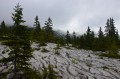
This hike combines two Visorandonneurs routes and part ofthe GR®91. Starting with the central trail and ending with Bacha de l'Ours, it seems easier. You can discover the splendidGR®91from south to north over a short distance to gauge your ability to go further.
Villard-de-Lans: From Les Clots to Col Vert, return via Combe Charbonnière
 6.91 mi
+2,152 ft
-2,126 ft
5h 05
Average
Departure from Villard-de-Lans (Isère)
6.91 mi
+2,152 ft
-2,126 ft
5h 05
Average
Departure from Villard-de-Lans (Isère)
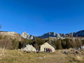
Climb from the very pretty spot called Les Clots towards the Col Vert and descend via the Combe Charbonnière, a scree slope that is a little tricky to navigate. View of the Belledonne massif from the Col.
This allows you to get a good view of the Vercors landscapes and enjoy the variety of the mid-mountain terrain.
Not to be attempted in winter! Between 6 and 7, there is a high risk of avalanches, especially towards the Combe de la Charbonnière.
Saint-Nizier - Lans-en-Vercors circular via Le Moucherotte
 11.50 mi
+3,675 ft
-3,684 ft
8h 30
Difficult
Departure from Saint-Nizier-du-Moucherotte (Isère)
11.50 mi
+3,675 ft
-3,684 ft
8h 30
Difficult
Departure from Saint-Nizier-du-Moucherotte (Isère)
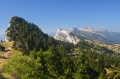
A fairly long circular route (20 km in reality) which takes you up the classic Moucherotte climb, but descends via the Pas de la Tinette, Les Jeux and Les Traverses, which are less well known.
The return from Lans-en-Vercors to Saint-Nizier is via a new, well-marked and well-maintained path, which keeps hikers away from the road.
Water sources below Grand Veymont, starting point: Maison Forestière de la Coche
 11.36 mi
+1,207 ft
-1,198 ft
6h 15
Difficult
Departure from Saint-Agnan-en-Vercors (Drôme)
11.36 mi
+1,207 ft
-1,198 ft
6h 15
Difficult
Departure from Saint-Agnan-en-Vercors (Drôme)
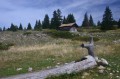
Water sources are rare on the Vercors plateau, but where are they? This long walk will show you four: Pichet, La Chau, Les Serrons and Gerland. Organise group games to find them.
Alpe d'Huez: the Tour des Lacs - from Lac Besson to Lac Carrelet
 4.12 mi
+348 ft
-354 ft
2h 10
4.12 mi
+348 ft
-354 ft
2h 10
 Easy
Departure from Huez (Isère)
Easy
Departure from Huez (Isère)
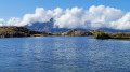
An easy walk at medium altitude, accessible to most people, around the four lakes: Lac Noir, Lac Besson, Lac Faucille and Lac Carrelet, above Alpe d'Huez. Beautiful views of the surrounding mountains. Get off the beaten track by passing by Lac Noir and return above Lac Carrelet and Lac Besson!
Les Allières, Grandes Roches de Saint-Michel and Les Ramées
 7.44 mi
+1,916 ft
-1,913 ft
5h 05
Difficult
Departure from Lans-en-Vercors (Isère)
7.44 mi
+1,916 ft
-1,913 ft
5h 05
Difficult
Departure from Lans-en-Vercors (Isère)
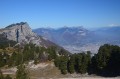
An extraordinary hike, passing through the little-visited Combe Oursière and offering an unusual ascent through the sharp limestone pavement towards Grand Cheval (Grandes Roches de Saint-Michel). Magnificent views over the Trièves, the Taillefer and, in good weather, Mont Blanc. A hike best suited to summer or autumn, requiring a good sense of direction and reserved for experienced walkers.
Walk in the Jean-Jacques Rousseau Desert - Les Vouillants
 3.04 mi
+472 ft
-453 ft
1h 50
Easy
Departure from Seyssinet-Pariset (Isère)
3.04 mi
+472 ft
-453 ft
1h 50
Easy
Departure from Seyssinet-Pariset (Isère)
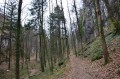
The perfect family walk: easy, fun, with trails that all lead to the same place, Pré Faure.
This circuit is unique in that it passes through the "Désert Jean-Jacques Rousseau", worthy of the greatest romantics, climbs up to the Ferme Froussard, a historic site linked to the Resistance, and returns via a viewpoint offering a superb view of Grenoble and its valley.
More challenging access from the town of Fontaine via the "Coup de Sabre"
The Bastille and Mont Jalla, from the city to the mountains
 5.45 mi
+1,417 ft
-1,411 ft
3h 45
Average
Departure from Grenoble (Isère)
5.45 mi
+1,417 ft
-1,411 ft
3h 45
Average
Departure from Grenoble (Isère)
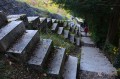
Grenoble, capital of the Alps, is well known. Climbing 400 metres from the centre of the city reputed to be the flattest in France is less common. We suggest a slightly challenging walk to the military memorial on Mont Jalla and, on the way back, discovering the "380 steps".
From Place Bellecour to Notre-Dame-de-Fourvière near the traboules
 4.31 mi
+420 ft
-413 ft
2h 20
Easy
Departure from Lyon (Rhône)
4.31 mi
+420 ft
-413 ft
2h 20
Easy
Departure from Lyon (Rhône)
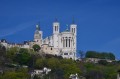
An easy walk through Lyon via the Saint-Jean district, up to Notre-Dame-de-Fourvière, the Saint-Georges district and, finally, near the traboules, these narrow passages between the houses of the Saint-Jean district (see the websites for guided tours).
A visit to the Roman amphitheatres is included, as well as a stop at the Jardin des Curiosités, a little green gem with one of the most beautiful views of Lyon.
Departure from Place Bellecour.
Circular route on the Allières plateau
 7.50 mi
+1,946 ft
-1,942 ft
5h 10
Average
Departure from Lans-en-Vercors (Isère)
7.50 mi
+1,946 ft
-1,942 ft
5h 10
Average
Departure from Lans-en-Vercors (Isère)
A circular route starting from Lans-en-Vercors, with an immediate climb to the little-known Combe du Crêt. This route, which is straightforward to follow, is ideal for exploring the mid-altitude areas of Lans-en-Vercors. You pass through Les Allières and La Sierre, returning to Lans-en-Vercors via the picturesque hamlet of Les Jeux.
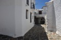
Los Tres Barrios: discover the white villages
 5.53 mi
+1,896 ft
-1,926 ft
4h 10
Average
Departure from Pampaneira (Granada)
5.53 mi
+1,896 ft
-1,926 ft
4h 10
Average
Departure from Pampaneira (Granada)
The 3 white villages of Pampaneira, Bubion and Capileira in Spain's Sierra Nevada are linked by a well-marked footpath that allows you to admire the region without much difficulty for walkers. The welcome is warm, the walkers rare and the scenery magnificent. Unique views from the opposite shore, inaccessible to other tourists in vehicles.
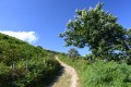
The Mondarrain and Ourrezti peaks in the Basque Country highlands
 4.59 mi
+1,486 ft
-1,486 ft
3h 25
Average
Departure from Itxassou (Pyrénées-Atlantiques)
4.59 mi
+1,486 ft
-1,486 ft
3h 25
Average
Departure from Itxassou (Pyrénées-Atlantiques)
The ascent of Le Mondarrain provides access to a viewpoint covering the Basque Country as far as the sea. Views to the south over a wild landscape, kingdom of birds of prey, horses and local breeds of cattle, which are a little wild as they are free to come and go.
Corrençon circuit via Darbounouse and La Coinchette
 10.98 mi
+1,355 ft
-1,355 ft
6h 15
Difficult
Departure from Corrençon-en-Vercors (Isère)
10.98 mi
+1,355 ft
-1,355 ft
6h 15
Difficult
Departure from Corrençon-en-Vercors (Isère)
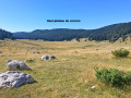
A trail at the gateway to the Vercors plateaus, with the outward journey on theGR®91and the return via La Coinchette.
Most of the route is through woodland, offering views of the Vercors ridges from Darbounouse. The return journey is partly off the beaten track, before rejoining the forest paths via the Baraque Guillet, Les Auberges and La Fleur du Roy.
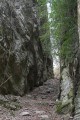
Le Coup de Sabre and La Tour Sans Venin: places of interest in Grenoble
 6.67 mi
+1,522 ft
-1,522 ft
4h 25
Average
Departure from Fontaine (Isère) (Isère)
6.67 mi
+1,522 ft
-1,522 ft
4h 25
Average
Departure from Fontaine (Isère) (Isère)
This walk takes you past a few local points of interest along a varied route with scenic views, without leaving the Grenoble urban area; the start is at the foot of the ‘La Poya’ terminus on Tram Line A.The varied sections through Les Vouillants are described in another walk on Visorando and can be added to the route for experienced walkers.
The Peuil peat bog via Savoyères
 5.59 mi
+1,171 ft
-1,148 ft
3h 35
Average
Departure from Claix (Isère) (Isère)
5.59 mi
+1,171 ft
-1,148 ft
3h 35
Average
Departure from Claix (Isère) (Isère)
This circuit has the advantage of being able to be interrupted at any time for a shorter return. It can also be the starting point for a long hike to Le Moucherotte to the north or the Col de l'Arc to the south. Finally, for very young children, there is a short round trip to the peat bog, a unique feature in this area. The views of the other mountains are only possible from the peat bog, as the rest of the hike is in the woods until Savoyères.
 A route in a bike to discover street art in Grenoble
 6.83 mi
+23 ft
-23 ft
2.5 hrs
Easy
Departure from Fontaine (Isère) (Isère)
6.83 mi
+23 ft
-23 ft
2.5 hrs
Easy
Departure from Fontaine (Isère) (Isère)
Every year, Grenoble organises a Street Art Festival, best explored by bike rather than on foot. This route brings together the main temporary artworks from the last three years, some of which are monumental.
The owners have kindly allowed renowned artists to use their walls and garage doors.
It’s best to set off on this city tour on a Sunday morning around 9.00 am, as there’s less traffic, the light is better and, above all, the shutters on shop fronts and garages are down.
From Col du Joly to Col de la Fenêtre
 4.07 mi
+1,010 ft
-988 ft
2h 45
Average
Departure from Les Contamines-Montjoie (Haute-Savoie)
4.07 mi
+1,010 ft
-988 ft
2h 45
Average
Departure from Les Contamines-Montjoie (Haute-Savoie)
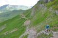
Hike on the trail separating the two passes. This hike offers views of the Mont Blanc massif from both passes. Not particularly difficult, but be careful on the slopes where the trail sometimes climbs quite steeply
The Furon Gorges and the resurgence of the Mermaid Melusine
 1.68 mi
+712 ft
-699 ft
1h 25
Easy
Departure from Sassenage (Isère)
1.68 mi
+712 ft
-699 ft
1h 25
Easy
Departure from Sassenage (Isère)
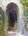
Walk through the Furon Gorges leading to the top of the village, where restaurants once welcomed Grenoble residents seeking coolness on Sundays. This short walk is very popular in hot weather, as the Furon area remains cool.
The Lipari observatory with a view of Vulcano
 3.74 mi
+686 ft
-705 ft
2h 20
Average
Departure from Lipari (Italy)
3.74 mi
+686 ft
-705 ft
2h 20
Average
Departure from Lipari (Italy)
This walk, well known to locals, offers a unique view to the south, towards the island of Vulcano. The vegetation is in full bloom in May. The observatory is run by the Italian Institute of Geophysics and Volcanology and monitors Vulcano.
The Pariset to Saint-Nizier-du-Moucherotte tramway route
 11.07 mi
+2,648 ft
-2,648 ft
7h 25
Difficult
Departure from Seyssinet-Pariset (Isère)
11.07 mi
+2,648 ft
-2,648 ft
7h 25
Difficult
Departure from Seyssinet-Pariset (Isère)
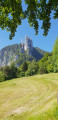
Climbing to Saint-Nizier-du-Moucherotte from Grenoble remains a challenge for most of us, given the distance and elevation gain. It is possible to follow part of the old tramway line at Pariset for a gentler ascent, then descend via theGR®9.
These three circular loops will allow you to discover a particularly overlooked area as you climb.
It is possible to shorten the route from the first circular loop, at the tunnel, or from the second, at a place known as "Blanche Neige"
Circular walk around Saint-Nizier-du-Moucherotte
 3.92 mi
+778 ft
-787 ft
2h 30
Difficult
Departure from Saint-Nizier-du-Moucherotte (Isère)
3.92 mi
+778 ft
-787 ft
2h 30
Difficult
Departure from Saint-Nizier-du-Moucherotte (Isère)
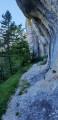
This circular route takes you past several vantage points overlooking the 3 Pucelles.It features a tricky but short section – the passage beneath the cliff, which is narrow and steep but absolutely stunning. (Hence its ‘difficult’ classification).On this walk, you’ll have the chance to enjoy unique views of the village of Saint-Nizier-du-Moucherotte and the local farming landscape, without having to tackle the rather technical climbs of the Pas de la Corne and the Pas du Curé from Engins, or theGR®®9from La Tour sans Venin.
A short circular loop near Le Sornin, starting from La Molière
 4.13 mi
+469 ft
-479 ft
2h 20
Average
Departure from Engins (Isère)
4.13 mi
+469 ft
-479 ft
2h 20
Average
Departure from Engins (Isère)
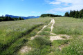
The northern part of the Molière plateau is well worth a visit for its rocky outcrops and lush vegetation.
The suggested circular route follows the “Sentier des Génisses” both out and back, coming close to the Sornin without reaching it, to explore a section ofthe GR®9, which is very wild in this area, both in terms of vegetation and as it winds its way through the sharp limestone pavement.
The return journey along the “Sentier des Génisses” is a delightfully gentle walk.
Discover the Ria de Pouldu
 4.50 mi
+305 ft
-312 ft
2h 20
Easy
Departure from Guidel (Morbihan)
4.50 mi
+305 ft
-312 ft
2h 20
Easy
Departure from Guidel (Morbihan)
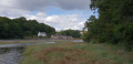
This route opposite the Pouldu marina is a simple, pleasant and varied circular route, touching on theGR®34, which remains one of the most scenic trails in the area. An easy walk along sunken paths at first, then following the Laita river estuary.
The Merdassier Viewpoint
 6.85 mi
+2,664 ft
-2,667 ft
5h 30
Difficult
Departure from La Clusaz (Haute-Savoie)
6.85 mi
+2,664 ft
-2,667 ft
5h 30
Difficult
Departure from La Clusaz (Haute-Savoie)
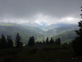
In summer, this gradual climb will take you through the forest, then the mountain pastures to halfway around a beautiful artificial reservoir. (medium level)
You will then climb a very steep forest path (difficult rating) leading to the viewpoint at 1980m, offering an incomparable view of La Clusaz, the Col des Aravis, the Mont Blanc massif and the peaks of the Jura.
The second part of the descent, after the reservoir, is easy and informative (plants and habitats).
Mont Lachat for beginners
 5.57 mi
+2,156 ft
-2,136 ft
4h 25
Average
Departure from Le Grand-Bornand (Haute-Savoie)
5.57 mi
+2,156 ft
-2,136 ft
4h 25
Average
Departure from Le Grand-Bornand (Haute-Savoie)
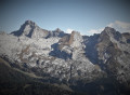
This is a great opportunity to use the Grand-Bornand ski lifts to reach the base or summit of Mont Lachat via a figure-of-eight route, which can also be shortened depending on how far you want to hike.
Beautiful panoramic view of the mountains and peaks surrounding Le Grand-Bornand.
The Mont Blanc massif is not visible from the Mont Lachat viewpoint.
Ideal for beginners in alpine hiking due to its gradual progression and adaptability to different levels.
Le Grand Colombier with return via the Griffe du Diable ridge
 9.11 mi
+1,785 ft
-1,772 ft
5h 45
Average
Departure from Lochieu (Ain)
9.11 mi
+1,785 ft
-1,772 ft
5h 45
Average
Departure from Lochieu (Ain)
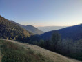
To complete the hike (Le Grand Colombier from the lodge d'Arvière n°1241202), you can extend it from the pass by returning via the Griffe du Diable and Grange d'en Bas ridges.
This trail is less frequented than the one leading to the cross and then to Le Grand Colombier itself, offering you more distant views.
Best done in good weather without snow, this trail seems less suitable for snowshoes.
The Beach and the Piton de Grande Anse
 1.59 mi
+262 ft
-262 ft
1h 00
Easy
Departure from Petite-Île (Réunion)
1.59 mi
+262 ft
-262 ft
1h 00
Easy
Departure from Petite-Île (Réunion)
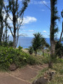
Grande Anse beach is renowned for being almost perfectly suited to a family picnic. For tourists, it also offers the chance to enjoy a fairly short, relaxing discovery walk with a lovely view from the top of the piton.
Beach, shaded areas, picnic spots and viewpoints overlooking the sea or the beach: the epitome of Réunion’s hospitality!
Heading towards Peter Both from the Pavillon
 3.53 mi
+1,729 ft
-1,722 ft
3h 10
Average
Departure from Saint-Louis (La Réunion) (Réunion)
3.53 mi
+1,729 ft
-1,722 ft
3h 10
Average
Departure from Saint-Louis (La Réunion) (Réunion)
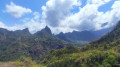
The climb to Cilaos is reputed to be long and tiring – why not stop off at Le Pavillon on the way for a walk that you can extend as far as Peter Both?
The path has just been refurbished by the ONF, much to our delight, and Îlet-Haut is secluded and unspoilt.
A truly unique viewpoint overlooking the peaks of the Cilaos cirque. If you’re heading up to Cilaos for the first time, this is a great introduction to understanding just how isolated the cirque is.
The ‘Chemin des Caves et des Loges’ trail around Mareuil-sur-Cher
 5.75 mi
+341 ft
-348 ft
2h 55
Easy
Departure from Mareuil-sur-Cher (Loir-et-Cher)
5.75 mi
+341 ft
-348 ft
2h 55
Easy
Departure from Mareuil-sur-Cher (Loir-et-Cher)
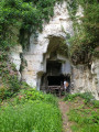
This locally well-known walk will take you on a tour of the countryside around Mareuil-sur-Cher. You’ll discover the quarries where the tuffeau stone was extracted, which was used to build the houses and later to age the wine.
You’ll pass through vineyards and farmland, with views over the Cher from the watchtowers and winegrowers’ tool sheds.
The return journey follows the banks of the Cher to complete this easy circular walk.
From Mareuil-sur-Cher to Saint-Aignan-sur-Cher, following the banks of the Cher
 3.26 mi
+23 ft
-10 ft
1h 30
Easy
Departure from Mareuil-sur-Cher (Loir-et-Cher)
3.26 mi
+23 ft
-10 ft
1h 30
Easy
Departure from Mareuil-sur-Cher (Loir-et-Cher)
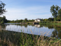
This unpretentious one-way route is an invitation to discover the banks of the Cher and admire one of the remains of the dams regulating the river, complete with its operational building. Partially shaded, it is particularly beautiful and the light is at its best if walked in the afternoon from 4.00 pm in summer. The town of Saint-Aignan is in talks with the riverside landowners to extend the path for the final kilometre and a half.
Journey time (there and back): 3 hours
From Sassenage to Noyarey on the slopes of the Vercors
 3.77 mi
+1,125 ft
-1,119 ft
2h 45
Average
Departure from Sassenage (Isère)
3.77 mi
+1,125 ft
-1,119 ft
2h 45
Average
Departure from Sassenage (Isère)
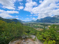
This exploratory hike along the paths on the northern flank of the Vercors should be treated as a training session if it is cold higher up. There are three viewpoints, two of which have been developed.
That said, the constant change in gradient along this route is sure to please any hiker or runner hoping to tackle the drovers' road leading to the Sornin plateau at a later date.
This walk is only enjoyable in dry weather, as the slopes become slippery after rain.
Descend from La Roche de Mio towards La Plagne Bellecôte
 4.47 mi
+0 ft
-2,592 ft
2h 05
Average
Departure from Bellentre (Savoie)
4.47 mi
+0 ft
-2,592 ft
2h 05
Average
Departure from Bellentre (Savoie)
In summer, the resort of La Plagne offers a number of hiking routes that are very accessible thanks to the cable cars.
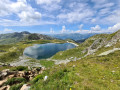
This entirely downhill walk allows you to admire the area from a high vantage point (2,710 m) and discover a varied mountain landscape along a very pleasant path to La Plagne Bellecôte.
Suitable for the whole family, provided everyone can cover this distance; please note that there are no shortcuts if you get tired.
Approach Mont Jovet and the Crête des Étroits via the Pas des Brebis
 6.37 mi
+2,264 ft
-2,244 ft
4h 55
Average
Departure from Aime (Savoie)
6.37 mi
+2,264 ft
-2,244 ft
4h 55
Average
Departure from Aime (Savoie)
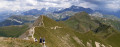
Heading to Mont Jovet via the Tête du Jarset then the Col du Lac and continuing along the Crête des Étroits remains a classic route in La Plagne. However, this ridge walk puts off hikers prone to vertigo due to a few steep slopes.
The suggested route avoids the difficult sections and allows everyone to admire the mountain accessible via the Pas des Brebis. The return journey offers views of the entire resort.
The length and elevation gain mean this circular route is best suited to experienced hikers.
Discover the Montagne de l'Arc via Lac du Carroley
 4.75 mi
+1,496 ft
-1,467 ft
3h 30
Average
Departure from Mâcot-la-Plagne (Savoie)
4.75 mi
+1,496 ft
-1,467 ft
3h 30
Average
Departure from Mâcot-la-Plagne (Savoie)
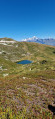
This hike is a longer version of the one suggested by the La Plagne Tourist Office. You will see Les Inversens and the summit of Bellecôte as you pass by the Carroley mountain and its small lake.
You will descend to Belle Plagne via the foot of Mont Saint-Jacques (2,407 m).
Discovering the Val d'Enfer in Les Baux-de-Provence
 3.90 mi
+627 ft
-636 ft
2h 20
Easy
Departure from Les Baux-de-Provence (Bouches-du-Rhône)
3.90 mi
+627 ft
-636 ft
2h 20
Easy
Departure from Les Baux-de-Provence (Bouches-du-Rhône)
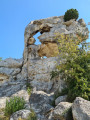
Les Baux-de-Provence is a wonderful village dominated by the Alpilles mountain range, hidden in the middle of a landscape of rugged relief.
This hike takes you deep into the Val d'Enfer, following the ridges along a wide forest path with panoramic views of the Alpilles, before returning to Les Baux-de-Provence for a tour of the neighbourhood.
No difficulty except for the stairs to access the village.
Discovering the mills of Alphonse Daudet
 1.39 mi
+128 ft
-128 ft
0h 45
Easy
Departure from Fontvieille (Bouches-du-Rhône)
1.39 mi
+128 ft
-128 ft
0h 45
Easy
Departure from Fontvieille (Bouches-du-Rhône)
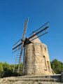
The Provençal writer Alphonse Daudet (1840-1897) spent some time in Fontvieille, where he drew inspiration from the landscapes to write Lettres de mon moulin (Letters from My Mill). This short family route takes you to four mills that are part of Provençal heritage and passes by the Château de Montauban, where Daudet was a guest.
 Le Habert and Croix des Ramées from the Lans-en-Vercors snow stadium
 4.60 mi
+974 ft
-971 ft
3 hrs
Average
Departure from Lans-en-Vercors (Isère)
4.60 mi
+974 ft
-971 ft
3 hrs
Average
Departure from Lans-en-Vercors (Isère)
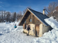
This snowshoe hike takes you along a well-marked trail from the snow stadium in Lans-en-Vercors to the foot of the Grande Roche Saint-Michel (without reaching it).
You will stop in front of the Habert des Ramées, then continue your exploration of the plateau beneath the Grande Roche to reach the viewpoint over the Lans valley from the Croix des Ramées.
The descent to the snow stadium offers different landscapes, even though it is the same path.
From the Frange Verte to the Hauts de Jarrie, return via the Voie Romaine
 5.01 mi
+719 ft
-712 ft
2h 55
Average
Departure from Échirolles (Isère)
5.01 mi
+719 ft
-712 ft
2h 55
Average
Departure from Échirolles (Isère)
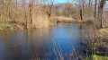
The Grenoble metropolitan area has developed a Frange Verte (Green Belt) to the south, bringing together several walking trails that are popular with everyone and offer views of the mountains.
This route takes you along the Frange Verte in Échirolles, up the Combe de la Gouderie to the Étang de Jarrie-Le-Haut, then down the Voie Romaine, which no longer exists today.
The route is classified as easy, although the climb up the Gouderie may put some people off. Fortunately, it is relatively short.
Les Vouillants, the tramway and the Tour sans Venin
 4.72 mi
+1,115 ft
-1,093 ft
3h 10
Average
Departure from Seyssinet-Pariset (Isère)
4.72 mi
+1,115 ft
-1,093 ft
3h 10
Average
Departure from Seyssinet-Pariset (Isère)
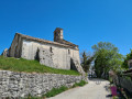
From the Promenade des Vouillants, treat yourself to a little adventure by climbing up to Saint-Nizier-du-Moucherotte on pleasant trails to Pariset. You will return via the tramway, which no longer exists but has been replaced by a very pleasant forest path. You will pass in front of Pariset station, then, after visiting the Tour sans Venin, you will descend to Les Vouillants. Along the way, you will enjoy beautiful views of Moucherotte and the Grenoble valley.
Follow the GR®9 to the Tunnel du Mortier, climbing via Plénouze
 6.62 mi
+1,847 ft
-1,854 ft
4h 40
Average
Departure from Autrans (Isère)
6.62 mi
+1,847 ft
-1,854 ft
4h 40
Average
Departure from Autrans (Isère)
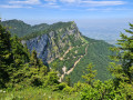
This hike takes you along the ridges to the north-east of the Vercors, partly following theGR®9.
You will climb via the Route Forestière des Pichières to reach Plénouze and theGR®9, which you will follow westwards to La Sure, then descend along the Tunnel du Mortier.
The Roman bridge and Romanin chapel
 4.22 mi
+131 ft
-135 ft
2h 05
Easy
Departure from Eygalières (Bouches-du-Rhône)
4.22 mi
+131 ft
-135 ft
2h 05
Easy
Departure from Eygalières (Bouches-du-Rhône)
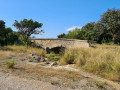
This is a short family hike that takes you to the foot of the Alpilles on a wide, easily accessible forest path.
The path follows the old Roman road, of which nothing remains, and even the bridge dates back to the Middle Ages. However, the variety of landscapes along this circular route is very interesting.
The section near the Mazet de Romanin aerodrome offers the opportunity to watch gliders taking off, with some precautions.
From La Baule to Le Croisic, returning through the salt marshes
 23.25 mi
+108 ft
-112 ft
4 hrs
Average
Departure from La Baule-Escoublac (Loire-Atlantique)
23.25 mi
+108 ft
-112 ft
4 hrs
Average
Departure from La Baule-Escoublac (Loire-Atlantique)
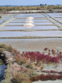
This cycle route is a classic along the Côte Sauvage and through the salt marshes.
You’ll pass through Le Pouliguen, Batz-sur-Mer and the Pointe du Croisic. On the return journey, you’ll cross the salt marshes.
From Sainte-Marguerite beach to Saint-Marc beach
 4.87 mi
+295 ft
-312 ft
2h 30
Easy
Departure from Pornichet (Loire-Atlantique)
4.87 mi
+295 ft
-312 ft
2h 30
Easy
Departure from Pornichet (Loire-Atlantique)
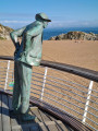
A round trip hike to admire the Loire estuary. From Sainte Marguerite beach, take the coastal path linking beautiful sandy beaches to Saint-Marc beach, where Jacques Tati's film "Les vacances de monsieur Hulot" (1953) was shot. A statue of Mr Hulot watches over the beach eternally.
Walk in Grande Brière around Saint-Malo-de-Guersac
 4.56 mi
+23 ft
-23 ft
2h 05
Easy
Departure from Saint-Malo-de-Guersac (Loire-Atlantique)
4.56 mi
+23 ft
-23 ft
2h 05
Easy
Departure from Saint-Malo-de-Guersac (Loire-Atlantique)
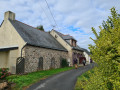
Walk along the edge of the Grande Brière. As you circle the village, you will discover meadows sometimes flooded by the rising spring waters, separated by the canals you will be walking alongside. In Rozé, you can climb up to a viewpoint to enjoy a view of the entire Grande Brière.
Pas de l'Œille via the Vallon de la Fauge and return via Grande Combe
 7.90 mi
+2,733 ft
-2,723 ft
6h 00
Average
Departure from Villard-de-Lans (Isère)
7.90 mi
+2,733 ft
-2,723 ft
6h 00
Average
Departure from Villard-de-Lans (Isère)
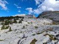
You start from a place called Les Clots and head to the magnificent Vallon de la Fauge. At the bottom, you climb up the Combe Charbonnière, reach the Pas de l'Œille and look out over Prélenfrey at 1,960 m and the Lac de Notre-Dame de Commiers on the Grenoble valley side. The return route passes through Grande Combe, offering spectacular views, and follows the tracks down to 1,350 metres. You return to Les Clots via L'Aversin. A feast for the eyes, sometimes with chamois!
The Col d'Hurtières circular route via Vararey and the Goulet d'Hurtières
 7.09 mi
+1,972 ft
-1,972 ft
5h 00
Average
Departure from Saint-Pierre-de-Chartreuse (Isère)
7.09 mi
+1,972 ft
-1,972 ft
5h 00
Average
Departure from Saint-Pierre-de-Chartreuse (Isère)
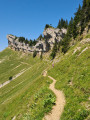
From the Col de la Charmette in Chartreuse, climbing up through the Plaine de Varavey, a magnificent summer pasture, you will reach the Col d'Hurtières to admire the Grande Sure. You will walk along cliffs to pass the Goulet d'Hurtières.
Once past this aerial gully, the descent takes you back to the car park through very varied landscapes.
This route is less steep than the Col de la Grande Vache, and therefore less difficult, but it follows a path on a sloping hillside.
Pilgrimage to the Chapel of Saint-Jean le Fromental
 4.57 mi
+705 ft
-696 ft
2h 45
Easy
Departure from Saint-Antoine-l'Abbaye (Isère)
4.57 mi
+705 ft
-696 ft
2h 45
Easy
Departure from Saint-Antoine-l'Abbaye (Isère)
This short walk takes you north of Saint-Antoine-l’Abbaye to explore the walnut groves. You’ll catch a glimpse of the foothills of the Vercors.
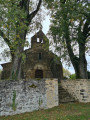
The Chapel of Saint-Jean le Fromental is quite large and houses a small, very old cemetery.
The return route takes you straight back to the abbey, just like the pilgrims of the ‘du mal ardent’ era.
You can fit in the walk, a tour of the town and a visit to the monuments all in the same day if you arrive early enough in the morning.
The island of Sal in the Cape Verde archipelago, from salt flats to sky surfing
 7.23 mi
+30 ft
-30 ft
3h 20
Easy
Departure from Sal (Cape Verde)
7.23 mi
+30 ft
-30 ft
3h 20
Easy
Departure from Sal (Cape Verde)
The Cape Verde islands are home to many tourist attractions that are not always promoted to hikers.
The island of Sal, in Santa Maria, is no exception to the beach-swimming clichés.
If you have a day to spare before heading to the other islands, you can still go hiking and discover the salt flats and the sky surfing beach, then return along the coast to the fish market.
You'll end up back in the shopping street of Santa Maria.